Self-guided Sightseeing Tour #8 in Toronto, Canada
Legend
Guided Free Walking Tours
Book free guided walking tours in Toronto.
Guided Sightseeing Tours
Book guided sightseeing tours and activities in Toronto.
Tour Facts
6 km
80 m
Experience Toronto in Canada in a whole new way with our free self-guided sightseeing tour. This site not only offers you practical information and insider tips, but also a rich variety of activities and sights you shouldn't miss. Whether you love art and culture, want to explore historical sites or simply want to experience the vibrant atmosphere of a lively city - you'll find everything you need for your personal adventure here.
Activities in TorontoIndividual Sights in TorontoSight 1: Congregation Shaarei Tzedec
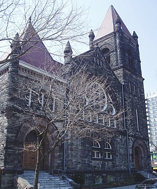
Shaarei Tzedec Congregation is an Orthodox Jewish synagogue located at 397 Markham Street in Toronto, Ontario, Canada.
Sight 2: First Narayever Congregation
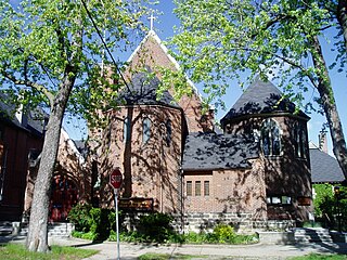
First Narayever Congregation is a traditional-egalitarian synagogue located at 187 Brunswick Avenue, in the Harbord Village neighbourhood of Toronto, Ontario, Canada. It is the largest Jewish congregation in downtown Toronto. It was founded by the Jewish immigrants from Narayiv, western Ukraine, hence the Yiddish name "Narayever".
Sight 3: Knox Presbyterian Church
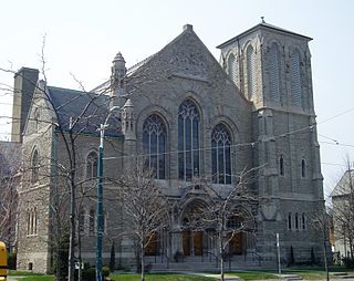
Knox Presbyterian Church is a Presbyterian church in downtown Toronto, Ontario, Canada.
Sight 4: Trinity-St. Paul's United Church
Trinity-St. Paul's United Church and Centre for Faith, Justice and the Arts is a church belonging to the United Church of Canada in Toronto, Ontario, Canada. It is located at 427 Bloor Street West, just west of Spadina Avenue in the city's downtown core. The church is formed of a mix of three different former congregations and houses a fourth independent congregation within its building.
Sight 5: Bata Shoe Museum
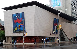
Get Ticket*The Bata Shoe Museum (BSM) is a museum of footwear and calceology in Toronto, Ontario, Canada. The museum's building is situated near the northwest of the University of Toronto's St. George campus, in downtown Toronto. The 3,665-square-metre (39,450 sq ft) museum building was designed by Moriyama & Teshima Architects, with Raymond Moriyama as the lead architect.
Sight 6: Saint Thomas's Anglican Church
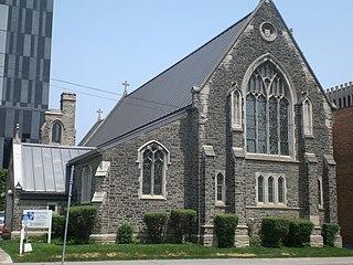
St. Thomas's Church, Huron Street is a parish of the Anglican Church of Canada in Toronto, Ontario. One of the earliest Anglo-Catholic congregations in Canada, it was established in 1874, moving twice before settling into its present building, adjacent to the Annex on the western edge of the University of Toronto's downtown campus.
Wikipedia: St. Thomas's Anglican Church (Toronto) (EN), Website
Sight 7: St. Thomas Aquinas Church
St. Thomas Aquinas Church or Newman Chapel is a Roman Catholic church within the St. George campus of the University of Toronto in Toronto, Ontario, Canada. It was built in 1926-1927 as a chapel for the Newman Centre next door. In 1995, it became a quasi-parish church. It is situated on the corner of Hoskin Avenue and St. George Street in Toronto, next to Massey College.
Sight 8: University College

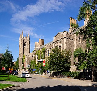
University College, popularly referred to as UC, is a constituent college of the University of Toronto, created in 1853 specifically as an institution of higher learning free of religious affiliation. It was the founding member of the university's modern collegiate system, and its non-denominationalism contrasted with contemporary colleges at the time, such as Trinity College and St. Michael's College, both of which later became part of the University of Toronto.
Sight 9: Toronto Magnetic and Meteorological Observatory
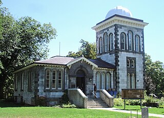
The Toronto Magnetic and Meteorological Observatory is a historical observatory located on the grounds of the University of Toronto, in Toronto, Ontario, Canada. The original building was constructed in 1840 as part of a worldwide research project run by Edward Sabine to determine the cause of fluctuations in magnetic declination. Measurements from the Toronto site demonstrated that sunspots were responsible for this effect on Earth's magnetic field. When this project concluded in 1853, the observatory was greatly expanded by the Canadian government and served as the country's primary meteorological station and official timekeeper for over fifty years. The observatory is considered the birthplace of Canadian astronomy.
Wikipedia: Toronto Magnetic and Meteorological Observatory (EN)
Sight 10: Hart House Theatre
Hart House Theatre is a 428-seat theatre in Toronto, Ontario located on the campus of the University of Toronto in the Hart House Student Centre. The theatre serves the university and the Toronto community at large.
Sight 11: Ontario Veterans Memorial
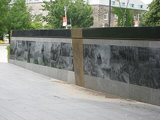
Ontario Veterans' War Memorial is a 30-metre-long (98 ft) granite wall located on the front south lawn of Queen's Park in Toronto, Ontario, Canada. The wall was designed by Allan Harding MacKay and landscape architectural firm Phillips Farevaag Smallenberg. Besides images laser-etched into the granite, the wall also includes inscriptions from author Jane Urquhart and military historian Jack Granatstein on the bronze centre- and end-pieces respectively. The wall was advocated for by the Veterans’ Memorial Advisory Committee under the leadership of retired Lieutenant-general Richard Rohmer, former Minister of Government Services, Gerry Phillips and public art consultant Karen Mills of Public Art Management.
Sight 12: Queen Elizabeth II
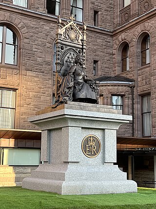
A statue of Elizabeth II, Queen of Canada, stands in Queen's Park, in Toronto, Ontario. The bronze sculpture, depicting the Queen on the sovereign's throne from 1878, was unveiled in 2023.
Sight 13: 48th Highlanders Regimental Memorial
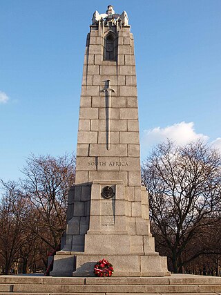
The 48th Highlanders of Canada Regimental Memorial is a monument in Toronto's Queen's Park, in Ontario, Canada. The monument was erected in 1923.
Wikipedia: 48th Highlanders of Canada Regimental Memorial (EN)
Sight 14: Royal Ontario Museum
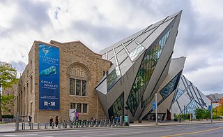
Get Ticket*The Royal Ontario Museum (ROM) is a museum of art, world culture and natural history in Toronto, Ontario, Canada. It is one of the largest museums in North America and the largest in Canada. It attracts more than one million visitors every year, making it the most-visited museum in Canada. It is north of Queen's Park, in the University of Toronto district, with its main entrance on Bloor Street West. Museum subway station is named after it and, since a 2008 renovation, is decorated to resemble the ROM's collection at the platform level; Museum station's northwestern entrance directly serves the museum.
Sight 15: Gardiner Museum
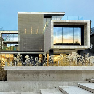
The George R. Gardiner Museum of Ceramic Art is a ceramics museum in Toronto, Ontario, Canada. The museum is situated within University of Toronto's St. George campus, in downtown Toronto. The 4,299.2-square-metre (46,276 sq ft) museum building was designed by Keith Wagland, with further expansions and renovations done by KPMB Architects.
Sight 16: Church of the Redeemer
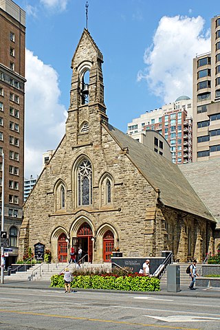
The Church of the Redeemer is an Anglican church in Toronto, Ontario, Canada. The small church is prominently located at the intersection of Bloor Street and Avenue Road, near the Royal Ontario Museum. The Gothic Revival style building opened on June 15, 1879.
Sight 17: Taddle Creek Park
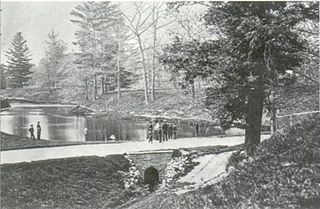
Taddle Creek Park is a small but busy park at the southwest corner of Lowther Avenue and Bedford Road, in The Annex area of Toronto.
Share
How likely are you to recommend us?
Disclaimer Please be aware of your surroundings and do not enter private property. We are not liable for any damages that occur during the tours.
GPX-Download For navigation apps and GPS devices you can download the tour as a GPX file.
