Self-guided Sightseeing Tour #6 in Toronto, Canada
Legend
Guided Free Walking Tours
Book free guided walking tours in Toronto.
Guided Sightseeing Tours
Book guided sightseeing tours and activities in Toronto.
Tour Facts
4.4 km
74 m
Experience Toronto in Canada in a whole new way with our free self-guided sightseeing tour. This site not only offers you practical information and insider tips, but also a rich variety of activities and sights you shouldn't miss. Whether you love art and culture, want to explore historical sites or simply want to experience the vibrant atmosphere of a lively city - you'll find everything you need for your personal adventure here.
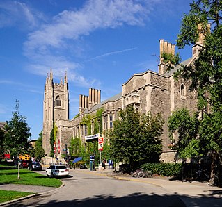
Activities in TorontoIndividual Sights in TorontoSight 1: University College

University College, popularly referred to as UC, is a constituent college of the University of Toronto, created in 1853 specifically as an institution of higher learning free of religious affiliation. It was the founding member of the university's modern collegiate system, and its non-denominationalism contrasted with contemporary colleges at the time, such as Trinity College and St. Michael's College, both of which later became part of the University of Toronto.
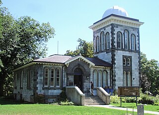
Sight 2: Toronto Magnetic and Meteorological Observatory
The Toronto Magnetic and Meteorological Observatory is a historical observatory located on the grounds of the University of Toronto, in Toronto, Ontario, Canada. The original building was constructed in 1840 as part of a worldwide research project run by Edward Sabine to determine the cause of fluctuations in magnetic declination. Measurements from the Toronto site demonstrated that sunspots were responsible for this effect on Earth's magnetic field. When this project concluded in 1853, the observatory was greatly expanded by the Canadian government and served as the country's primary meteorological station and official timekeeper for over fifty years. The observatory is considered the birthplace of Canadian astronomy.
Wikipedia: Toronto Magnetic and Meteorological Observatory (EN)
Sight 3: Hart House Theatre
Hart House Theatre is a 428-seat theatre in Toronto, Ontario located on the campus of the University of Toronto in the Hart House Student Centre. The theatre serves the university and the Toronto community at large.
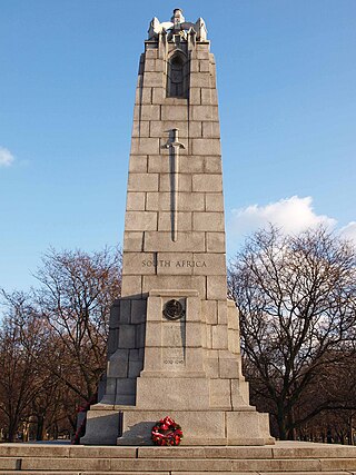
Sight 4: 48th Highlanders Regimental Memorial
The 48th Highlanders of Canada Regimental Memorial is a monument in Toronto's Queen's Park, in Ontario, Canada. The monument was erected in 1923.
Wikipedia: 48th Highlanders of Canada Regimental Memorial (EN)
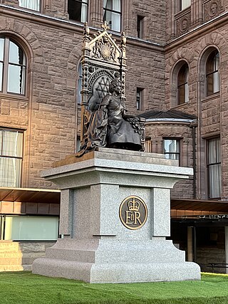
Sight 5: Queen Elizabeth II
A statue of Elizabeth II, Queen of Canada, stands in Queen's Park, in Toronto, Ontario. The bronze sculpture, depicting the Queen on the sovereign's throne from 1878, was unveiled in 2023.
Sight 6: Ontario Veterans Memorial
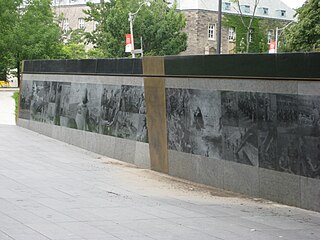
Ontario Veterans' War Memorial is a 30-metre-long (98 ft) granite wall located on the front south lawn of Queen's Park in Toronto, Ontario, Canada. The wall was designed by Allan Harding MacKay and landscape architectural firm Phillips Farevaag Smallenberg. Besides images laser-etched into the granite, the wall also includes inscriptions from author Jane Urquhart and military historian Jack Granatstein on the bronze centre- and end-pieces respectively. The wall was advocated for by the Veterans’ Memorial Advisory Committee under the leadership of retired Lieutenant-general Richard Rohmer, former Minister of Government Services, Gerry Phillips and public art consultant Karen Mills of Public Art Management.
Sight 7: Victoria Hospital for Sick Children
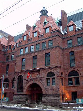
Victoria Hospital for Sick Children is a building in Toronto, Ontario, Canada. The building served as a hospital until 1951 and currently serves as the Toronto regional headquarters of Canadian Blood Services. The building has received a Commendation of Adaptive Re-use from the Toronto Historical Board.
Sight 8: Little Glenn
Eldon Garnet is a multidisciplinary artist and novelist based in Toronto, Ontario and a professor at the Ontario College of Art and Design. From 1975 to 1990 he was the editor of Impulse, a Canadian magazine of art and culture.
Sight 9: McLaughlin Car Showroom
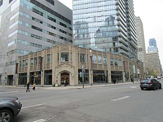
The McLaughlin Motor Car Showroom was built in 1925 and operated continuously as a car dealership until March 2007 when it was last occupied by Addison on Bay dealership (Cadillac) at 832 Bay Street, Toronto, Ontario.
Sight 10: CARLU
The Carlu is an historic event space in Toronto, Ontario, Canada. Opened in 1930 and known as the eponymous "Eaton's Seventh Floor", the venue was restored and reopened in 2003, renamed for its original architect. The Carlu is one of Toronto's best examples of Art Moderne architecture. The venue is owned by restaurant firm Oliver & Bonacini.
Sight 11: Jarvis Street Baptist Church
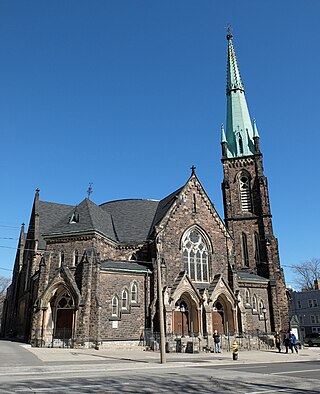
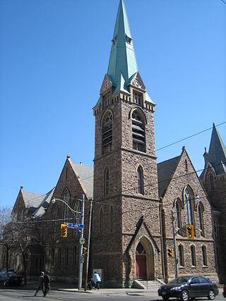
The Jarvis Street Baptist Church is a Baptist church located at the intersection of Gerrard Street and Jarvis Street in downtown Toronto. One of the oldest churches in the city, its congregation was founded in 1818, and the present church constructed in 1875. It is a member of the Sovereign Grace Fellowship of Canada.
Sight 12: Allan Gardens
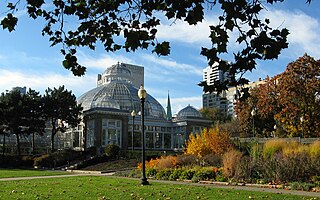
Allan Gardens is a conservatory and urban park located in the Garden District of Toronto, Ontario, Canada. The property includes a playground, off-leash dog park, and a 1,500 square metres (16,000 sq ft) conservatory with six green houses.
Sight 13: Grace Toronto Church
Grace Toronto Church is a Presbyterian Church in America congregation worshipping in the historic Old St. Andrew's Church building at 383 Jarvis Street in Toronto, Ontario, Canada.
Sight 14: The Keg
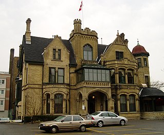
The Keg Mansion is a former residential building that is presently used as a location for a The Keg restaurant, in Toronto, Ontario, Canada. The building was initially known as Euclid Hall, a prominent downtown heritage building located at 515 Jarvis Street.
Wikipedia: Keg Mansion (EN), Website, Website En, Website Fr
Share
How likely are you to recommend us?
Disclaimer Please be aware of your surroundings and do not enter private property. We are not liable for any damages that occur during the tours.
GPX-Download For navigation apps and GPS devices you can download the tour as a GPX file.
