Self-guided Sightseeing Tour #3 in Toronto, Canada
Legend
Guided Free Walking Tours
Book free guided walking tours in Toronto.
Guided Sightseeing Tours
Book guided sightseeing tours and activities in Toronto.
Tour Facts
6.7 km
299 m
Experience Toronto in Canada in a whole new way with our free self-guided sightseeing tour. This site not only offers you practical information and insider tips, but also a rich variety of activities and sights you shouldn't miss. Whether you love art and culture, want to explore historical sites or simply want to experience the vibrant atmosphere of a lively city - you'll find everything you need for your personal adventure here.
Activities in TorontoIndividual Sights in TorontoSight 1: LKTY Theatre for Young People
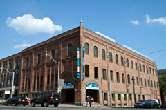
Young People's Theatre (YPT) is a professional theatre for youth located in Toronto, Ontario. The company produces and presents a full season of theatre and arts education programming, performing to approximately 150,000 patrons annually. Founded in 1966 by Susan Douglas Rubeš, YPT originally operated out of the now-demolished Colonnade Theatre on Bloor Street. Since its 1977–78 season, the company has resided in a renovated heritage building in downtown Toronto.
Sight 2: The Market Gallery
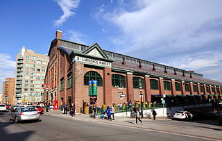
The St. Lawrence Market South building is a major public market building in Toronto, Ontario, Canada. It is located on the southwest corner of Front and Lower Jarvis Streets. Along with the St. Lawrence Market North and St. Lawrence Hall, it comprises the St. Lawrence Market complex. The current building was opened in 1902, incorporating the 1845 Toronto City Hall building into the structure. The building was restored during the 1970s.
Sight 3: St. Lawrence Market South
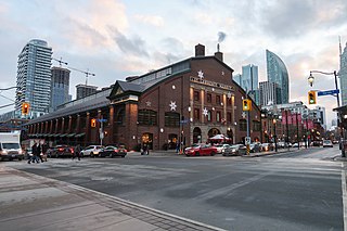
St. Lawrence Market is a major public market in Toronto, Ontario, Canada. It is located along Front Street East and Jarvis Street in the St. Lawrence neighbourhood of downtown Toronto. The public market is made up of two sites adjacent to one another west of Jarvis Street, St. Lawrence Market North, and St. Lawrence Market South. St. Lawrence Market South is situated south of Front Street East, and is bounded by The Esplanade to the south. St. Lawrence Market North is situated north of Front Street East, and is bounded by St. Lawrence Hall to the north.
Sight 4: St. Lawrence Hall
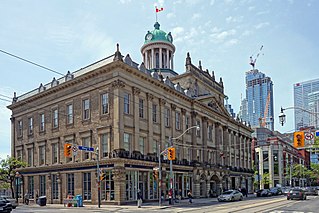
St. Lawrence Hall is a meeting hall in Toronto, Ontario, Canada, located at the corner of King Street East and Jarvis Street. It was created to be Toronto's public meeting hall home to public gatherings, concerts, and exhibitions. Its main feature was a thousand-seat amphitheatre. For decades the hall was the centre of Toronto's social life before larger venues took over much of this business. Today the hall continues as a venue for events including weddings, conferences, and art shows.
Sight 5: Daniel Brooke Building
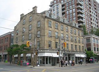
Daniel Brooke Building is a 19th-century Georgian building in Toronto, Ontario, Canada located on the northeast corner of Jarvis Street and King Street. The building is one of the last remaining buildings of the old Town of York. Built in 1833 for owners Daniel Brooke and John Murchison, it was rebuilt before 1849 and damaged by the Toronto Fire of 1849.
Sight 6: Cathedral Church of St. James
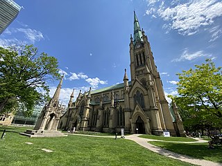
The Cathedral Church of St. James is an Anglican cathedral in Downtown Toronto, Ontario, Canada. It is the location of the oldest congregation in the city, with the parish being established in 1797. The church, the fourth on the site, began construction in 1850 and opened for services on June 19, 1853. It was one of the largest buildings in the city at that time. It was designed by Frederick William Cumberland and is an example of Gothic Revival architecture.
Sight 7: Gooderham Building
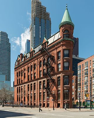
The Gooderham Building, also known as the Flatiron Building, is an historic office building at 49 Wellington Street East in Toronto, Ontario, Canada. It is located on the eastern edge of the city's Financial District in the St. Lawrence neighbourhood, wedged between Front Street and Wellington Street in Downtown Toronto, where they join up to form a triangular intersection. Completed in 1892, the red-brick edifice was an early example of a prominent flatiron building.
Sight 8: The Flatiron Mural
Derek Michael Besant is a Canadian artist living in Calgary, Alberta who, since the 1980s, has created prints, watercolours and large-scale art, shown in exhibitions and as public art projects in Canada and abroad. Since the mid-1990s, he has developed working with the new technology available in photographic imaging to create experimental prints and print installations.
Sight 9: Berczy Park
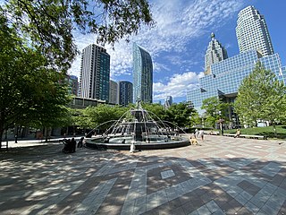
Get Ticket*Berczy Park is a small park in downtown Toronto, Ontario, Canada. The park is triangular in shape, bounded by Scott Street, Front Street and Wellington Street. The park is bordered at its eastern tip, where Wellington and Front join, by the Gooderham Building, a heritage building that is an example of a "flatiron building". A widely admired mural graces the western facade of the building.
Sight 10: St. Lawrence Centre for the Arts
The St. Lawrence Centre for the Arts is a performing arts theatre complex located in downtown Toronto, Ontario, Canada. Situated on Front Street one block east of Yonge Street, it was the City of Toronto's official centennial project, commemorating the 1967 Canadian Centennial. It houses two auditoriums, the 868-seat Bluma Appel Theatre and the 499-seat Jane Mallett Theatre.
Sight 11: Meridian Hall
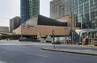
Meridian Hall is a performing arts venue in Toronto, Ontario, and it is the country's largest soft-seat theatre. The facility was constructed for the City of Toronto municipal government and is currently managed by TO Live, an arms-length agency and registered charity created by the city. Located at 1 Front Street East, the venue opened as the O'Keefe Centre on October 1, 1960. From 1996 to 2007, the building was known as the Hummingbird Centre for the Performing Arts. From 2007 to 2019, it was known as the Sony Centre for the Performing Arts. On September 15, 2019, it was re-branded as Meridian Hall.
Sight 12: Hockey Hall of Fame
Get Ticket*
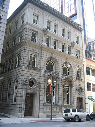
The Hockey Hall of Fame is a museum and hall of fame located in Toronto, Ontario, Canada. Dedicated to the history of ice hockey, it holds exhibits about players, teams, National Hockey League (NHL) records, memorabilia and NHL trophies, including the Stanley Cup. Founded in Kingston, Ontario, the Hockey Hall of Fame was established in 1943 under the leadership of James T. Sutherland. The first class of honoured members was inducted in 1945, before the Hall of Fame had a permanent location. It moved to Toronto in 1958 after the NHL withdrew its support for the International Hockey Hall of Fame in Kingston, Ontario, due to funding issues. Its first permanent building opened at Exhibition Place in 1961. The hall was relocated in 1993, and is now in Downtown Toronto, inside Brookfield Place, and a historic Bank of Montreal building. The Hockey Hall of Fame has hosted International Ice Hockey Federation (IIHF) exhibits and the IIHF Hall of Fame since 1998.
Sight 13: Design Exchange
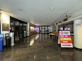
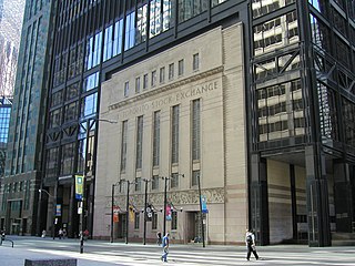
The Design Exchange (DX) is a Canadian event venue. It is located in Toronto's financial district in the historical Toronto Stock Exchange building, that was incorporated into a skyscraper in 1991, the Toronto-Dominion Centre. The organization operated a design museum, but this museum was closed in 2019. Since 2017, it hosts a biennial design festival, the Expo for Design, Innovation, & Technology (EDIT).
Sight 14: Monument to Multiculturalism
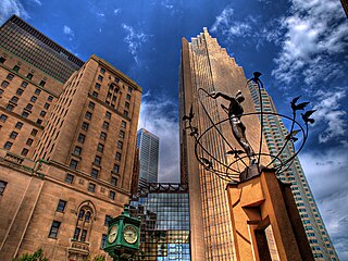
Multiculturalism is the coexistence of multiple cultures. The word is used in sociology, in political philosophy, and colloquially. In sociology and everyday usage, it is usually a synonym for ethnic or cultural pluralism in which various ethnic and cultural groups exist in a single society. It can describe a mixed ethnic community area where multiple cultural traditions exist or a single country. Groups associated with an indigenous, aboriginal or autochthonous ethnic group and settler-descended ethnic groups are often the focus.
Sight 15: Roundhouse Park
Roundhouse Park is a 17-acre (6.9 ha) park in the downtown core of Toronto, Ontario, Canada. It is in the former Railway Lands. It features the John Street Roundhouse, a preserved locomotive roundhouse that houses the Toronto Railway Museum, Steam Whistle Brewing, and the Rec Room restaurant and entertainment complex. The park is also home to a collection of trains, the former Canadian Pacific Railway Don Station, and the Roundhouse Park Miniature Railway. The park is bounded by Bremner Boulevard, Lower Simcoe Street, Lake Shore Boulevard West/Gardiner Expressway, and Rees Street.
Sight 16: Ripley's Aquarium of Canada
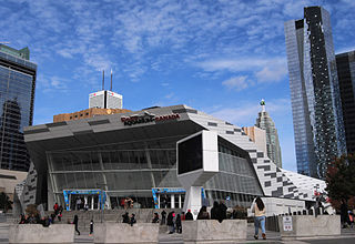
Ripley's Aquarium of Canada is a public aquarium in Toronto, Ontario, Canada. The aquarium is one of three aquariums owned-and-operated by Ripley Entertainment. It is located in downtown Toronto, just southeast of the CN Tower. The aquarium has 5.7 million litres of marine and freshwater habitats from across the world. The exhibits hold more than 20,000 exotic sea and freshwater specimens from more than 450 species.
Sight 17: CN Tower
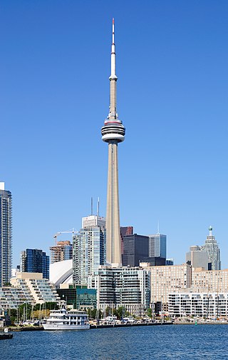
Get Ticket*The CN Tower is a 553.3 m-high (1,815.3 ft) concrete communications and observation tower in Toronto, Ontario, Canada. Completed in 1976, it is located in downtown Toronto, built on the former Railway Lands. Its name "CN" referred to Canadian National, the railway company that built the tower. Following the railway's decision to divest non-core freight railway assets prior to the company's privatization in 1995, it transferred the tower to the Canada Lands Company, a federal Crown corporation responsible for the government's real estate portfolio.
Sight 18: Princess of Wales Theatre
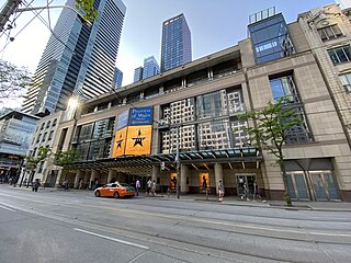
The Princess of Wales Theatre is a 2,000-seat live theatre in Toronto, Ontario, Canada. It is located on King Street West, in Toronto's downtown Entertainment District. The theatre's name has a triple meaning: it honours Diana, Princess of Wales, with whose consent the theatre was named; it links the building to its sister theatre, the Royal Alexandra, one block to the east, also named – with Royal assent – for a former Princess of Wales; and it recalls the Princess Theatre, Toronto's first "first-class legitimate" playhouse, that stood three blocks to the east until 1931.
Sight 19: Royal Alexandra Theatre
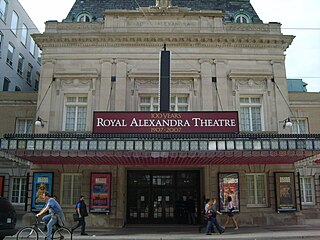
The Royal Alexandra Theatre, commonly known as the Royal Alex, is an historic performing arts theatre in Toronto, Ontario. The theatre is located at 260 King Street West, in the downtown Toronto Entertainment District. Owned and operated by Mirvish Productions, the theatre has approximately 1,244 seats across three levels. Built in 1907, the Royal Alexandra Theatre is the oldest continuously operating legitimate theatre in North America.
Sight 20: Roy Thomson Hall
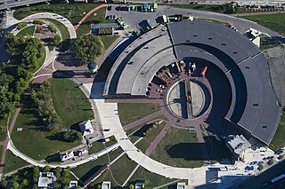
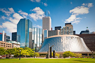
Roy Thomson Hall is a concert hall in Toronto, Ontario, Canada. Located downtown in the city's entertainment district, it is home to the Toronto Symphony Orchestra, the Toronto Mendelssohn Choir, and the esports team Toronto Defiant. Opened in 1982, its circular architectural design exhibits a sloping and curvilinear glass exterior. It was designed by Canadian architects Arthur Erickson and Mathers and Haldenby. Itzhak Perlman acted as a special advisor to the architects on accessibility needs for disabled performers and guests.
Sight 21: St. Andrew's Church
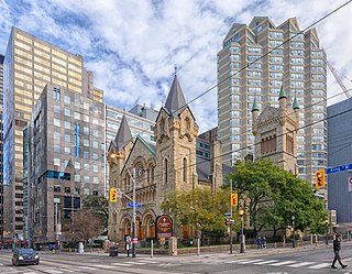
St. Andrew's Church is a historic Presbyterian church located at the corner of King Street West and Simcoe Street in the city's downtown core of Toronto, Ontario, Canada. It was designed by William George Storm in the Romanesque Revival style and completed in 1876.
Sight 22: Dreaming
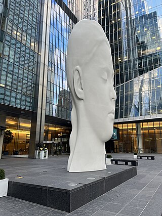
Dreaming is an 8.5 metre tall, 2.5-tonne sculpture by Jaume Plensa, colloquially known as "Lucia", installed in Toronto, Ontario, Canada.
Sight 23: Ontario Heritage Centre
The Ontario Heritage Trust is a non-profit agency of the Ontario Ministry of Tourism and Culture. It is responsible for protecting, preserving and promoting the built, natural and cultural heritage of Canada's most populous province, Ontario.
Sight 24: Metropolitan United Church
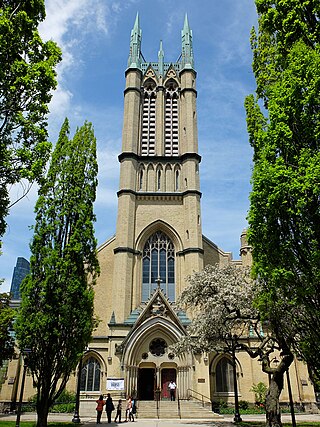
Metropolitan United Church is a historic Neo-Gothic style church in downtown Toronto, Ontario, Canada. It is one of the largest and most prominent churches of the United Church of Canada. It is located at 56 Queen Street East, between Bond and Church streets, in Toronto's Garden District.
Share
How likely are you to recommend us?
Disclaimer Please be aware of your surroundings and do not enter private property. We are not liable for any damages that occur during the tours.
GPX-Download For navigation apps and GPS devices you can download the tour as a GPX file.
