Self-guided Sightseeing Tour #10 in Toronto, Canada
Legend
Guided Free Walking Tours
Book free guided walking tours in Toronto.
Guided Sightseeing Tours
Book guided sightseeing tours and activities in Toronto.
Tour Facts
2 km
29 m
Experience Toronto in Canada in a whole new way with our free self-guided sightseeing tour. This site not only offers you practical information and insider tips, but also a rich variety of activities and sights you shouldn't miss. Whether you love art and culture, want to explore historical sites or simply want to experience the vibrant atmosphere of a lively city - you'll find everything you need for your personal adventure here.
Activities in TorontoIndividual Sights in TorontoSight 1: St. Francis of Assisi Church

Saint Francis of Assisi is a Roman Catholic church founded in 1902 in Toronto, Ontario, Canada. It is located in the west end neighbourhood of Little Italy and Trinity-Bellwoods and within the Roman Catholic Archdiocese of Toronto.
Sight 2: College Street United Church
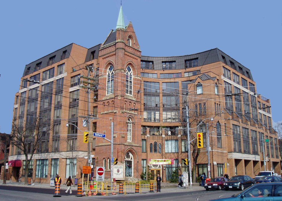
College Street United Church is a United Church of Canada church at the corner of College and Bathurst Streets in Toronto, Ontario, Canada. As of 1990 the church is part of the same structure as The Channel Club Condo at 456 College Street.
Sight 3: No. 8 Hose Station
The No. 8 Hose Station is a small fire hall that is a Toronto landmark. It is located on College Street at Bellevue and marks the northern end of Kensington Market and serves the Chinatown area at Spadina and Dundas.
Sight 4: First Russian Congregation - The Kiever Shul

The First Russian Congregation of Rodfei Sholem Anshei Kiev, known as the Kiever Synagogue or Kiever Shul, is a Modern Orthodox Jewish synagogue in Toronto, Ontario, Canada. It was founded by Jewish immigrants from Ukraine in 1912, and formally incorporated in 1914. The congregants were poor working-class people, and services were led by members and held in their homes. Two houses were eventually purchased in the Kensington Market area, and in their place construction was completed on the current twin-domed Byzantine Revival building in 1927. The building was once the site of George Taylor Denison's home Bellevue.
Sight 5: Alexandra Park

Alexandra Park is a neighbourhood located in downtown Toronto, Ontario, Canada. Alexandra Park is bounded by Dundas Street West on the north, Spadina Avenue on the east, Queen Street West on the south, and Bathurst Street on the west. Alexandra Park consists of private and public housing, with at grade retail along Queen Street West and Spadina Avenue, some institutional, and several commercial buildings scattered through the neighborhood. The neighborhood takes its name from Alexandra Park, a municipal park at the south-east corner of Dundas Street West and Bathurst Street. The park is named for Queen Alexandra, whose husband, King Edward VII, was the first future monarch to visit Toronto.
Share
How likely are you to recommend us?
Disclaimer Please be aware of your surroundings and do not enter private property. We are not liable for any damages that occur during the tours.
GPX-Download For navigation apps and GPS devices you can download the tour as a GPX file.