Free Walking Sightseeing Tours in Salvador, Brazil
Legend
Self-guided Tours
Paid Tours & Activities
Guided Free Walking Tours
Book free guided walking tours in Salvador.
Guided Sightseeing Tours
Book guided sightseeing tours and activities in Salvador.
Are you ready for an unforgettable time in Salvador, Brazil? Then you've come to the right place with our sightseeing tours. Whether you prefer a guided free walking tour with insider knowledge or enjoy the freedom of a self-guided route, you'll find exactly what you're looking for. Click on a tour and find out more about the highlights that await you!
Individual Sights in Salvador 0$
English, Spanish and Portuguese
English, Spanish and Portuguese
2 hours
5/5 stars, 503 ratings
5/5 stars, 503 ratings
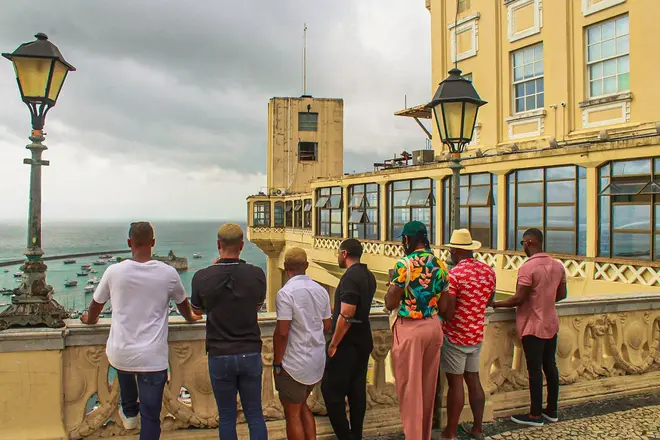
Our meeting will take place at Praça Castro Alves, where we can appreciate an incredible view of the Baía de Todos os Santos and its islands. Leaving Praça Castro Alves, we will continue walking...
Show on GuruWalk*
0$
English, Spanish and Portuguese
English, Spanish and Portuguese
2 hours 30 minutes
4.9/5 stars, 35 ratings
4.9/5 stars, 35 ratings
Discover the origins of Salvador and Brazil on foot with our Free Walking Tour Salvador, a journey through the city where Brazilian history truly began. This historic walking tour Salvador...
Show on GuruWalk* 20 sights
3.4 km
3.4 km
154 m
124 m
124 m
- Monumento Cruz do Pascoal
- Church of the Third Order of Mount Carmel
- Igreja do Santíssimo Sacramento do Passo
- Igreja do Rosário dos Pretos
- Museu da Cidade
- Museu Abelardo Rodrigues
- Solar Ferrão
- Fundação Casa de Jorge Amado
- Largo do Pelourinho
- Igreja São Pedro dos Clérigos
- Museu Afro-Brasileiro
- Escola Olodum
- Terreiro de Jesus
- Praça da Sé
- Praça Cairu
- Casarão dos Azulejos Azuis
- Elevador Lacerda
- Mario Cravo
- Historic Centre of Salvador de Bahia
- Praça Castro Alves
5 sights
1.3 km
1.3 km
48 m
59 m
59 m
- Museu Geológico da Bahia
- Museu de Arte da Bahia
- Museu Carlos Costa Pinto
- Museu de Arte Contemporânea da Bahia
- Igreja Nossa Senhora da Vitória
10 sights
3 km
3 km
66 m
115 m
115 m
- Museu Carlos Costa Pinto
- Museu de Arte da Bahia
- Museu Geológico da Bahia
- Largo do Campo Grande
- Monumento ao Cabloco
- Teatro Castro Alves
- Forte São Pedro
- Passeio Público
- Teatro Vila velha
- Museu de Arte Moderna da Bahia
9 sights
3.5 km
3.5 km
134 m
164 m
164 m
- Passeio Público
- Teatro Vila velha
- Museu de Arte Moderna da Bahia
- Praça da Piedade
- Museu de Arte Sacra
- Praça Castro Alves
- Mario Cravo
- Praça Cairu
- Historic Centre of Salvador de Bahia
Share
Spread the word! Share this page with your friends and family.
How likely are you to recommend us?
What can we improve?
Why Visit Sights? Self-guided sightseeing tours are a free and safe alternative to bus tours. You can explore Salvador at your own pace, any time! Do something good for your health by walking.