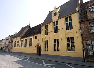
Self-guided Sightseeing Tour #6 in Bruges, Belgium
Legend
Guided Free Walking Tours
Book free guided walking tours in Bruges.
Guided Sightseeing Tours
Book guided sightseeing tours and activities in Bruges.
Tour Facts
6.4 km
44 m
Experience Bruges in Belgium in a whole new way with our free self-guided sightseeing tour. This site not only offers you practical information and insider tips, but also a rich variety of activities and sights you shouldn't miss. Whether you love art and culture, want to explore historical sites or simply want to experience the vibrant atmosphere of a lively city - you'll find everything you need for your personal adventure here.
Activities in BrugesIndividual Sights in BrugesSight 1: Grootseminarie
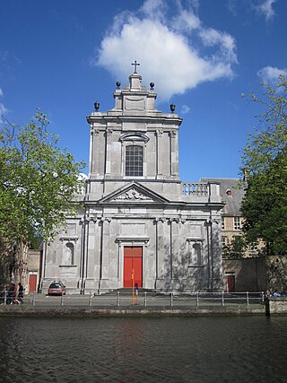
The Major Seminary in Bruges, in Dutch Grootseminarie, is a centre for training and formation in the Roman Catholic Diocese of Bruges, formerly used as the seminary for preparing candidates for the diocesan priesthood. It is located on the Potterierei in Bruges.
Sight 2: Kruisvest
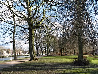
The Kruisvest is a promenade and street in Bruges.
Sight 3: Sint Janshuismolen
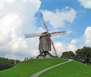
The Sint-Janshuis mill in the Belgian city of Bruges is located on the Kruisvest, on the edge of the city center. The windmill that stands there today was built in 1770 and functions as a flour mill. It is already the third mill on that site. It owes its name to the hospital of St. John. The hospital may never have owned the mill, but a rent was imposed in favor of it.
Sight 4: Sint-Annakerk
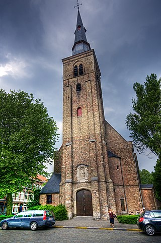
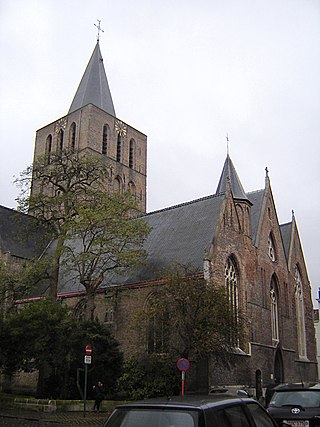
St. Anne's Church is a Catholic church in the St. Anne's district and parish in Bruges. It was rebuilt at the beginning of the 17th century and decorated in typical Baroque style as far as the interior is concerned. Mother Anna is the patroness of the church.
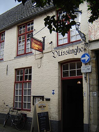
Sight 5: Café Vlissinghe
Café Vlissinghe is the oldest continuously running café in Bruges, the first written record about it is from 1515.
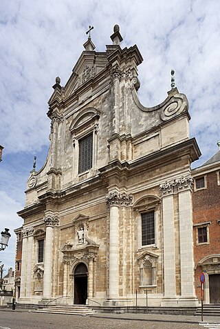
Sight 6: St. Walburga Church
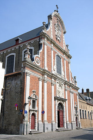
The St. Walburga Church is a 17th-century Roman-Catholic church in Bruges built by the Jesuits in a Baroque style. It is now a parish church and contains many valuable art objects.
Wikipedia: St. Walburga Church (Bruges) (EN), Heritage Website
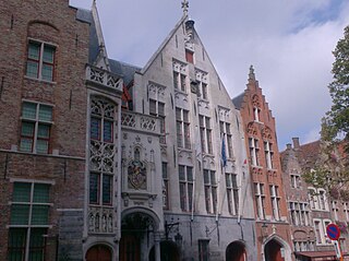
Sight 7: Tolhuis
The old Tolhuis on the Jan van Eyckplein in the Belgian city of Bruges consists of several buildings: the corner house "Het Heilig Graf", the Pijndershuisje, the actual Tolhuis and the house "Het Wezelkin".
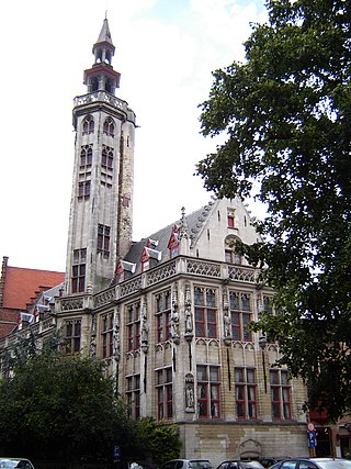
Sight 8: Poortersloge
The Poortersloge in the Belgian city of Bruges is located on the Jan van Eyckplein, diagonally opposite the Tolhuis. It is located in the part of Bruges that focused on international trade in the late Middle Ages.
Sight 9: Sint-Franciscus Xaveriusziekenhuis
The Sint-Franciscus-Xaverius Instituut, abbreviated SFX-Brugge, is a Catholic school in the Belgian city of Bruges. It has about 800 students. The institute is also known by the nickname of the Xaverian Brothers, the Frères. The school is located between the Guido Gezelleplein, the Simon Stevinplein, the Mariastraat and the Nieuwstraat. The Frères' primary school is called "Het Palet".
Wikipedia: Sint-Franciscus-Xaveriusinstituut (Brugge) (NL), Heritage Website
Sight 10: Torenbrug
The Torenbrug is a bridge over the Gouden-Handrei and Augustijnenrei and a street name in Bruges.
Sight 11: Sint-Gilliskerk
The Church of St. Gilles in the Belgian city of Bruges is located in the district and parish of St. Gilles, in the city center.
Sight 12: Hof De Jonghe
The Hof De Jonghe and Hof Campers is an urban park in the Belgian city of Bruges. It is located on the Langerei, between the Stokersstraat and the Julius and Maurits Sabbestraat. The entrance to the park can be entered from the Langerei through the Tudor arch gate and is also referred to as the Hof Campers and Hof de Jonghe.
Sight 13: Godshuis Laris
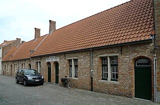
The almshouses Brooloos, Laris and Stochove are Bruges almshouses in the Baliestraat.
Wikipedia: Brooloos, Laris en Stochove (NL), Heritage Website
Sight 14: Godshuizen van het Metselaarsambacht
The almshouses of the Masons' Craft are located in the Noord-Gistelhof 1-9 in Bruges.
Sight 15: Godshuizen Soutieu
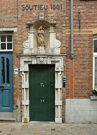
Soutieu is a place of worship in Bruges.
Sight 16: Karmelietenkerk
The Carmelite Church is a church in the center of the Belgian city of Bruges.
Sight 17: Godshuizen Sint-Joos
Sint-Joos is a set of almshouses and chapels located in the Ezelstraat in Bruges.
Sight 18: Jan Guilinibad
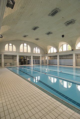
The Jan Guilinibad is a swimming pool in the Belgian city of Bruges. It was erected on the corner of Rue Charles Quint and Rue Lauwer, in the Kristus-Koning district, with an external construction in the so-called "Bruges style" and with an Art Deco interior.
Sight 19: Bizon
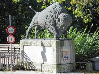
Bison on the Canada Bridge is an artwork by Octave Rotsaert on the Canada Bridge in Bruges. The people sometimes refer to it as the Bison Bridge or the Buffalo Bridge. The artwork and the bridge became a protected monument in 2010.
Share
How likely are you to recommend us?
Disclaimer Please be aware of your surroundings and do not enter private property. We are not liable for any damages that occur during the tours.
GPX-Download For navigation apps and GPS devices you can download the tour as a GPX file.
