Self-guided Sightseeing Tour #16 in Vienna, Austria
Legend
Guided Free Walking Tours
Book free guided walking tours in Vienna.
Guided Sightseeing Tours
Book guided sightseeing tours and activities in Vienna.
Tour Facts
6.6 km
97 m
Experience Vienna in Austria in a whole new way with our free self-guided sightseeing tour. This site not only offers you practical information and insider tips, but also a rich variety of activities and sights you shouldn't miss. Whether you love art and culture, want to explore historical sites or simply want to experience the vibrant atmosphere of a lively city - you'll find everything you need for your personal adventure here.
Activities in ViennaIndividual Sights in ViennaSight 1: Wettsteinpark
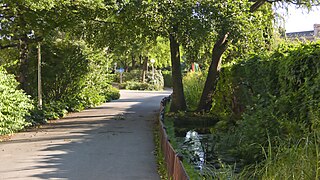
Wettsteinpark is a park in Vienna's 2nd district of Leopoldstadt. It is located as a linear riverside park between the Danube Canal and the Upper Danube Road and stretches approximately from the Siemens-Nixdorf-Steg to the Rossauer Bridge. It is named after the Austrian botanist Richard Wettstein.
Sight 2: Johannes-Nepomuk-Kapelle
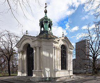
The Johannes Nepomuk Chapel, also known as the Schanzelkapelle, on the Upper Danube Street in the Wilhelm-Kienzl-Park in Vienna was dedicated to the priest and martyr Johannes Nepomuk and is a listed building. The statue of the saint located here is one of the numerous representations of John of Nepomuk in Vienna.
Wikipedia: Johannes-Nepomuk-Kapelle (Obere Donaustraße) (DE)
Sight 3: Schützenhaus
The Kaiserbad weir and lock in Vienna is an important monument to the technical challenges of making the Danube Canal navigable around 1900. The associated shooting house is one of Otto Wagner's main works. The Schützenhaus (list entry) and the lock as part of the Danube Canal (list entry) are listed as historical monuments.
Sight 4: Deutschmeister-Denkmal
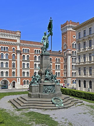
The Deutschmeister Monument is a monument on Deutschmeisterplatz in Vienna's 1st district, Innere Stadt. It was the first large monument of the Danube Monarchy that was not dedicated to a single person, but to a unit of troops. It is possible that the Deutschmeister monument in 1945 was also the model for the heroes' monument of the Red Army on Schwarzenbergplatz.
Sight 5: Palais Sturany
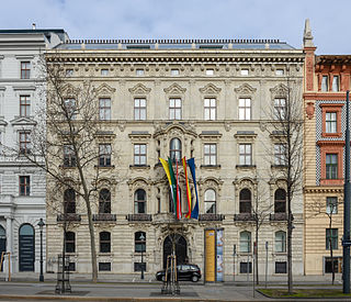
The Palais Sturany is a palace in the 1st district of Vienna, Innere Stadt, at Schottenring 21. It was built according to the plans of the architects Ferdinand Fellner and Hermann Helmer from 1874 as a residence for the court architect Johann Sturany.
Sight 6: Servitenkirche
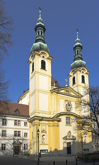
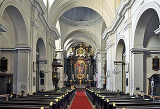
The Servite Church is a church in Vienna, Austria.
Sight 7: Schauspielhaus Wien
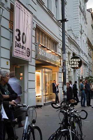
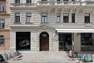
Schauspielhaus Wien is a theatre in Vienna, Austria, located at 19 Porzellangasse in the 9th District of Vienna (Alsergrund).
Sight 8: Sigmund Freud Museum
Get Ticket*The Sigmund Freud Museum in Vienna is a museum founded in 1971 covering Sigmund Freud's life story. It is located in the Alsergrund district, at Berggasse 19. In 2003, the museum was put in the hands of the newly established Sigmund Freud Foundation, which has since received the entire building as an endowment. It also covers the history of psychoanalysis.
Wikipedia: Sigmund Freud Museum (Vienna) (EN), Website, Facebook
Sight 9: Votivkirche
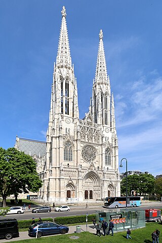
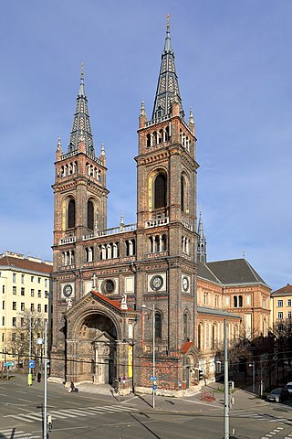
The Votivkirche is a neo-Gothic style church located on the Ringstraße in Vienna, Austria. Following the attempted assassination of Emperor Franz Joseph in 1853, the Emperor's brother Archduke Ferdinand Maximilian inaugurated a campaign to create a church to thank God for saving the Emperor's life. Funds for construction were solicited from throughout the Empire. The church was dedicated in 1879 on the silver anniversary of Emperor Franz Joseph and his wife Empress Elisabeth.
Sight 10: Money Museum
The Money Museum of the Oesterreichische Nationalbank is located in the main building of the Oesterreichische Nationalbank on Otto-Wagner-Platz in Vienna-Alsergrund. The only money museum in Austria illuminates the topics of money – currency – economy with its exhibitions.
Wikipedia: Geldmuseum der Oesterreichischen Nationalbank (DE), Website
Sight 11: Memorial to the Jewish Children, Women and Men of Austria who were murdered in the Shoah
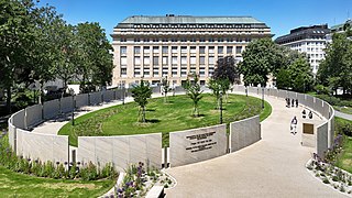
Memorial for the Jewish Children, Women and Men from Austria Murdered in the Shoah (Shoah Name Walls) is the name of a memorial of the Republic of Austria for the 65,000 Jewish Austrians who were murdered in the course of the Shoah. Engraved are the names of all Austrian victims of the Shoah. The location is Ostarrichipark in Vienna's 9th district, Alsergrund. In English, the memorial is called Memorial to the Jewish Children, Women and Men of Austria who were murdered in the Shoah.
Wikipedia: Gedenkstätte für die in der Shoah ermordeten Jüdischen Kinder, Frauen und Männer aus Österreich (DE), Website
Sight 12: Dreifaltigkeitskirche
The Holy Trinity Church of the Minorites in Vienna, popularly known as the Zu den Weißspaniern and today the Alserkirche, but also known as the Trinitarian Church, is the Roman Catholic parish church of the Alservorstadt district in Vienna's 8th district of Josefstadt. The Minorite monastery in Vienna is closely connected to the church. Both are listed as historical monuments.
Sight 13: Schönbornpark
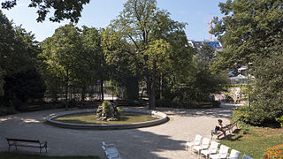
Schönbornpark is a 10,000 m² park in Vienna's 8th district on Florianigasse and Lange Gasse.
Sight 14: Palais Damian
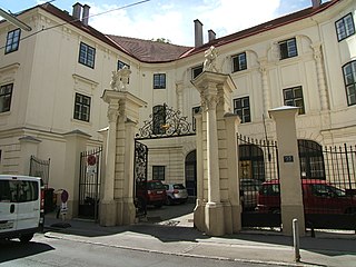
The Palais Damian is located in the 8th district of Vienna, Josefstadt, Lange Gasse 53.
Sight 15: Piaristenkirche Maria Treu
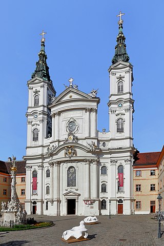
The Piarist Church, also known as the Church of Maria Treu, is a Baroque parish church of the Order of the Piarists in Vienna, Austria. It is located in Vienna's 8th district (Josefstadt). The Piaristenkirche was elevated to the rank of Basilica Minor in 1949.
Sight 16: Wachsamkeitsbrunnen
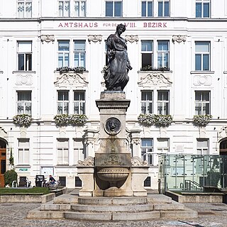
The Wachsamkeitsbrunnen is a listed fountain on Schlesingerplatz in Vienna's 8th district of Josefstadt.
Sight 17: Hamerlingpark
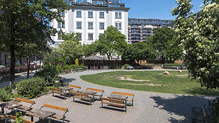
The Hamerlingpark on the Hamerlingplatz is a park in the 8th district of Vienna, the Josefstadt. With an area of around 6,000 m², it is the second largest park in the 8th district after Schönbornpark. It is located between Skodagasse and Kupkagasse, one block north of Josefstädter Straße.
Sight 18: Breitenfelder Pfarrkirche hl. Franziskus Seraphicus
The Breitenfeld Parish Church in Vienna is a Roman Catholic parish church on Uhlplatz in the Breitenfeld district of Vienna's 8th district, Josefstadt. It is dedicated to St. Francis Seraphicus.
Share
How likely are you to recommend us?
Disclaimer Please be aware of your surroundings and do not enter private property. We are not liable for any damages that occur during the tours.
GPX-Download For navigation apps and GPS devices you can download the tour as a GPX file.
