Self-guided Sightseeing Tour #3 in New London, United States
Legend
Tour Facts
2.1 km
28 m
Experience New London in United States in a whole new way with our free self-guided sightseeing tour. This site not only offers you practical information and insider tips, but also a rich variety of activities and sights you shouldn't miss. Whether you love art and culture, want to explore historical sites or simply want to experience the vibrant atmosphere of a lively city - you'll find everything you need for your personal adventure here.
Individual Sights in New LondonSight 1: Huntington Street Baptist Church
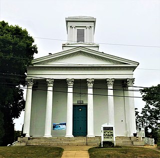
The Huntington Street Baptist Church is a historic Baptist Church meeting house at 29 Huntington Street in New London, Connecticut. Built in 1843 by John Bishop, who also designed it, it is one of the last major examples of Greek Revival architecture to be built in the city. The church was built by a Universalist congregation and then purchased by a Baptist one. The building was listed on the National Register of Historic Places in 1982. As of 2017, the church is still in use as a Baptist house of worship.
Wikipedia: Huntington Street Baptist Church (EN), Heritage Website
Sight 2: Public Library of New London
The Public Library of New London is a historic library located at 63 Huntington Street at the corner of State Street, New London, Connecticut. The library was given to the city by Henry Philomen Haven. It was constructed in 1889-92 and was designed by Shepley, Rutan and Coolidge in the Richardsonian Romanesque style; George Warren Cole was the project supervisor.
Sight 3: Hempstead Historic District
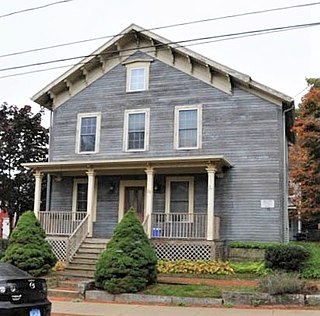
The Hempstead Historic District of New London, Connecticut encompasses a residential area north of the city's harbor and central business district, extending mainly along three roughly parallel streets: Franklin and Hempstead Streets, and Mountain Avenue. The area was settled in the 17th century, and has three centuries of architecture depicting an increasingly urban area. The district was listed on the National Register of Historic Places on July 31, 1986.
Wikipedia: Hempstead Historic District (EN), Heritage Website
Sight 4: Civic Institutions Historic District
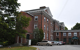
The Civic Institutions Historic District in New London, Connecticut is a historic district that was listed on the National Register of Historic Places in 1990. It includes six contributing buildings over a 7 acres (2.8 ha) area. The district includes properties that were historically developed between 1867 and 1917 to provide for the city's indigent population and to provide medical services to the community at large. Two of the buildings are almshouses, built in 1867 and 1917, and the others were historically associated with the delivery of medical services, and date to the turn of the 20th century. The district properties are 179 Colman Street, 32 Walden Avenue, and 156, 158, 171, and 173-5 Garfield Avenue.
Wikipedia: Civic Institutions Historic District (EN), Heritage Website
Sight 5: United States Housing Corporation Historic District
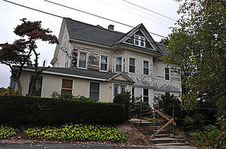
The United States Housing Corporation Historic District is a residential historic district located on the west side of New London, Connecticut. It contains a relatively uniform collection of Colonial Revival houses, most of them built in 1919 and 1920 by the United States Housing Corporation, a United States federal government agency founded to provide housing for workers in strategically significant war-related industries. The development of this district was overseen by the noted landscape architect Frederick Law Olmsted Jr. The district is bounded on the west by Colman Avenue, the south by West Pleasant Street, the east by Jefferson Street, and on the north by Fuller Street. The district was listed on the National Register of Historic Places on April 16, 1990.
Wikipedia: United States Housing Corporation Historic District (EN), Heritage Website
Share
How likely are you to recommend us?
Disclaimer Please be aware of your surroundings and do not enter private property. We are not liable for any damages that occur during the tours.
GPX-Download For navigation apps and GPS devices you can download the tour as a GPX file.


