Self-guided Sightseeing Tour #3 in Charleston, United States
Legend
Tour Facts
5.6 km
68 m
Experience Charleston in United States in a whole new way with our free self-guided sightseeing tour. This site not only offers you practical information and insider tips, but also a rich variety of activities and sights you shouldn't miss. Whether you love art and culture, want to explore historical sites or simply want to experience the vibrant atmosphere of a lively city - you'll find everything you need for your personal adventure here.
Activities in CharlestonIndividual Sights in CharlestonSight 1: Moultrie Playground and Colonial Lake
Moultrie Playground is a public park in Charleston, South Carolina.
Sight 2: Old Marine Hospital
The Old Marine Hospital is a historic medical building at 20 Franklin Street in Charleston, South Carolina. Built 1831–33 to a design by Robert Mills, it was designated a National Historic Landmark in 1973 for its association with Mills, and as a high-quality example of Gothic Revival architecture. The hospital was built as a public facility for the treatment of sick sailors and other transient persons.
Wikipedia: United States Marine Hospital (Charleston, South Carolina) (EN), Website, Heritage Website
Sight 3: Cathedral of Saint John the Baptist
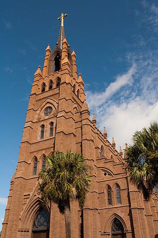
The Cathedral of St. John the Baptist is the mother church of the Roman Catholic Diocese of Charleston, located in Charleston, South Carolina. Designed by Brooklyn architect Patrick Keely in the Gothic Revival style, it opened in 1907. The Most Reverend Jacques E. Fabre, the fourteenth Bishop of Charleston, was ordained and installed on May 13, 2022
Wikipedia: Cathedral of Saint John the Baptist (Charleston, South Carolina) (EN), Website
Sight 4: Saint Michael Protestant Episcopal Church
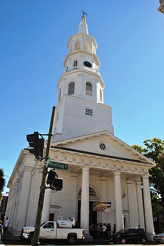
St. Michael's Anglican Church is a historic church and the oldest surviving religious structure in Charleston, South Carolina. It is located at Broad and Meeting streets on one of the Four Corners of Law, and represents ecclesiastical law. It was built in the 1750s by order of the South Carolina Assembly. It is listed on the National Register of Historic Places and is a National Historic Landmark.
Wikipedia: St. Michael's Episcopal Church (Charleston, South Carolina) (EN)
Sight 5: Washington Square
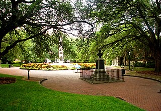
Get Ticket*Washington Square is a park in downtown Charleston, South Carolina. It is located behind City Hall at the corner of Meeting Street and Broad Street in the Charleston Historic District. The planting beds and red brick walks were installed in April 1881. It was known as City Hall Park until October 19, 1881, when it was renamed in honor of George Washington. The new name was painted over the gates in December 1881.
Sight 6: South Carolina Historical Society
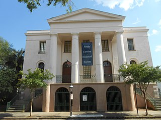
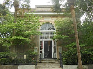
Get Ticket*The Fireproof Building, also known as the County Records Building, is located at 100 Meeting Street, at the northwest corner of Washington Square, in Charleston, South Carolina. Completed in 1827, it was the most fire-resistant building in America at the time, and is believed to be the oldest fire-resistant building in America today.
Sight 7: Gibbes Museum of Art
Get Ticket*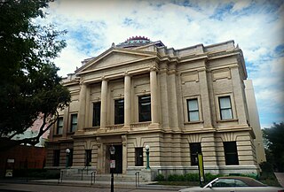
The Gibbes Museum of Art, formerly known as the Gibbes Art Gallery, is an art museum in Charleston, South Carolina. Established as the Carolina Art Association in 1858, the museum moved into a new Beaux Arts building at 135 Meeting Street, in the Charleston Historic District, in 1905. The Gibbes houses a premier collection of over 10,000 works of fine art, principally American works, many with a connection to Charleston or the South.
Sight 8: Saint Stephens Episcopal Church
St. Stephen's Episcopal Church is an Episcopal parish in Charleston, South Carolina, founded in 1822. It was the first Episcopal church in the United States at which pews were offered to attendants at no cost; other Episcopal churches either sold or leased pews to members to fund the churches. The church was named as a contributing property to the Charleston Historic District when it was expanded in 1970.
Wikipedia: St. Stephen's Episcopal Church (Charleston, South Carolina) (EN)
Sight 9: Historic Charleston City Market
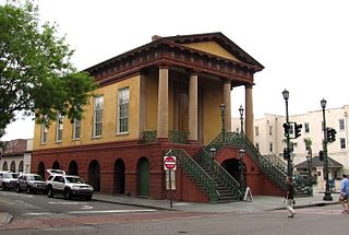
The City Market is a historic market complex in downtown Charleston, South Carolina. Established in the 1790s, the market stretches for four city blocks from the architecturally-significant Market Hall, which faces Meeting Street, through a continuous series of one-story market sheds, the last of which terminates at East Bay Street. The market should not be confused with the Old Slave Mart where enslaved people were sold, as enslaved people were never sold in the City Market. The City Market Hall has been described as a building of the "highest architectural design quality." The entire complex was listed on the National Register of Historic Places as Market Hall and Sheds and was further designated a National Historic Landmark.
Wikipedia: City Market (Charleston, South Carolina) (EN), Website
Sight 10: Saint Philip Protestant Episcopal Church
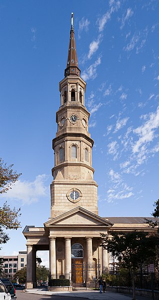
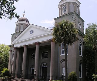
St. Philip's Church is an historic church at 142 Church Street in Charleston, South Carolina. Its National Historic Landmark description states: "Built in 1836, this stuccoed brick church features an imposing tower designed in the Wren-Gibbs tradition. Three Tuscan pedimented porticoes contribute to this design to make a building of the highest quality and sophistication." On November 7, 1973, it was added to the National Register of Historic Places and designated a National Historic Landmark.
Wikipedia: St. Philip's Episcopal Church (Charleston, South Carolina) (EN), Website, Tripadvisor, Facebook, Yelp
Sight 11: Rainbow Row (north end)
Rainbow Row is the name for a series of thirteen colorful historic houses in Charleston, South Carolina. The houses are located north of Tradd St. and south of Elliott St. on East Bay Street, that is, 79 to 107 East Bay Street. The name Rainbow Row was coined after the pastel colors they were painted as they were restored in the 1930s and 1940s. It is a popular tourist attraction and is one of the most photographed parts of Charleston.
Sight 12: Heyward-Washington House Museum
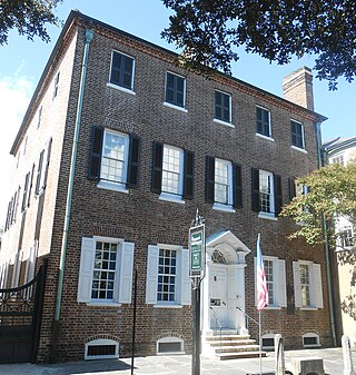
The Heyward-Washington House is a historic house museum at 87 Church Street in Charleston, South Carolina. Built in 1772, it was home to Thomas Heyward, Jr., a signer of the United States Declaration of Independence, and was where George Washington stayed during his 1791 visit to the city. It is now owned and operated by the Charleston Museum. Furnished for the late 18th century, the house includes a collection of Charleston-made furniture. Other structures include the carriage shed and 1740s kitchen building.
Sight 13: First Scots Presbyterian Church of Charleston
First (Scots) Presbyterian Church is a historic church located at 53 Meeting St., Charleston, South Carolina. The congregation was established in 1731 when a dozen Scottish residents left the Independent Church of Charleston, now called the Circular Congregational Church.
Sight 14: The Calhoun Mansion
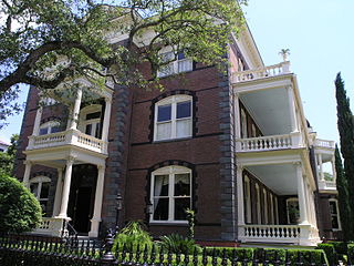
The Williams Mansion is a Victorian house at 16 Meeting St., Charleston, South Carolina. The mansion is open for public tours.
Sight 15: White Point Gardens
Get Ticket*White Point Garden is a 5.7 acre public park located in peninsular Charleston, South Carolina, at the tip of the peninsula. It is the southern terminus for the Battery, a defensive seawall and promenade. It is bounded by East Battery, Murray Blvd., King St., and South Battery.
Share
How likely are you to recommend us?
Disclaimer Please be aware of your surroundings and do not enter private property. We are not liable for any damages that occur during the tours.
GPX-Download For navigation apps and GPS devices you can download the tour as a GPX file.
