Self-guided Sightseeing Tour #4 in London, United Kingdom
Legend
Tour Facts
10.5 km
248 m
Experience London in United Kingdom in a whole new way with our free self-guided sightseeing tour. This site not only offers you practical information and insider tips, but also a rich variety of activities and sights you shouldn't miss. Whether you love art and culture, want to explore historical sites or simply want to experience the vibrant atmosphere of a lively city - you'll find everything you need for your personal adventure here.
Activities in LondonIndividual Sights in LondonSight 1: St Philip's Church Library
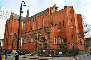
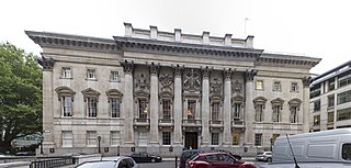
The St Augustine with St Philip's Church is a Grade II* listed former Victorian church in Whitechapel in the London Borough of Tower Hamlets, subsequently converted for use as a medical library for Barts and The London School of Medicine and Dentistry and known as the Whitechapel Library.
Wikipedia: St Augustine with St Philip's Church, Whitechapel (EN)
Sight 2: Whitechapel Bell Foundry
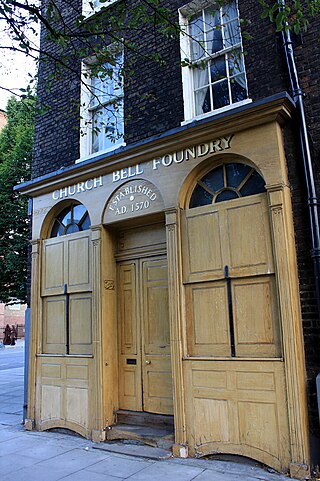
The Whitechapel Bell Foundry was a business in the London Borough of Tower Hamlets. At the time of the closure of its Whitechapel premises, it was the oldest manufacturing company in Great Britain. The bell foundry primarily made church bells and their fittings and accessories, although it also provided single tolling bells, carillon bells and handbells. The foundry was notable for being the original manufacturer of the Liberty Bell, a famous symbol of American independence, and for re-casting Big Ben, which rings from the north clock tower at the Houses of Parliament in London.
Sight 3: Brick Lane
Get Ticket*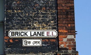
Brick Lane is a famous street in the East End of London, in the borough of Tower Hamlets. It runs from Swanfield Street in Bethnal Green in the north, crosses the Bethnal Green Road before reaching the busiest, most commercially active part which runs through Spitalfields, or along its eastern edge. Brick Lane's southern end is connected to Whitechapel High Street by a short extension called Osborn Street.
Sight 4: Christ Church Spitalfields
Christ Church Spitalfields is an Anglican church built between 1714 and 1729 to a design by Nicholas Hawksmoor. On Commercial Street in the East End and in today's Central London it is in the London Borough of Tower Hamlets, on its western border facing the City of London, it was one of the first of the so-called "Commissioners' Churches" built for the Commission for Building Fifty New Churches, which had been established by an act of parliament in 1711.
Wikipedia: Christ Church, Spitalfields (EN), Website, Heritage Website
Sight 5: Bishopsgate Institute
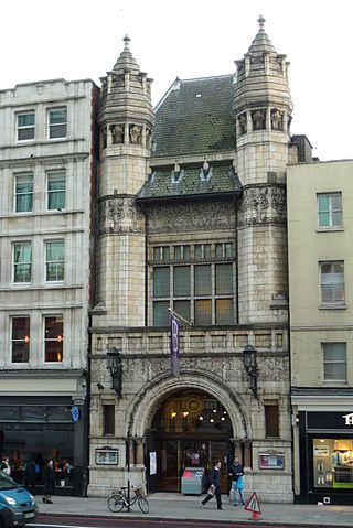
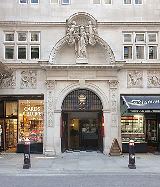
Bishopsgate Institute is a cultural institute in the Bishopsgate area of the City of London, located in the East End of London near Spitalfields and Shoreditch. The institute was established in 1895. It offers a cultural events programme, courses for adults, historic library and archive collections and community programme.
Sight 6: Fulcrum
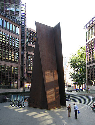
Fulcrum is a large sculpture by American artist Richard Serra installed in 1987 near the western entrance to Liverpool Street station, London, as part of the Broadgate development. The sculpture consists of five pieces of Cor-Ten steel, and is approximately 55 feet (17 m) tall. Deyan Sudjic, director of the Design Museum, has called it one of London's "design icons".
Sight 7: Catholic Church of St Mary, Moorfields
St Mary Moorfields is a Roman Catholic church in Eldon Street near Moorgate, on a site previously known as Moorfields. It is the only Catholic church in the City of London. Prior to a 1994 boundary change, the church was in the Borough of Hackney, such that there were no Catholic churches in the City.
Sight 8: St Botolph-without-Bishopsgate
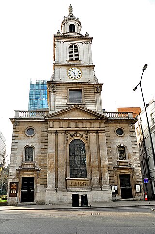
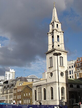
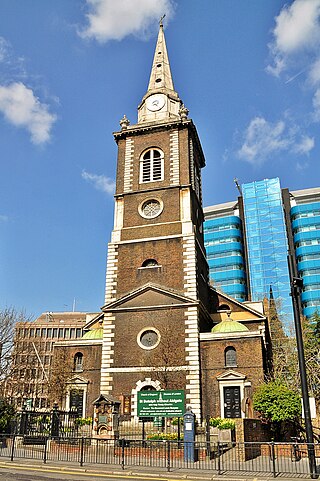
St Botolph-without-Bishopsgate is a Church of England church in the Bishopsgate Without area of the City of London, and also, by virtue of lying outside the city's eastern walls, part of London's East End.
Wikipedia: St Botolph-without-Bishopsgate (EN), Heritage Website
Sight 9: Guildhall Art Gallery
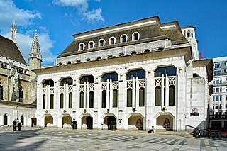
The Guildhall Art Gallery houses the art collection of the City of London, England. The museum is located in the Moorgate area of the City of London. It is a stone building in a semi-Gothic style intended to be sympathetic to the historic Guildhall, which is adjacent and to which it is connected internally.
Sight 10: Roman Amphitheatre Site
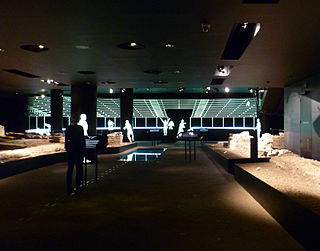
The visible remains of an amphitheatre constructed during Roman London lie beneath Guildhall Yard in the City of London. Some of these remains are displayed in situ in a room in the basement of the Guildhall Art Gallery complex. Discovered in 1988, the site is now a scheduled monument.
Sight 11: The Guild Church of Saint Lawrence Jewry
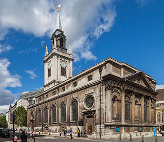
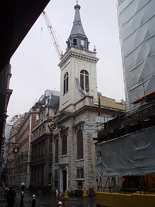
St Lawrence Jewry next Guildhall is a Church of England guild church in the City of London on Gresham Street, next to the Guildhall. It was destroyed in the Great Fire of London in 1666, and rebuilt to the designs of Sir Christopher Wren. It is the official church of the Lord Mayor of London.
Sight 12: Goldsmiths' Hall
Goldsmiths' Hall is a Grade I listed building at the junction of Foster Lane and Gresham Street in the City of London. It has served as an assay office and the headquarters of London's goldsmith guild, the Worshipful Company of Goldsmiths, one of the livery companies of the City of London. The company has been based at this location since 1339, the present building being their third hall on the site.
Sight 13: St Vedast
Saint Vedast Foster Lane or Saint Vedast-alias-Foster, a church in Foster Lane, in the City of London, is dedicated to St. Vedast, a French saint whose cult arrived in England through contacts with Augustinian clergy.
Sight 14: St Paul's Cathedral
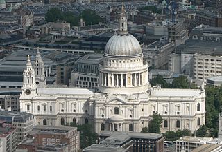
Get Ticket*St Paul's Cathedral, formally the Cathedral Church of St Paul the Apostle, is an Anglican cathedral in London, England, the seat of the Bishop of London. The cathedral serves as the mother church of the Diocese of London. It is on Ludgate Hill at the highest point of the City of London. Its dedication in honour of Paul the Apostle dates back to the original church on this site, founded in AD 604. The present structure, which was completed in 1710, is a Grade I listed building that was designed in the English Baroque style by Sir Christopher Wren. The cathedral's reconstruction was part of a major rebuilding programme initiated in the aftermath of the Great Fire of London. The earlier Gothic cathedral, largely destroyed in the Great Fire, was a central focus for medieval and early modern London, including Paul's walk and St Paul's Churchyard, being the site of St Paul's Cross.
Wikipedia: St Paul's Cathedral (EN), Website, Heritage Website
Sight 15: St Augustine, Watling Street
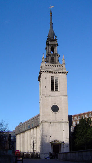
St Augustine, Watling Street, was an Anglican church which stood just to the east of St Paul's Cathedral in the City of London. First recorded in the 12th century, it was destroyed by the Great Fire of London in 1666 and rebuilt to the designs of Christopher Wren. This building was destroyed by bombing during the Second World War, and its remains now form part of St Paul's Cathedral Choir School.
Wikipedia: St Augustine Watling Street (EN), Heritage Website
Sight 16: The Guild Church of Saint Benet
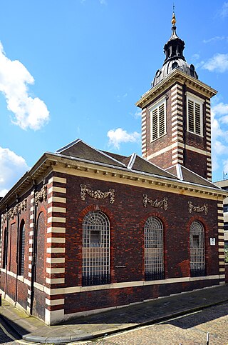
The Church of St Benet Paul's Wharf is a Welsh Anglican church in the City of London, England. Since 1556, it has also been the official church of the College of Arms in which many officers of arms have been buried. In 1666 it was destroyed in the Great Fire of London, after which it was rebuilt and merged with nearby St Peter's. The current church was designed by Sir Christopher Wren. It is one of only four churches in the City of London to escape damage during World War II.
Wikipedia: St Benet's, Paul's Wharf (EN), Website, Heritage Website
Sight 17: St. James Garlickhythe
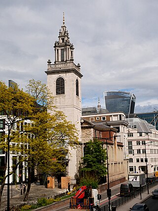
St James Garlickhythe is a Church of England parish church in Vintry ward of the City of London, nicknamed "Wren's lantern" owing to its profusion of windows.
Wikipedia: St James Garlickhythe (EN), Website, Heritage Website
Sight 18: St Mary Aldermary
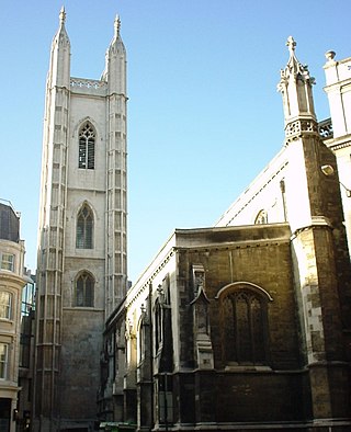
St Mary Aldermary is an Anglican church located on Bow Lane at the junction with Watling Street, in the City of London within the United Kingdom.
Wikipedia: St Mary Aldermary (EN), Website, Heritage Website
Sight 19: London Stone
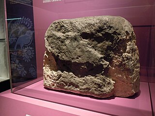
London Stone is a historic landmark housed at 111 Cannon Street in the City of London. It is an irregular block of oolitic limestone measuring 53 × 43 × 30 cm, the remnant of a once much larger object that had stood for many centuries on the south side of the street.
Sight 20: St Mary Abchurch
St Mary Abchurch is a Church of England church off Cannon Street in the City of London. Dedicated to the Blessed Virgin Mary, it is first mentioned in 1198–1199. The medieval church was destroyed in the Great Fire of London in 1666, and replaced by the present building.
Sight 21: Mansion House
Get Ticket*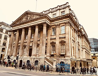
The Mansion House is the official residence of the Lord Mayor of London. It is a Grade I listed building. Designed by George Dance in the Palladian style, it was built primarily in the 1740s.
Sight 22: London Mithraeum
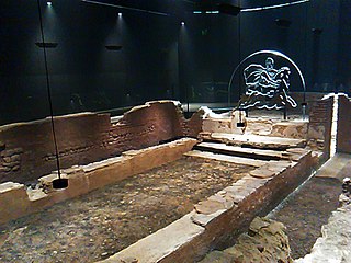
The London Mithraeum, also known as the Temple of Mithras, Walbrook, is a Roman Mithraeum that was discovered in Walbrook, a street in the City of London, during a building's construction in 1954. The entire site was relocated to permit continued construction and this temple of the mystery god Mithras became perhaps the most famous 20th-century Roman discovery in London.
Sight 23: St Stephen Walbrook
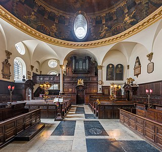
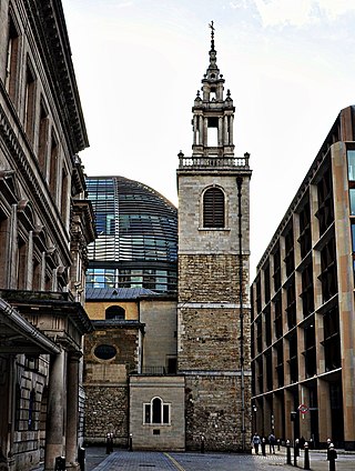
St Stephen Walbrook is a church in the City of London, part of the Church of England's Diocese of London. The present domed building was erected to the designs of Sir Christopher Wren following the destruction of its medieval predecessor in the Great Fire of London in 1666. It is located in Walbrook, next to the Mansion House, and near to Bank and Monument Underground stations.
Wikipedia: St Stephen Walbrook (EN), Website, Heritage Website
Sight 24: No 1 Poultry
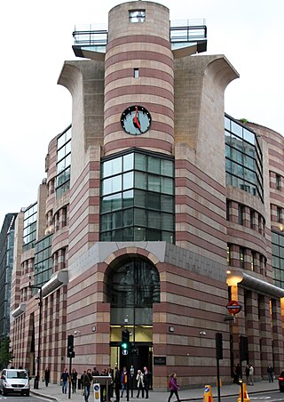
No 1 Poultry is a building in the City of London, allocated to office and commercial use. It occupies the apex where the eastern ends of Poultry and Queen Victoria Street meet at Mansion House Street, the western approach to Bank junction.
Sight 25: Duke of Wellington
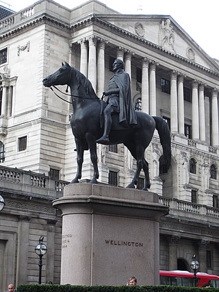
The equestrian statue of the Duke of Wellington is an outdoor sculpture of Arthur Wellesley, 1st Duke of Wellington, a British soldier and statesman, located at the Royal Exchange in London. It overlooks Bank junction in the historic City of London. The sculptor was Francis Leggatt Chantrey. The statue commemorates Wellington's assistance to the City of London in ensuring that a bill was passed to allow the rebuilding of London Bridge.
Wikipedia: Equestrian statue of the Duke of Wellington, City of London (EN)
Sight 26: London Troops War Memorial
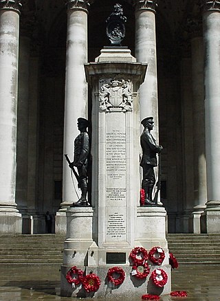
The London Troops War Memorial, located in front of the Royal Exchange in the City of London, commemorates the men of London who fought in World War I and World War II.
Wikipedia: London Troops War Memorial (EN), Heritage Website
Sight 27: Royal Exchange
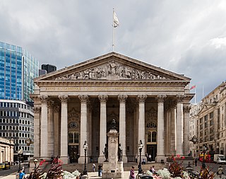
Get Ticket*The Royal Exchange in London was founded in the 16th century by the merchant Sir Thomas Gresham on the suggestion of his factor Richard Clough to act as a centre of commerce for the City of London. The site was provided by the City of London Corporation and the Worshipful Company of Mercers, who still jointly own the freehold. The original foundation was ceremonially opened by Queen Elizabeth I who granted it its "royal" title. The current neoclassical building has a trapezoidal floor plan and is flanked by Cornhill and Threadneedle Street, which converge at Bank junction in the heart of the city. It lies in the Ward of Cornhill.
Sight 28: Saint Andrew Undershaft
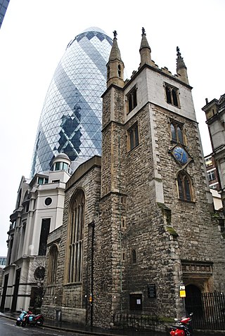
St Andrew Undershaft is a Church of England church in the City of London, the historic nucleus and modern financial centre of London. It is located on St Mary Axe, within the Aldgate ward, and is a rare example of a City church that survived both the Great Fire of London and the Blitz.
Sight 29: St Ethelburga-the-Virgin within Bishopsgate
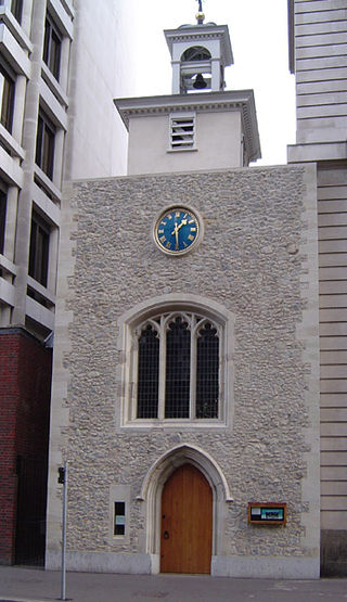
St Ethelburga-the-Virgin within Bishopsgate is a Church of England church in the City of London, located on Bishopsgate near Liverpool Street station.
Wikipedia: St Ethelburga's Bishopsgate (EN), Website, Heritage Website
Sight 30: The Baltic Exchange
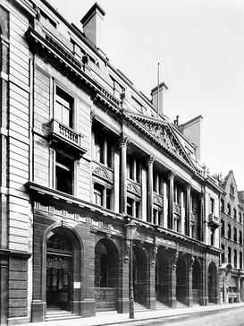
The Baltic Exchange was an important listed building and historic landmark at 24–28 St Mary Axe in the City of London, occupied by the Baltic Exchange, a market for shipping, marine insurance, and information on maritime transportation. The building was known to architectural historians for its cathedral-like trading hall and the Baltic Exchange Memorial Glass, a stained glass war memorial.
Wikipedia: Baltic Exchange (building) (EN), Heritage Website
Sight 31: 30 St Mary Axe
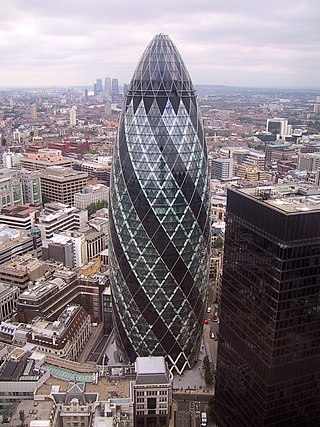
The Gherkin, officially 30 St Mary Axe and previously known as the Swiss Re Building, is a commercial skyscraper in London's primary financial district, the City of London. It was completed in December 2003 and opened in April 2004. With 41 floors, it is 180 metres (591 ft) tall and stands on the sites of the former Baltic Exchange and Chamber of Shipping, which were extensively damaged in 1992 in the Baltic Exchange bombing by a device placed by the Provisional IRA in St Mary Axe, a narrow street leading north from Leadenhall Street.
Sight 32: St Botolph's Aldgate
St Botolph's Aldgate is a Church of England parish church in the City of London and also, as it lies outside the line of the city's former eastern walls, a part of the East End of London. The church served the ancient parish of St Botolph without Aldgate which included the extramural Portsoken Ward of the City of London, as well as East Smithfield which is outside the City.
Wikipedia: St Botolph's Aldgate (EN), Website, Heritage Website
Sight 33: Aldgate Pump (Dry)
.jpg)
Aldgate Pump is an historic former water pump located at the junction where Aldgate High Street meets Fenchurch Street and Leadenhall Street in the City of London. The pump is considered to be the symbolic start point of the East End of London.
Sight 34: Lloyd's of London
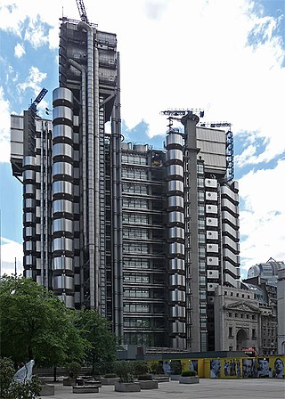
The Lloyd's building is the home of the insurance institution Lloyd's of London. It is located on the former site of East India House in Lime Street, in London's main financial district, the City of London. The building is a leading example of radical Bowellism architecture in which the services for the building, such as ducts and lifts, are located on the exterior to maximise space in the interior.
Sight 35: Leadenhall Market
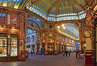
Get Ticket*Leadenhall Market is a covered market in London, England, located on Gracechurch Street but with vehicular access also available via Whittington Avenue to the north and Lime Street to the south and east, and additional pedestrian access via a number of narrow passageways.
Wikipedia: Leadenhall Market (EN), Website, Heritage Website
Sight 36: St Michael Cornhill War Memorial
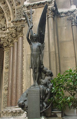
St Michael Cornhill War Memorial is a First World War memorial by the entrance to the church of St Michael Cornhill, facing Cornhill in the City of London. The memorial became a Grade II* listed building in December 2016 ; the church itself is Grade I listed.
Wikipedia: St Michael Cornhill War Memorial (EN), Heritage Website
Sight 37: St Michael's Cornhill
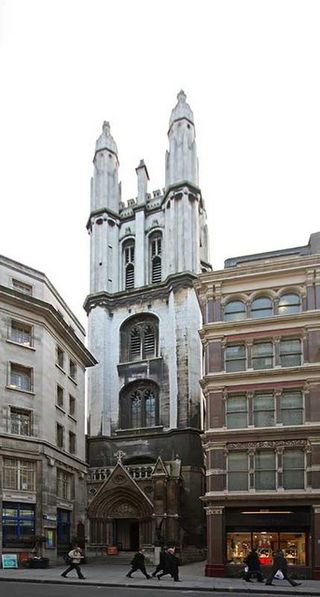
St Michael, Cornhill, is a medieval parish church in the City of London with pre-Norman Conquest parochial foundation. It lies in the ward of Cornhill. The medieval structure was lost in the Great Fire of London, and replaced by the present building, traditionally attributed to Sir Christopher Wren. The upper parts of the tower are by Nicholas Hawksmoor. The church was embellished by Sir George Gilbert Scott and Herbert Williams in the nineteenth century.
Wikipedia: St Michael, Cornhill (EN), Website, Heritage Website
Sight 38: Saint Edmund King and Martyr
St Edmund, King and Martyr, is an Anglican church in Lombard Street, in the City of London, dedicated to St Edmund the Martyr. From 2001 it housed the London Centre for Spirituality, renamed the London Centre for Spiritual Direction, but is still a consecrated church. Since 2019, Imprint Church organises regular worship inside of the building.
Wikipedia: St Edmund, King and Martyr (EN), Heritage Website
Sight 39: Berwin Leighton Paisner
Berwin Leighton Paisner (BLP) was an international law firm with 14 offices across 10 countries. It specialized in real estate, finance, litigation and corporate risk, private wealth and tax. In 2018, Bryan Cave merged with Berwin Leighton Painser to create Bryan Cave Leighton Paisner LLP, led by Lisa Mayhew and Therese Pritchard.
Wikipedia: Berwin Leighton Paisner (EN), Website, Heritage Website
Share
How likely are you to recommend us?
Disclaimer Please be aware of your surroundings and do not enter private property. We are not liable for any damages that occur during the tours.
GPX-Download For navigation apps and GPS devices you can download the tour as a GPX file.
