Self-guided Sightseeing Tour #19 in London, United Kingdom

Legend

Churches & Art
Nature
Water & Wind
Historical
Heritage & Space
Tourism
Paid Tours & Activities

Tour Facts

Number of sights 28 sights
Distance 15.8 km
Ascend 203 m
Descend 200 m

Experience London in United Kingdom in a whole new way with our self-guided sightseeing tour. This site not only offers you practical information and insider tips, but also a rich variety of activities and sights you shouldn't miss. Whether you love art and culture, want to explore historical sites or simply want to experience the vibrant atmosphere of a lively city - you'll find everything you need for your personal adventure here.

Activities in LondonIndividual Sights in London

Sight 1: Mecklenburgh Square Gardens

Show sight on map

Mecklenburgh Square is a Grade II listed square in Bloomsbury, London. The square and its garden were part of the Foundling Estate, a residential development of 1792–1825 on fields surrounding and owned by the Foundling Hospital. The square was named in honour of King George III's queen, Charlotte of Mecklenburg-Strelitz. It was begun in 1804, but was not completed until 1825.

Wikipedia: Mecklenburgh Square (EN)

469 meters / 6 minutes

Sight 2: Brunswick Square Gardens

Show sight on map

Brunswick Square is a 3-acre (1.2 ha) public garden and ancillary streets along two of its sides in Bloomsbury, in the London Borough of Camden. It is overlooked by the School of Pharmacy and the Foundling Museum to the north; the Brunswick Centre to the west; and International Hall to the south. East is an enclosed area of playgrounds with further trees, Coram's Fields, associated with charity Coram Family which is just over double its size; next to that area Brunswick Square is mirrored, symmetrically by Mecklenburgh Square, likewise of 3 acres including roads. The squares are named after contemporary Queen consorts.

Wikipedia: Brunswick Square (EN)

902 meters / 11 minutes

Sight 3: Gordon Square

Show sight on map
Gordon Square Ewan-M / CC BY-SA 2.0

Gordon Square is a public park square in Bloomsbury, London, England. It is part of the Bedford Estate and was designed as one of a pair with the nearby Tavistock Square. It is owned by the University of London.

Wikipedia: Gordon Square (EN)

168 meters / 2 minutes

Sight 4: Church of Christ the King

Show sight on map

The Church of Christ the King belongs to Catholic Apostolic Church trustees; it is in Gordon Square, Bloomsbury, London. It adjoins Dr Williams's Library and is within sight of University College London. The church is used by the Anglican mission Euston Church for Sunday services and its English Chapel, at its east end, by Forward in Faith for weekday services. It has been a Grade I listed building since 10 June 1954, one of 129 such Christian buildings in London.

Wikipedia: Church of Christ the King, Bloomsbury (EN), Heritage Website

224 meters / 3 minutes

Sight 5: Petrie Museum of Egyptian Archeology

Show sight on map

The Petrie Museum of Egyptian Archaeology in London is part of University College London Museums and Collections. The museum contains 80,000 objects, making it one of the world's largest collections of Egyptian and Sudanese material. It is designated under the Arts Council England Designation Scheme as being of "national and international importance".

Wikipedia: Petrie Museum of Egyptian Archaeology (EN), Website

206 meters / 2 minutes

Sight 6: Bloomsbury Theatre

Show sight on map

The Bloomsbury Theatre is a theatre on Gordon Street, Bloomsbury, in the London Borough of Camden, owned by University College London. The Theatre has a seating capacity of 541 and offers a professional programme of innovative music, drama, comedy and dance all year round as well as providing a space for student-led productions.

Wikipedia: Bloomsbury Theatre (EN), Website

693 meters / 8 minutes

Sight 7: BT Tower

Show sight on map

The BT Tower is a grade II listed communications tower in Fitzrovia, London, England, owned by BT Group. It was also known as the GPO Tower and the Post Office Tower. It was later officially renamed the Telecom Tower. The main structure is 581 feet (177 m) high, with a further section of aerial rigging bringing the total height to 620 feet (189 m).

Wikipedia: BT Tower (EN)

631 meters / 8 minutes

Sight 8: Former Holy Trinity Church

Show sight on map
Former Holy Trinity Church

Holy Trinity Church, in Marylebone, Westminster, London, is a Grade I listed former Anglican church, built in 1828 and designed by John Soane. In 1818 Parliament passed an act setting aside one million pounds to celebrate the defeat of Napoleon. This is one of the so-called "Waterloo churches" that were built with the money. The building has an entrance off-set with four large Ionic columns. There is a lantern steeple, similar to St Pancras New Church, which is also on Euston Road to the east.

Wikipedia: Holy Trinity Church, Marylebone (EN), Heritage Website

78 meters / 1 minutes

Sight 9: John F. Kennedy Memorial

Show sight on map

A 1965 memorial bust of John F. Kennedy by Jacques Lipchitz stands in the lobby of International Students House on Great Portland Street in London, England, and is visible from the outside through the glass doors. It was moved there in April 2019 from its original location on the Marylebone Road, to the west of Great Portland Street underground station, after it was vandalised in 2017.

Wikipedia: John F. Kennedy Memorial, London (EN)

949 meters / 11 minutes

Sight 10: St. Marylebone Parish Church

Show sight on map

St Marylebone Parish Church is an Anglican church on the Marylebone Road in London. It was built to the designs of Thomas Hardwick in 1813–17. The present site is the third used by the parish for its church. The first was further south, near Oxford Street. The church there was demolished in 1400 and a new one erected further north. This was completely rebuilt in 1740–42, and converted into a chapel-of-ease when Hardwick's church was constructed. The Marylebone area takes its name from the church. Located behind the church is St Marylebone School, a Church of England school for girls.

Wikipedia: St Marylebone Parish Church (EN), Website, Heritage Website

422 meters / 5 minutes

Sight 11: Madame Tussauds

Show sight on map
Madame Tussauds self-made / CC BY-SA 3.0

Madame Tussauds is a wax museum founded in London in 1835 by the French wax sculptor Marie Tussaud. One of the early main attractions was the Chamber of Horrors, which appeared in advertising in 1843.

Wikipedia: Madame Tussauds (EN), Website

439 meters / 5 minutes

Sight 12: Self-Realization Fellowship

Show sight on map
Self-Realization Fellowship

Self-Realization Fellowship (SRF) is a worldwide religious organization founded in 1920 by Paramahansa Yogananda, the Indian guru who authored Autobiography of a Yogi. Before coming to the United States, Yogananda began his spiritual work in India in 1917 and named it Yogoda Satsanga Society of India (YSS). He came to the West in 1920 and in 1925 established SRF's headquarters at Mount Washington, Los Angeles, California. Before his return visit to India in 1935, he legally incorporated SRF in the United States, designating it as the only organization to carry on his work – to care for and disseminate his teachings.

Wikipedia: Self-Realization Fellowship (EN), Website

489 meters / 6 minutes

Sight 13: Saint James's

Show sight on map

St James' Church is a large English Gothic Catholic church in George Street, Marylebone, London. Although currently situated in George Street, the church maintains its connection with Spanish Place, the road opposite the current church, because of its historic connection with the Spanish Embassy. It is a Grade II* listed building.

Wikipedia: St James's, Spanish Place (EN), Heritage Website

594 meters / 7 minutes

Sight 14: Chandos House

Show sight on map

Chandos House is a Grade I listed building at N° 2 Queen Anne Street, Marylebone, in central London. It was designed by Robert Adam, the most prominent architect in Georgian Britain, and built by William Adam and Company. It is seen as the first of a series of large townhouses in London, including 20 St. James's Square and Derby House.

Wikipedia: Chandos House (EN), Heritage Website

345 meters / 4 minutes

Sight 15: Cavendish Square

Show sight on map

Cavendish Square is a public garden square in Marylebone in the West End of London. It has a double-helix underground commercial car park. Its northern road forms ends of four streets: of Wigmore Street that runs to Portman Square in the much larger Portman Estate to the west; of Harley Street which runs an alike distance; of Chandos Street which runs for one block and; of Cavendish Place which runs the same. The south side itself is modern: the rear façade and accesses to a flagship department store and office block. On the ground floors facing are Comptoir Libanais, Royal Bank of Scotland and Pret a Manger premises.

Wikipedia: Cavendish Square (EN)

418 meters / 5 minutes

Sight 16: Wigmore Hall

Show sight on map
Wigmore Hall Russ London -- (Russ London) / CC BY-SA 2.5

The Wigmore Hall is a concert hall at 36 Wigmore Street, in west London. It was designed by Thomas Edward Collcutt and opened in 1901 as the Bechstein Hall; it is considered to have particularly good acoustics. It specialises in performances of chamber music, early music, vocal music and song recitals, and hosts over five hundred concerts each year, as well as a weekly concert broadcast on BBC Radio 3.

Wikipedia: Wigmore Hall (EN), Website, Facebook

295 meters / 4 minutes

Sight 17: Manchester Square

Show sight on map
Manchester Square

Manchester Square is an 18th-century garden square in Marylebone, London. Centred 950 feet (290 m) north of Oxford Street it measures 300 feet (91 m) internally north-to-south, and 280 feet (85 m) across. It is a small Georgian predominantly 1770s-designed instance in central London; construction began around 1776. The north side has a central mansion, Hertford House, flanked by approach ways; its first name was Manchester House — its use is since 1897 as the Wallace Collection (gallery/museum) of fine and decorative arts sits alongside the Madame Tussauds museum and the Wigmore Hall concert rooms. The square forms part of west Marylebone, most of which sees minor but overarching property interests held by one owner among which many buildings have been recognised by statutory protection.

Wikipedia: Manchester Square (EN)

771 meters / 9 minutes

Sight 18: West London Synagogue of British Jews

Show sight on map

The West London Synagogue, abbreviated WLS, and fully the West London Synagogue of British Jews is a Reform Jewish congregation and synagogue, located near Marble Arch, at 34 Upper Berkeley Street, in the City of Westminster, in Central London, England, in the United Kingdom.

Wikipedia: West London Synagogue (EN), Url, Heritage Website

656 meters / 8 minutes

Sight 19: Speakers' Corner

Show sight on map

A Speakers' Corner is an area where free speech open-air public speaking, debate, and discussion are allowed. The original and best known is in the north-east corner of Hyde Park in London, England. Historically there were a number of other areas designated as Speakers' Corners in other parks in London, such as Lincoln's Inn Fields, Finsbury Park, Clapham Common, Kennington Park, and Victoria Park. Areas for Speakers' Corners have been established in other countries and elsewhere in the UK.

Wikipedia: Speakers' Corner (EN), Website

618 meters / 7 minutes

Sight 20: Hyde Park

Show sight on map
Hyde Park @LondonNPC #NationalParkCity / CC BY 2.0

Hyde Park is a 350-acre (140 ha), historic Grade I-listed urban park in Westminster, Greater London. A Royal Park, it is the largest of the parks and green spaces that form a chain from Kensington Palace through Kensington Gardens and Hyde Park, via Hyde Park Corner and Green Park, past Buckingham Palace to St James's Park. Hyde Park is divided by the Serpentine and the Long Water lakes.

Wikipedia: Hyde Park, London (EN), Heritage Website

1105 meters / 13 minutes

Sight 21: Statue of Edward Jenner

Show sight on map

A statue of Edward Jenner, the physician, scientist and pioneer of the world's first vaccine, is located in Kensington Gardens in London. A work of the sculptor William Calder Marshall, the bronze was originally unveiled by Albert, Prince Consort in Trafalgar Square on 17 May 1858, before being moved to its present location in 1862. It is a Grade II listed building.

Wikipedia: Statue of Edward Jenner, London (EN)

735 meters / 9 minutes

Sight 22: Kensington Gardens

Show sight on map

Kensington Gardens, once the private gardens of Kensington Palace, are among the Royal Parks of London. The gardens are shared by the City of Westminster and the Royal Borough of Kensington and Chelsea and sit immediately to the west of Hyde Park, in western central London known as the West End. The gardens cover an area of 107 hectares. The open spaces of Kensington Gardens, Hyde Park, Green Park, and St. James's Park together form an almost continuous "green lung" in the heart of London. Kensington Gardens are Grade I listed on the Register of Historic Parks and Gardens.

Wikipedia: Kensington Gardens (EN), Heritage Website

676 meters / 8 minutes

Sight 23: The Elfin Oak

Show sight on map

The Elfin Oak is the stump of a 900-year-old oak tree located in Kensington Gardens, London, carved and painted to look as though elves, gnomes, fairies and small animals are living in its bark.

Wikipedia: Elfin Oak (EN)

755 meters / 9 minutes

Sight 24: Leinster Gardens

Show sight on map

Leinster Gardens is a street in Bayswater, London. It is lined with tall, ornate, mid-Victorian terraced houses, many of which are listed buildings.

Wikipedia: Leinster Gardens (EN)

978 meters / 12 minutes

Sight 25: New West End Synagogue

Show sight on map
New West End SynagogueChesdovi (for attribution details, contact me using the link at https://en.wikipedia.org/wiki/User:Chesdovi) / CC BY 3.0

The New West End Synagogue is an Orthodox Jewish congregation and synagogue, located in St. Petersburgh Place, Bayswater, in the City of Westminster, London, England, in the United Kingdom. The congregation has been a member of United Synagogue since 1879.

Wikipedia: New West End Synagogue (EN), Heritage Website

326 meters / 4 minutes

Sight 26: Capellanía Catolica Española

Show sight on map

47 Palace Court is a Grade II listed building at Palace Court, Bayswater, London, W2.

Wikipedia: 47 Palace Court (EN)

790 meters / 9 minutes

Sight 27: The Coronet Theatre

Show sight on map
The Coronet Theatre

The Coronet Theatre is a theatre located in Notting Hill, London. The building originated as an Off West End theatre in 1898. It became The Coronet Cinema in 1923. In 2014, it was acquired by The Print Room, a nearby theatre company, which made it its new home. It produces a programme of theatre, art, dance, poetry, film and music. The theatre is run by Artistic Director Anda Winters.

Wikipedia: Coronet Theatre, London (EN), Website

1086 meters / 13 minutes

Sight 28: Essex Unitarian Church

Show sight on map
Essex Unitarian Church

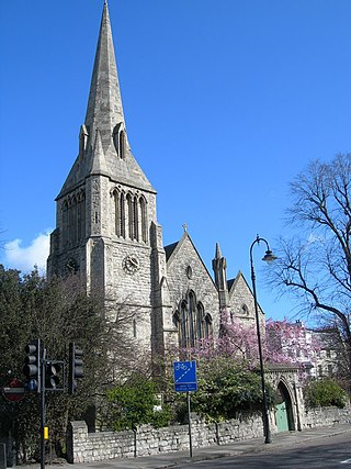
Essex Street Chapel, also known as Essex Church, is a Unitarian place of worship in London. It was the first church in England set up with this doctrine, and was established when Dissenters still faced legal threat. As the birthplace of British Unitarianism, Essex Street has particularly been associated with social reformers and theologians. The congregation moved west in the 19th century, allowing the building to be turned into the headquarters for the British and Foreign Unitarian Association and the Sunday School Association. These evolved into the General Assembly of Unitarian and Free Christian Churches, the umbrella organisation for British Unitarianism, which is still based on the same site, in an office building called Essex Hall. This article deals with the buildings, the history, and the current church, based in Kensington.

Wikipedia: Essex Street Chapel (EN), Website

Share

Spread the word! Share this page with your friends and family.

Disclaimer Please be aware of your surroundings and do not enter private property. We are not liable for any damages that occur during the tours.

GPX-Download For navigation apps and GPS devices you can download the tour as a GPX file.