Self-guided Sightseeing Tour #3 in City of London, United Kingdom
Legend
Tour Facts
8.9 km
198 m
Experience City of London in United Kingdom in a whole new way with our free self-guided sightseeing tour. This site not only offers you practical information and insider tips, but also a rich variety of activities and sights you shouldn't miss. Whether you love art and culture, want to explore historical sites or simply want to experience the vibrant atmosphere of a lively city - you'll find everything you need for your personal adventure here.
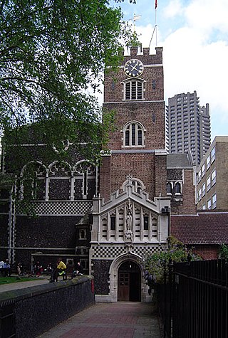
Individual Sights in City of LondonSight 1: St Bartholomew The Less
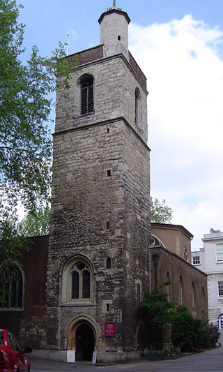
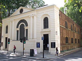
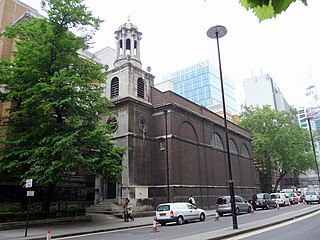
St Bartholomew the Less is an Anglican church in the City of London, associated with St Bartholomew's Hospital, within whose precincts it stands. Once a parish church, it has, since 1 June 2015, been a chapel of ease in the parish of St Bartholomew the Great.
Wikipedia: St Bartholomew-the-Less (EN), Website, Heritage Website
Sight 2: St Bartholomew-The Great
The Priory Church of St Bartholomew the Great, sometimes abbreviated to St-Barts-the-Great, is a mediaeval church in the Church of England's Diocese of London located in Smithfield within the City of London. The building was founded as an Augustinian priory in 1123. It adjoins St Bartholomew's Hospital of the same foundation.
Wikipedia: St Bartholomew-the-Great (EN), Website, Heritage Website
Sight 3: St-Giles-without-Cripplegate
St Giles-without-Cripplegate is an Anglican church in the City of London, located on Fore Street within the modern Barbican complex. When built it stood without the city wall, near the Cripplegate. The church is dedicated to St Giles, patron saint of handicapped and infirm people of many different kinds. It is one of the few medieval churches left in the City of London, having survived the Great Fire of 1666.
Wikipedia: St Giles-without-Cripplegate (EN), Heritage Website
Sight 4: St Olave Silver Street
St Olave's Church, Silver Street was a church on the south side of Silver Street, off Wood Street in the Aldersgate ward of the City of London. It was dedicated to St Olaf, a Norwegian Christian ally of the English king Ethelred II. The church was destroyed by the Great Fire of London in 1666 and not rebuilt.
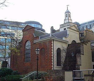
Sight 5: St. Anne and St. Agnes
St Anne and St Agnes is a church located at Gresham Street in the City of London, near the Barbican. While St Anne's is an Anglican foundation, from 1966 to 2013 it was let to a congregation of the Lutheran Church in Great Britain.
Sight 6: St Botolph's-without-Aldersgate Church
St. Botolph without Aldersgate is a Church of England church in London dedicated to St. Botolph. It was built just outside Aldersgate, one of the gates on London's wall, in the City of London.
Sight 7: Memorial to Heroic Self Sacrifice
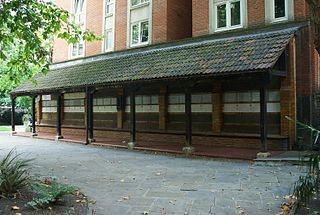
The Memorial to Heroic Self-Sacrifice is a public monument in Postman's Park in the City of London, commemorating ordinary people who died saving the lives of others and who might otherwise have been forgotten. It was first proposed by painter and sculptor George Frederic Watts in 1887, to commemorate the Golden Jubilee of Queen Victoria. The scheme was not accepted at that time, and in 1898 Watts was approached by Henry Gamble, vicar of St Botolph's Aldersgate church. Postman's Park was built on the church's former churchyard, and the church was at that time trying to raise funds to secure its future; Gamble felt that Watts's proposed memorial would raise the profile of the park. The memorial was unveiled in an unfinished state in 1900, consisting of a 50-foot (15 m) wooden loggia designed by Ernest George, sheltering a wall with space for 120 ceramic memorial tiles to be designed and made by William De Morgan. At the time of opening, only four of the memorial tiles were in place. Watts died in 1904, and his widow Mary Watts took over the running of the project.
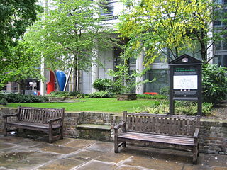
Sight 8: St John Zachary
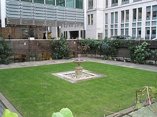
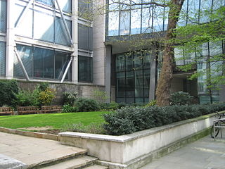
St John Zachary was a church, first mentioned in official records in 1181, within the City of London, England, on the north side of Gresham Street, Aldersgate. Its vicar from 25 May 1424 to an unknown date was William Byngham, the founder of England's first teacher training college. It was destroyed in the Great Fire of London in 1666 and not rebuilt, with its parish being united with that of St Anne and St Agnes by Act of Parliament in 1670 –an arrangement that lasted until the 20th century. Its site is now a garden, first made by the fire watchers in 1941. Partial records survive at IGI.
Sight 9: St Mary Staining
St. Mary Staining was a parish church in Oat Lane, northeast of St. Paul's Cathedral, in the City of London. First recorded in the 12th century, it was destroyed in the Great Fire of London in 1666 and not rebuilt.
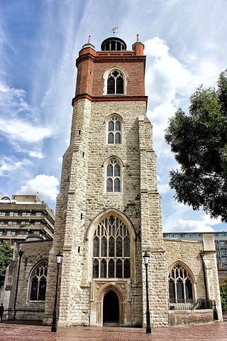
Sight 10: St Alban Church Tower
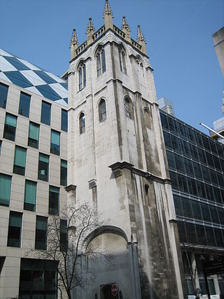
St Alban's was a church in Wood Street, City of London. It was dedicated to Saint Alban. Of medieval origin, it was rebuilt in 1634, destroyed in the Great Fire of London in 1666, and rebuilt, this time to a Gothic design by Sir Christopher Wren. It was severely damaged by bombing during the Second World War and the ruins cleared, leaving only the tower.
Sight 11: St Mary Aldermanbury
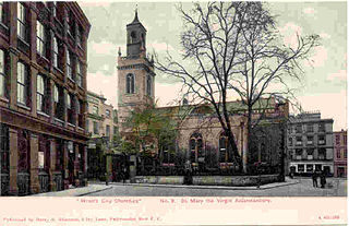
St Mary Aldermanbury was a parish church in the City of London first mentioned in 1181 and destroyed by the Great Fire of London in 1666. Rebuilt in Portland stone by Christopher Wren, it was again gutted by the Blitz in 1940, leaving only the walls standing. These stones were transported to Fulton, Missouri in 1966, by the residents of that town, and rebuilt in the grounds of Westminster College as a memorial to Winston Churchill. Churchill had made his Sinews of Peace, "Iron Curtain" speech in the Westminster College Gymnasium in 1946.
Sight 12: Heminge & Condell memorial
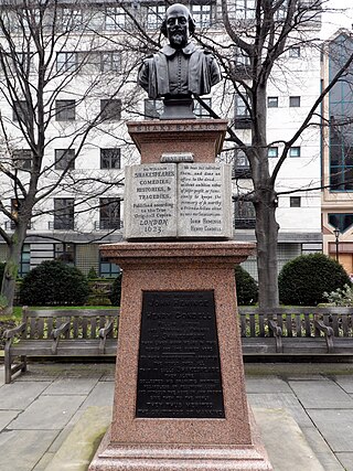
The John Heminges and Henry Condell Memorial is a memorial to the actors John Heminges and Henry Condell – the editors of William Shakespeare's First Folio, published in 1623 – in the former churchyard of St Mary Aldermanbury on Love Lane, London EC2. The memorial is made from pink granite and is topped with a bust of Shakespeare by C. J. Allen, dated 1895.
Sight 13: Guildhall
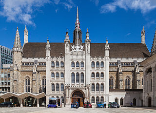
Guildhall is a municipal building in the Moorgate area of the City of London, England. It is off Gresham and Basinghall streets, in the wards of Bassishaw and Cheap. The current building dates from the 15th century; however documentary evidence suggests that a guildhall had existed at the site since at least the early 12th century. The building has been used as a town hall for several hundred years, and is still the ceremonial and administrative centre of the City of London and its Corporation. It should not be confused with London's City Hall, the administrative centre for Greater London. The term "Guildhall" refers both to the whole building and to its main room, which is a medieval great hall. It is a Grade I-listed building.
Sight 14: Institute of Chartered Accountants in England and Wales
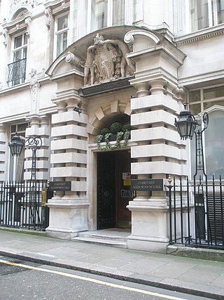
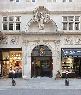
Chartered Accountants' Hall is a Grade II* listed building located at 1 Moorgate Place in the City of London. It is the headquarters of the Institute of Chartered Accountants in England & Wales (ICAEW). The Hall is one of the richest examples of late Victorian architecture in the City and has been praised for its seamless integration of sculpture.
Wikipedia: Chartered Accountants' Hall (EN), Heritage Website
Sight 15: All Hallows On The Wall
All Hallows-on-the-Wall is a Church of England church located in the City of London. Its name refers to its location, inside and adjacent to London Wall, the former city wall.
Sight 16: St Botolph-without-Bishopsgate
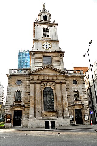
St Botolph-without-Bishopsgate is a Church of England church in the Bishopsgate Without area of the City of London, and also, by virtue of lying outside the city's eastern walls, part of London's East End.
Wikipedia: St Botolph-without-Bishopsgate (EN), Heritage Website
Sight 17: Kindertransport – The Arrival
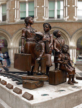
Kindertransport – The Arrival is an outdoor bronze memorial sculpture by Frank Meisler, located in the forecourt of Liverpool Street station in London, United Kingdom. It commemorates the 10,000 Jewish children who escaped Nazi persecution and arrived at the station during 1938–1939, whose parents were forced to take the decision to send them to safety in the UK. Most of the children never saw their parents again, as their parents were subsequently killed in concentration camps, although some were reunited. The memorial was installed in September 2006, replacing Flor Kent's bronze Für Das Kind, which was installed in 2003. It was commissioned by World Jewish Relief and the Association of Jewish Refugees (AJR).
Sight 18: Catholic Church of St Mary, Moorfields
St Mary Moorfields is a Roman Catholic church in Eldon Street near Moorgate, on a site previously known as Moorfields. It is the only Catholic church in the City of London. Prior to a 1994 boundary change, the church was in the Borough of Hackney, such that there were no Catholic churches in the City.
Sight 19: Finsbury Square
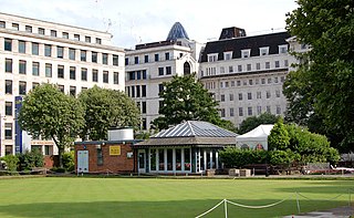
Finsbury Square is a 0.7-hectare (1.7-acre) square in Finsbury in central London which includes a six-rink grass bowling green. It was developed in 1777 on the site of a previous area of green space to the north of the City of London known as Finsbury Fields, in the parish of St Luke's and near Moorfields. It is sited on the east side of City Road, opposite the east side of Bunhill Fields. It is approximately 200m north of Moorgate station, 300m north-west of Liverpool Street station and 400m south of Old Street station. Nearby locations are Finsbury Circus and Finsbury Pavement. Named after it, but several miles away, are Finsbury Park and its eponymous neighbourhood. The centre of the square includes an underground NCP Car Park and two disused petrol stations, also owned by NCP for above-ground commercial parking. Finsbury Square is served by bus routes 21, 43, 141 and 214.
Sight 20: Fulcrum
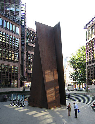
Fulcrum is a large sculpture by American artist Richard Serra installed in 1987 near the western entrance to Liverpool Street station, London, as part of the Broadgate development. The sculpture consists of five pieces of Cor-Ten steel, and is approximately 55 feet (17 m) tall. Deyan Sudjic, director of the Design Museum, has called it one of London's "design icons".
Sight 21: Heron Tower
Salesforce Tower, 110 Bishopsgate is a commercial skyscraper in London. It stands 230 metres (755 ft) tall including its 28-metre (92 ft) mast making it the second tallest building in the City of London financial district and the fifth tallest in Greater London and the United Kingdom, after the Shard in Southwark and One Canada Square at Canary Wharf. 110 Bishopsgate is located on Bishopsgate and is bordered by Camomile Street, Outwich Street and Houndsditch.
Sight 22: Bishopsgate Institute
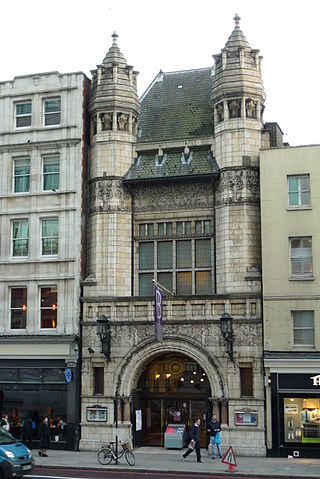
Bishopsgate Institute is a cultural institute in the Bishopsgate area of the City of London, located in the East End of London near Spitalfields and Shoreditch. The institute was established in 1895. It offers a cultural events programme, courses for adults, historic library and archive collections and community programme.
Sight 23: Dennis Severs' House
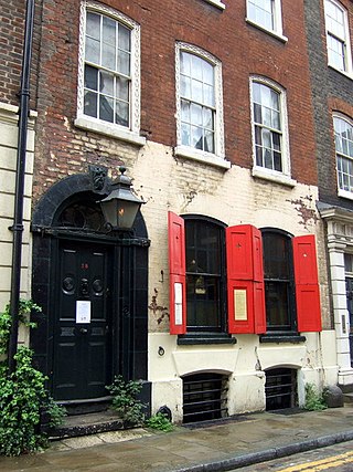
Dennis Severs' House is a historical tourist attraction in Folgate Street, London. Created by Dennis Severs, who owned and lived in the house until his death, it is intended as a "historical imagination" of what life would have been like inside for a family of Huguenot silk weavers. It is a Grade II listed Georgian terraced house in Spitalfields in the East End, Central London, England. From 1979 to 1999 it was lived in by Dennis Severs, who gradually recreated the rooms as a time capsule in the style of former centuries. Severs' friend Dan Cruickshank said: "It was never meant to be an accurate historical creation of a specific moment – it was an evocation of a world. It was essentially a theatre set."
Sight 24: Old Spitalfields Market
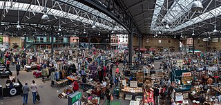
Old Spitalfields Market is a covered market in Spitalfields, London. There has been a market on the site for over 350 years. In 1991 it gave its name to New Spitalfields Market in Leyton, where fruit and vegetables are now traded. In 2005, a regeneration programme resulted in the new public spaces: Bishops Square and Crispin Place, which are now part of the modern Spitalfields Market. A range of public markets runs daily, with independent local stores and restaurants - as well as new office developments.
Sight 25: The Ten Bells
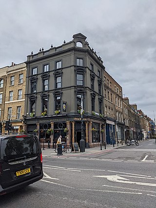
The Ten Bells is a public house at the corner of Commercial Street and Fournier Street in Spitalfields in the East End of London. It is sometimes noted for its supposed association with at least two victims of Jack the Ripper: Annie Chapman and Mary Jane Kelly.
Sight 26: Christ Church Spitalfields
Christ Church Spitalfields is an Anglican church built between 1714 and 1729 to a design by Nicholas Hawksmoor. On Commercial Street in the East End and in today's Central London it is in the London Borough of Tower Hamlets, on its western border facing the City of London, it was one of the first of the so-called "Commissioners' Churches" built for the Commission for Building Fifty New Churches, which had been established by an act of parliament in 1711.
Wikipedia: Christ Church, Spitalfields (EN), Website, Heritage Website
Sight 27: Brick Lane Jamme Masjid
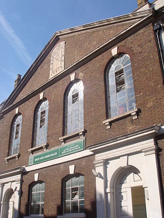
Brick Lane Mosque or Brick Lane Jamme Masjid, formerly known as the London Jamme Masjid, is a Muslim place of worship in Central London and is in the East End of London.
Sight 28: Saint Matthew's Church
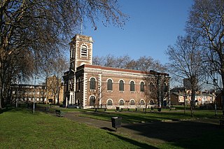
St Matthew's, Bethnal Green, is an 18th-century church in Bethnal Green, London, England. It is an Anglican church in the Diocese of London.
Share
How likely are you to recommend us?
Disclaimer Please be aware of your surroundings and do not enter private property. We are not liable for any damages that occur during the tours.
GPX-Download For navigation apps and GPS devices you can download the tour as a GPX file.
