Self-guided Sightseeing Tour #3 in Brighton, United Kingdom
Legend
Tour Facts
5.9 km
167 m
Experience Brighton in United Kingdom in a whole new way with our free self-guided sightseeing tour. This site not only offers you practical information and insider tips, but also a rich variety of activities and sights you shouldn't miss. Whether you love art and culture, want to explore historical sites or simply want to experience the vibrant atmosphere of a lively city - you'll find everything you need for your personal adventure here.
Activities in BrightonIndividual Sights in BrightonSight 1: Brighton Pier
Get Ticket*
The Brighton Palace Pier, commonly known as Brighton Pier or the Palace Pier, is a Grade II* listed pleasure pier in Brighton, England, located in the city centre opposite the Old Steine. Established in 1899, it was the third pier to be constructed in Brighton after the Royal Suspension Chain Pier and the West Pier, but is now the only one still in operation. It is managed and operated by the Eclectic Bar Group.
Sight 2: St Mary the Virgin
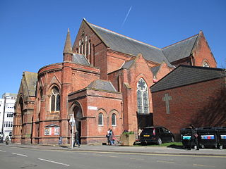
St Mary's Church is an Anglican church in the Kemptown area of Brighton, in the English city of Brighton and Hove. The present building dates from the late 1870s and replaced a church of the same name which suddenly collapsed while being renovated. The Gothic-style red-brick building, whose style resembles Early English revival and French Gothic revival, is now a Grade II* listed building, and remains in use despite threats of closure.
Sight 3: Pepper Pot
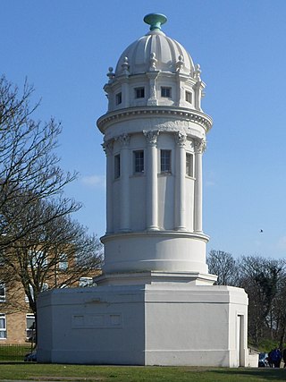
The Pepper Pot, also known as the Pepperpot, the Pepper Box or simply The Tower, is a listed building in the Queen's Park area of the English city of Brighton and Hove. It was designed and built in 1830 by architect Charles Barry in the grounds of a villa, which was built for the owner of Queen's Park. It survived the villa's demolition and is now one of its only surviving remnants. Its original purpose is unknown, but several possible explanations have been given for its construction. It has had a wide variety of uses in the 20th century, and is now owned by Brighton and Hove City Council, protected as a Grade II listed building.
Sight 4: Greek Orthodox Church of the Holy Trinity
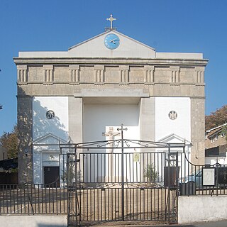
The Church of the Holy Trinity is a Greek Orthodox church in Brighton, part of the English city of Brighton and Hove. Built in 1838 in one of Brighton's most notorious slum districts, Carlton Hill, it was an Anglican church for most of its life: dedicated to St John the Evangelist, it was used by the Anglican community until it was declared redundant in 1980. After some uncertainty about its future, it was sold to Brighton's Greek Orthodox community in 1985 and has been used as their permanent place of worship since then. Reflecting its architectural and historical importance, it has been listed at Grade II since 1971.
Wikipedia: Greek Orthodox Church of the Holy Trinity, Brighton (EN)
Sight 5: Brighton National Spiritualist Church
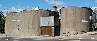
Brighton and Hove National Spiritualist Church, known until 2019 as Brighton National Spiritualist Church, is a Spiritualist place of worship in the Carlton Hill area of Brighton, part of the English seaside city of Brighton and Hove. Since its amalgamation with another church in the city in November 2019, it has been one of England's largest Spiritualist churches.
Wikipedia: Brighton and Hove National Spiritualist Church (EN), Website
Sight 6: Dorset Gardens Methodist Church
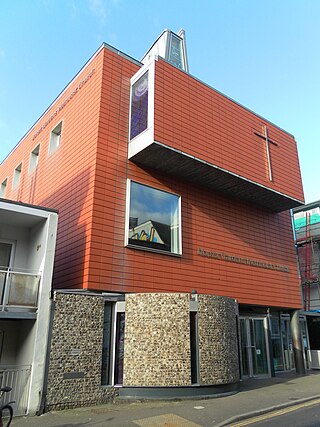
The Dorset Gardens Methodist Church is a Methodist church in the Kemptown area of the city of Brighton and Hove, England. Although it is a modern building—completed in 2003—it is the third Methodist place of worship on the site: it replaced an older, larger church which was in turn a rebuilding of Brighton's first Methodist church. Between them, the churches have played an important part in the history of Methodism in Brighton.
Sight 7: Old Steine Gardens
The Old Steine Gardens in Brighton, Brighton and Hove, East Sussex, England, adjacent to the Old Steine thoroughfare, are the site of several monuments of national historic significance.
Sight 8: The Marlborough Theatre
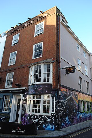
The Marlborough Pub and Theatre is a historic venue, situated at 4 Princes Street, Brighton. It has been associated, since the 1970s, with the LGBT community. The Marlborough's small theatre presents drama, cabaret and music throughout the year, including during the Brighton Fringe Festival, LGBT History Month and Brighton Pride Arts Festival. The pub reopened in 2021 as 'The Actors'.
Sight 9: Brighton Museum & Art Gallery
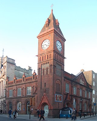
Get Ticket*Brighton Museum & Art Gallery is a municipally-owned public museum and art gallery in the city of Brighton and Hove in the South East of England. It is part of Brighton & Hove Museums. It costs £9.50 for a yearly pass, discounted to £7 for Brighton and Hove residents and students at local universities.
Sight 10: Brighton Dome Studio Theatre
The Brighton Dome Studio Theatre is a theatre in Brighton, England. It is part of the wider Brighton Dome complex of buildings. It was built in 1935, originally as a supper room, but later converted into a theatre. Its audience capacity is 232 seated or 350 standing.
Sight 11: Brighton Unitarian Church
The Brighton Unitarian Church, previously known as Christ Church, is a Unitarian chapel in Brighton, England. Built in 1820 by prolific local architect Amon Henry Wilds on land sold to the fledgling Unitarian community by the Prince Regent, the stuccoed Greek Revival building occupies a prominent position near the corner of Church Road and New Road in the centre of Brighton, near the Royal Pavilion and the city's main theatres. It has had Grade II listed status since 1952. It is a member of the General Assembly of Unitarian and Free Christian Churches, the umbrella organisation for British Unitarians.
Sight 12: Theatre Royal
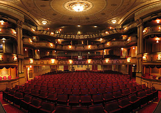
Get Ticket*The Theatre Royal is a theatre in Brighton, East Sussex, England presenting a range of West End and touring musicals and plays, along with performances of opera and ballet.
Sight 13: Royal Pavilion
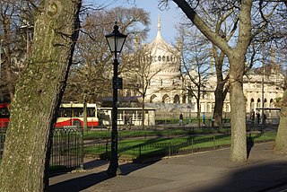
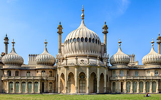
The Royal Pavilion and surrounding gardens is a Grade I listed former royal residence located in Brighton, England. Beginning in 1787, it was built in three stages as a seaside retreat for George, Prince of Wales, who became the Prince Regent in 1811, and King George IV in 1820. It is built in the Indo-Saracenic style prevalent in India for most of the 19th century. The current appearance, with its domes and minarets, is the work of the architect John Nash, who extended the building starting in 1815. George IV's successors William IV and Victoria also used the Pavilion, but Queen Victoria decided that Osborne House should be the royal seaside retreat, and the Pavilion was sold to the city of Brighton in 1850.
Sight 14: Chapel Royal
The Chapel Royal is an 18th-century place of worship in the centre of Brighton, part of the English city of Brighton and Hove. Built as a chapel of ease, it became one of Brighton's most important churches, gaining its own parish and becoming closely associated with the Prince Regent and fashionable Regency-era society. It remains an active church.
Sight 15: Brighton Fishing Museum
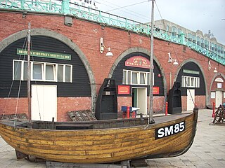
The Brighton Fishing Museum is a registered independent museum established in co-operation with the local fishing community in 1994. This museum is dedicated to Brighton's fishing and seaside history. It is located a short distance to the west of Brighton Pier within an area known as the Fishing Quarter, occupying two of the arches on the Kings' Road, which runs along Brighton's beachfront. Admission is free and donations appreciated.
Sight 16: West Pier
Get Ticket*The West Pier is a ruined pier in Brighton, England. It was designed by Eugenius Birch and opened in 1866. It was the first pier to be Grade I listed in England but has become increasingly derelict since its closure to the public in 1975. As of 2024 only a partial metal framework remains.
Share
How likely are you to recommend us?
Disclaimer Please be aware of your surroundings and do not enter private property. We are not liable for any damages that occur during the tours.
GPX-Download For navigation apps and GPS devices you can download the tour as a GPX file.
