Self-guided Sightseeing Tour #2 in Brighton, United Kingdom
Legend
Tour Facts
3.7 km
73 m
Experience Brighton in United Kingdom in a whole new way with our free self-guided sightseeing tour. This site not only offers you practical information and insider tips, but also a rich variety of activities and sights you shouldn't miss. Whether you love art and culture, want to explore historical sites or simply want to experience the vibrant atmosphere of a lively city - you'll find everything you need for your personal adventure here.
Activities in BrightonIndividual Sights in BrightonSight 1: St Mary and St Abraam Church
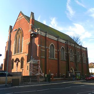
St Mary and St Abraam Church is a Coptic Orthodox Church in Hove, in the English city of Brighton and Hove. It is one of 27 such churches in the British Isles, twelve of which are British Orthodox churches. The Race community in Brighton and Hove was founded in 1990; four years later it moved to its present site on Davigdor Road, on the Brighton/Hove border.
Wikipedia: St Mary and St Abraam Coptic Orthodox Church, Hove (EN), Website
Sight 2: St Ann's Well Gardens
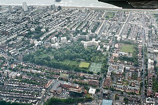
St. Ann's Well Gardens is a park in Hove, East Sussex, about half a mile from the shore. The park is renowned for its chalybeate spring, which is now named St. Ann's Well. In this case, the name "St. Ann" does not refer to any saint. Instead, the name was apparently based on a myth of Annafrieda, a Saxon lady whose lover was murdered. Her tears miraculously became the Chalybeate Spring which is now called St. Ann's Well.
Sight 3: Hove Progressive Synagogue
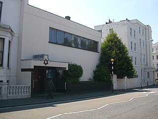
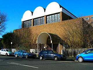
Brighton and Hove Progressive Synagogue, also known as Adat Shalom Verei’ut, is a Liberal Jewish congregation and synagogue, located in Hove, Sussex, England, in the United Kingdom. The congregation was established in 1935 and as of 2016 had more than 300 members. Services are held weekly on Friday evenings and Saturday mornings and also at the major Jewish festivals.
Sight 4: St Patrick's Church
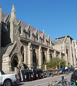
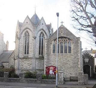
St Patrick's Church is an Anglican church in Hove, in the English city of Brighton and Hove. Situated on a narrow site at 3 Cambridge Road, off Western Road close to the boundary with Brighton, it is still in use as a place of worship. Since 1985 St Pat's developed a special ministry with homeless people, setting up a night shelter and a homeless hostel. In 2012, St Patrick's night shelter was closed. The homeless hostel continues to operate under new management, and is currently run by Riverside Housing Association. The church closed as a parish in 2015, and was then entrusted by the Bishop of Chichester to the Chemin Neuf Community under a Bishop's Mission Order. The leader of the Chemin Neuf Mission at St Patrick's is currently the Revd Tim Watson.
Sight 5: The Old Market
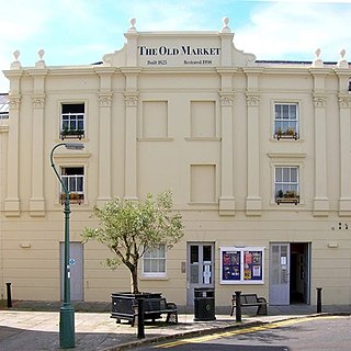
The Old Market, Hove is a historic building on the border of Brighton and Hove in England. It has served various functions, currently operating as an independent mixed-arts venue under the name "TOM – The Old Market".
Sight 6: Adelaide Crescent
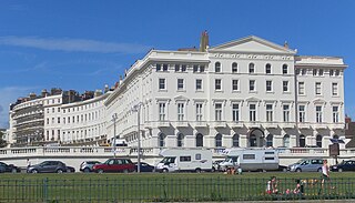
Adelaide Crescent is a mid-19th-century residential development in Hove, part of the English city and seaside resort of Brighton and Hove. Conceived as an ambitious attempt to rival the large, high-class Kemp Town estate east of Brighton, the crescent was not built to its original plan because time and money were insufficient. Nevertheless, together with its northerly neighbour Palmeira Square, it forms one of Hove's most important architectural set-pieces. Building work started in 1830 to the design of Decimus Burton. The adjacent land was originally occupied by "the world's largest conservatory", the Anthaeum; its collapse stopped construction of the crescent, which did not resume until the 1850s. The original design was modified and the crescent was eventually finished in the mid-1860s. Together with the Kemp Town and Brunswick Town estates, the crescent is one of the foremost pre-Victorian residential developments in the Brighton area: it has been claimed that "outside Bath, [they] have no superior in England". The buildings in the main part of Adelaide Crescent are Grade II* listed. Some of the associated buildings at the sea-facing south end are listed at the lower Grade II.
Sight 7: Palmeira Square
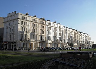
Palmeira Square is a mid-19th-century residential development in Hove, part of the English city and seaside resort of Brighton and Hove. At the southern end it adjoins Adelaide Crescent, another architectural set-piece which leads down to the seafront; large terraced houses occupy its west and east sides, separated by a public garden; and at the north end is one of Hove's main road junctions. This is also called Palmeira Square, and its north side is lined with late 19th-century terraced mansions. Commercial buildings and a church also stand on the main road, which is served by Brighton & Hove bus routes 1, 1A, N1, 2, 5, 5A, 5B, N5, 6, 25, 46, 49, 60, 71, 71A and 96.
Sight 8: St John the Baptist
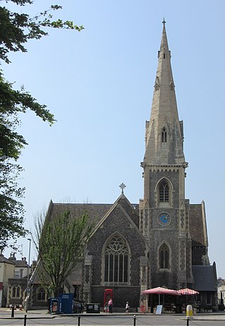
St John the Baptist's Church is an Anglican church in Hove, part of the English city of Brighton and Hove. It was built between 1852 and 1854 to serve the community of the Brunswick area of Hove, which had originally been established in the 1830s.
Sight 9: Holland Road Baptist Church
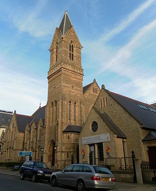
Holland Road Baptist Church is a Baptist church in Hove, part of the English city of Brighton and Hove. Built in 1887 to replace a temporary building on the same site, which had in turn superseded the congregation's previous meeting place in a nearby gymnasium, it expanded to take in nearby buildings and is a landmark on Holland Road, a main north–south route in Hove. It is one of ten extant Baptist church buildings in the city, and is the only one to have been listed by English Heritage in view of its architectural importance.
Sight 10: Brighton & Hove Reform Synagogue
The Brighton and Hove Reform Synagogue is a Reform Jewish congregation and synagogue, located on Palmeira Avenue, in Hove, East Sussex, England, in the United Kingdom.
Sight 11: Church of the Sacred Heart
The Church of the Sacred Heart is a Roman Catholic church in Hove, part of the English city of Brighton and Hove. It is the oldest of Hove's three Roman Catholic churches, and one of eleven in the city area. It has been designated a Grade II Listed building.
Share
How likely are you to recommend us?
Disclaimer Please be aware of your surroundings and do not enter private property. We are not liable for any damages that occur during the tours.
GPX-Download For navigation apps and GPS devices you can download the tour as a GPX file.
