Self-guided Sightseeing Tour #5 in Bangkok, Thailand
Legend
Guided Free Walking Tours
Book free guided walking tours in Bangkok.
Guided Sightseeing Tours
Book guided sightseeing tours and activities in Bangkok.
Tour Facts
5 km
64 m
Experience Bangkok in Thailand in a whole new way with our free self-guided sightseeing tour. This site not only offers you practical information and insider tips, but also a rich variety of activities and sights you shouldn't miss. Whether you love art and culture, want to explore historical sites or simply want to experience the vibrant atmosphere of a lively city - you'll find everything you need for your personal adventure here.
Activities in BangkokIndividual Sights in BangkokSight 1: Samphanthawong Museum
Samphanthawong Museum, also known as the Bangkok Local Museum, is a museum in Samphanthawong District, Bangkok, Thailand. The museum focuses on the history of early Chinese immigrants in the Samphanthawong district. Exhibits are presented in both Thai and English, with accompanying visuals.
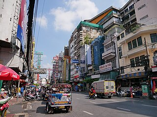
Sight 2: Yaowarat Road
Get Ticket*Yaowarat Road in Samphanthawong District is the main artery of Bangkok's Chinatown. Modern Chinatown now covers a large area around Yaowarat and Charoen Krung Road. It has been the main centre for trading by the Chinese community since they moved from their old site some 200 years ago to make way for the construction of Wat Phra Kaew, the Grand Palace. Nearby is the Phahurat or Little India. The area is bordered by the Chao Phraya River from the west to the south. Yaowarat Road is well known for its variety of foodstuffs, and at night turns into a large "food street" that draws tourists and locals from all over the city.
Sight 3: Leng Buai Ia Shrine
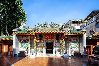
Leng Buai Ia Shrine is a Chinese shrine, in the Samphanthawong district of Bangkok's Chinatown. It is located within Talat Kao market on Yaowarat Soi 6, off Yaowarat Road.
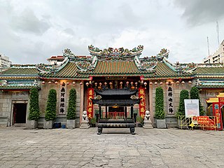
Sight 4: Wat Mangkon Kamalawat
Wat Mangkon Kamalawat, previously known as Wat Leng Noei Yi, is the largest and most important Chinese Buddhist temple in Bangkok, Thailand. It hosts celebrations of a number of year-round events, including Chinese New Year, and the annual Chinese vegetarian festival.
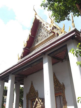
Sight 5: Wat Kan Matuyaram
Wat Kanmatuyaram, or written as Wat Kanma Tuyaram is a small Thai civilian temple in Bangkok, located on Mangkon Road, Samphanthawong Sub-district, Samphanthawong District, regarded as another Thai temple located in the area of Bangkok's Chinatown, in addition to Wat Traimit. The entrance of the temple on Charoen Krung Road located diagonally from Chinese temple Wat Mangkon Kamalawat. The temple belongs to Dhammayuttika Nikaya of Theravada Buddhism.
Sight 6: Wat Chakkrawat Rachawat Woramahawihan
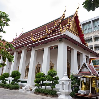
Wat Chakkrawat or full name Wat Chakkrawat Rachawat Woramahawihan is a Buddhist monastery in Bangkok.
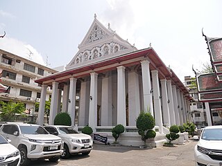
Sight 7: Wat Bophit Phimuk Worawihan
Wat Bophit Phimuk Worawihan, or simply Wat Bophit Phimuk is a second grade royal temple in Bangkok, located on Chakkrawat Road, Chakkrawat Sub-district, Samphanthawong District near the foot of Phra Pok Klao Bridge on periphery of Chakkrawat Sub-district, Samphanthawong District and Wang Burapha Phirom Sub-district, Phra Nakhon District. Regarded as another Thai temple located in the area known as Chinatown, in addition to the Wat Traimit or the Wat Chakkrawat.
Sight 8: Wat Ratchaburana Ratchaworawihan
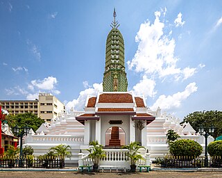
Wat Ratchaburana Ratchaworawihan or usually shortened to Wat Ratchaburana (วัดราชบูรณะ), commonly known as Wat Liap (วัดเลียบ), is a second-class temple in Maha Nikaya sect of Buddhism, located at 119 Chakkraphet Road, Wang Burapha Phirom Subdistrict, Phra Nakhon District, Bangkok at the foot of the Memorial Bridge near Pak Khlong Talat and Praisaniyakarn, diagonally from the Long Corridor of Suankularb Wittayalai School.
Sight 9: King Rama I (Phra Buddha Yodfa) Statue
The King of Thailand, King Rama I Monument or the Monument of His Majesty the King is the King of the Great. who is the first king of the royal family. It is enshrined at the foot of the Pathom Raja Nusorn Bridge or the Buddha Yodfa Bridge. The Bangkok side was built on the occasion of the 150th anniversary of the city.
Sight 10: Wat Prayurawongsawat
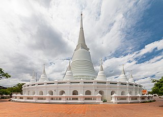
Wat Prayurawongsawat Worawihan, known in short as Wat Prayun is a 19th century Buddhist temple complex, located near the Memorial Bridge in Bangkok, Thailand.
Sight 11: Santa Cruz Church
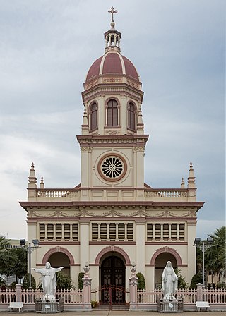
Santa Cruz Church, also known as Kudi Chin, is a Roman Catholic church in Bangkok. It is in Khwaeng (sub-district) Wat Kanlaya of the Thon Buri District on the west bank of Chao Phraya River, in the neighbourhood known as Kudi Chin. A church was first built on the site, which had been granted to a community of Portuguese Catholics, around 1770. It was then the main Catholic church in Bangkok, and served as the seat of the Apostolic Vicariate of Siam until 1821, when Assumption Cathedral was completed. The current building, in Renaissance Revival style, was built in 1913–1916 to replace a second structure from 1845.
Share
How likely are you to recommend us?
Disclaimer Please be aware of your surroundings and do not enter private property. We are not liable for any damages that occur during the tours.
GPX-Download For navigation apps and GPS devices you can download the tour as a GPX file.
-Statue.jpg)