Self-guided Sightseeing Tour #1 in Santa Coloma de Gramenet, Spain
Legend
Tour Facts
3.3 km
324 m
Experience Santa Coloma de Gramenet in Spain in a whole new way with our free self-guided sightseeing tour. This site not only offers you practical information and insider tips, but also a rich variety of activities and sights you shouldn't miss. Whether you love art and culture, want to explore historical sites or simply want to experience the vibrant atmosphere of a lively city - you'll find everything you need for your personal adventure here.
Sight 1: Poblat ibèric de Puig Castellar
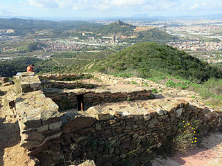
The Iberian settlement of Puig Castellar is an Iberian settlement located in Santa Coloma de Gramenet, at the top of Puig Castellar, 303 m. It was founded by the tribe of the Laietani around the sixth century BC and was abandoned between the third and second centuries BC. The old part, in the sun, and the new part, in the shade, can be highlighted. It is one of the best preserved Iberian settlements in the surroundings of the city of Barcelona. Currently, the village of Puig Castellar can be visited and guided tours can be taken there.
Sight 2: Cau d'en Genís
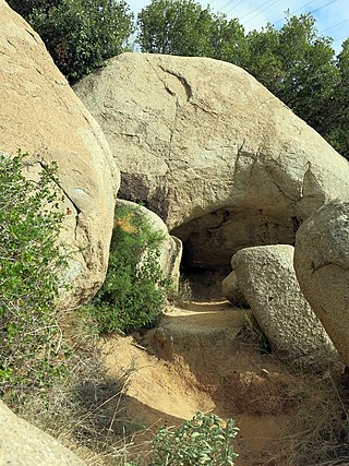
The Cova d'en Genís, also known as the Cau d'en Genís, is a paradolmen located in the municipality of Santa Coloma de Gramenet. It is located in the Serralada de Marina Park, on the southwest slope of the Pollo hill, near the hermitage of Sant Climent and 500 metres from the archaeological site of Puig Castellar.
Sight 3: Ermita de Sant Climent
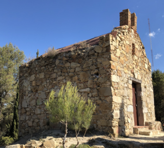
The Hermitage of Sant Climent is a church in Badalona included in the Inventory of the Architectural Heritage of Catalonia. It is located at the top of the Turó de Sant Climent, which together with the hill of Sant Onofre forms the Serrat de les Ermites.
Sight 4: Ermita de Sant Onofre
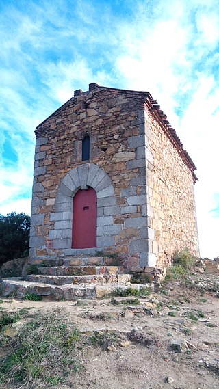
The hermitage of Sant Onofre is a small oratory located in the Badalona district of Canyet built in 1498 by the monks of Sant Jeroni de la Murtra in the Serrat de les Ermites, at the top of the hill of Sant Onofre, between the Font Santa stream and the Coll de les Ermites. Together with the hill of Sant Climent it forms the Serrat de les Ermites. It can be reached by the path that leaves the Coll de Vallençana or the one that passes through the Coll de Puig Castellar, from Santa Coloma de Gramenet.
Sight 5: Monestir de Sant Jeroni de la Murtra
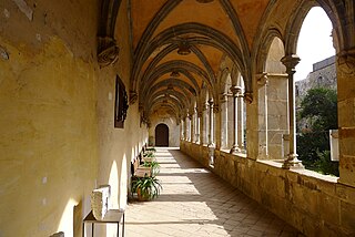
Sant Jeroni de la Murtra or Nostra Senyora de la Vall de Betlem is an ancient monastery of the Jerónimos order, located in the valley of Poià or Betlem, in the Marina mountain range, in the Canyet district of Badalona (Barcelonès). It was declared a historic-artistic monument of national interest in 1975, and later, in 2014, a Cultural Asset of National Interest, both the monastery and its grounds as well as the entire valley of Poià or Betlem, which also includes, for example, the hermitages of Sant Climent and Sant Onofre, the old hermitage of La Miranda or the aqueduct of Dosrius. In addition, the old monastery also occupies the first position within the so-called seven treasures of Badalona's cultural heritage, which were chosen in 2010 on the occasion of the city's capital of Catalan culture.
Sight 6: Serra de Can Mas
The Serra de Can Mas is a mountain range of the Serralada de Marina, part of the Serralada Litoral Catalana. It is a small mountain range in the municipality of Badalona, which separates the valley of Canyet, to the east, from the valley of Sant Jeroni de la Murtra, to the west, which was cultivated until well into the twentieth century. It rises in Turó d'en Roda-soques and as it extends southwards it loses height. The vegetation of the area is made up of garrigues, stone pines, dawn scrub and broom.
Share
How likely are you to recommend us?
Disclaimer Please be aware of your surroundings and do not enter private property. We are not liable for any damages that occur during the tours.
GPX-Download For navigation apps and GPS devices you can download the tour as a GPX file.
