Self-guided Sightseeing Tour #4 in Badalona, Spain
Legend
Guided Free Walking Tours
Book free guided walking tours in Badalona.
Guided Sightseeing Tours
Book guided sightseeing tours and activities in Badalona.
Tour Facts
3.8 km
107 m
Experience Badalona in Spain in a whole new way with our free self-guided sightseeing tour. This site not only offers you practical information and insider tips, but also a rich variety of activities and sights you shouldn't miss. Whether you love art and culture, want to explore historical sites or simply want to experience the vibrant atmosphere of a lively city - you'll find everything you need for your personal adventure here.
Individual Sights in BadalonaSight 1: Parc de Can Barriga

The Can Barriga Park is a park located in the Bufalà district of Badalona, inaugurated in 1993. It is small in size with only 0.52 ha, divided into two levels. It is bounded by Avinguda de Martí Pujol and Carrer Tànger and Carrer Xaloc, with access by the first two, adapted for the disabled.
Sight 2: Parc de Nelson Mandela

The Nelson Mandela Park is a park located in the Montigalà neighborhood of Badalona, although it is also next to Bufalà. It has a remarkable surface area of 1.3 ha, bounded by Migjorn, Xaloc and Nelson Mandela streets; with access around its entire perimeter. It was inaugurated in 2007.
Sight 3: parc del G5
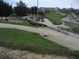
The G5 Park is a park located in the Montigalà neighborhood of Badalona. It was inaugurated in 2003. It occupies an area of 4.2 hectares, is bounded by Carrer d'Anna Tugas, the Camí de Sant Jeroni de la Murtra and the Travessera de Montigalà, with access around its perimeter; it is a continuation of the Montigalà park.
Sight 4: Parc de Montigalà
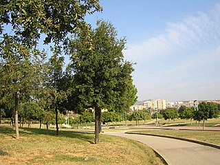
The Montigalà Park is a park located in the Montigalà district of Badalona. With an area of 8.1 ha, it is bounded by Avinguda de Puigfred, Carrer de Sant Fermí, Travessera de Montigalà and Rambla de Sant Joan. It is one of the most visited parks by the citizens of Badalona, since its inauguration in 1991.
Sight 5: parc de les Muntanyetes

The Parc de les Muntanyetes is a park located in the Lloreda district of Badalona. With an area of 3.4 ha, it is bordered by the streets of Mendelssohn, Rossini, Apennines, Passeig d'Olof Palme and Carrer de Liszt. It was built in two phases, the second being completed in 2003.
Sight 6: Parc de Nova Lloreda

The Parc de Nova Lloreda is a park located in the Nova Lloreda neighborhood of Badalona. It was inaugurated in 1982, so it has a certain history, as it was one of the first green areas created from the establishment of democracy after a neighborhood claim in the neighborhood, with the need to sponge it up. It is bounded by the Rambla de Sant Joan, the Camí de Sistrells and the Avinguda de Catalunya, with a total area of 1.5 ha.
Sight 7: Mare de Déu de Montserrat
The church of Our Lady of Montserrat is a Catholic parish church of the city of Badalona. It is located in the square of Cuba, in the district of Sant Crist de Can Cabanyes. The temple was built between 1969 and 1975, however, the history of the parish goes back to a catechistic center originally installed in the street of the Camèlia dependent on the parish of Santa Maria de Badalona, which was elevated to the parish possession of the parish. 1963 and, finally, in the parish two years later by decree of the archbishop of Barcelona, Gregorio Modrego.
Wikipedia: Església de la Mare de Déu de Montserrat (Badalona) (CA)
Share
How likely are you to recommend us?
Disclaimer Please be aware of your surroundings and do not enter private property. We are not liable for any damages that occur during the tours.
GPX-Download For navigation apps and GPS devices you can download the tour as a GPX file.