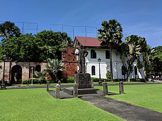
Self-guided Sightseeing Tour #1 in Manila, Philippines
Legend
Guided Free Walking Tours
Book free guided walking tours in Manila.
Guided Sightseeing Tours
Book guided sightseeing tours and activities in Manila.
Tour Facts
2.7 km
52 m
Experience Manila in Philippines in a whole new way with our free self-guided sightseeing tour. This site not only offers you practical information and insider tips, but also a rich variety of activities and sights you shouldn't miss. Whether you love art and culture, want to explore historical sites or simply want to experience the vibrant atmosphere of a lively city - you'll find everything you need for your personal adventure here.
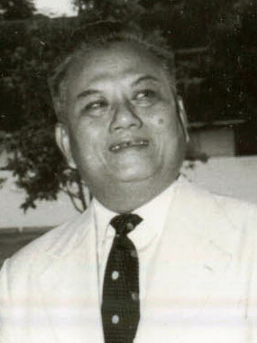
Activities in ManilaIndividual Sights in ManilaSight 1: Kaysone Phomvihane
Kaysone Phomvihane was the first leader of the Communist Lao People's Revolutionary Party from 1955 until his death in 1992. After the Communists seized power in the wake of the Laotian Civil War, he was the de facto leader of Laos from 1975 until his death. He served as the first Prime Minister of the Lao People's Democratic Republic from 1975 to 1991 and then as the second President from 1991 to 1992. His theories and policies are officially known as Kaysone Phomvihane Thought.
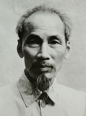
Sight 2: Ho Chi Minh
Hồ Chí Minh, colloquially known as Uncle Ho, and by other aliases and sobriquets, was a Vietnamese communist revolutionary and politician. He served as prime minister of the Democratic Republic of Vietnam from 1945 to 1955, and as president from 1945 until his death in 1969. Ideologically a Marxist–Leninist, he was the Chairman of the Workers' Party of Vietnam, the predecessor of the current Communist Party of Vietnam.
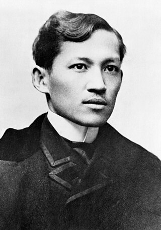
Sight 3: José Rizal
José Protasio Rizal Mercado y Alonso Realonda was a Filipino nationalist, writer and polymath active at the end of the Spanish colonial period of the Philippines. He is considered a national hero of the Philippines. An ophthalmologist by profession, Rizal became a writer and a key member of the Filipino Propaganda Movement, which advocated political reforms for the colony under Spain.
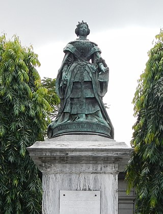
Sight 4: Isabella the Second
The Queen Isabel II Statue is located in front of Puerta Isabel II in Intramuros, Manila, Philippines. It is made of bronze and was funded by donations collected from the city in 1854 and 1855. Ponciano Ponzano, a Spanish sculptor was commissioned to do the work. It was erected amidst festive ceremonies on 14 July 1860 near Teatro Alfonso XII in Arroceros in what is now Plaza Lawton.
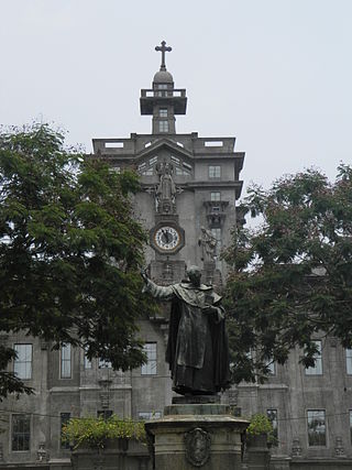
Sight 5: Miguel de Benavides
The Benavides Monument is a memorial in the University of Santo Tomas in Manila, Philippines built to commemorate the founder of the University of Santo Tomas, Miguel de Benavides. Located in the Plaza Benavides in front of the UST Main Building, the monument consists of a bronze statue of Benavides rising on top of a granite pedestal. The present monument was unveiled in 1946.
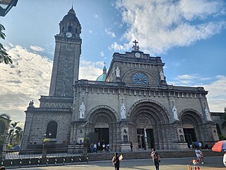
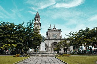
Sight 6: Manila Cathedral
Get Ticket*The Minor Basilica and Metropolitan Cathedral of the Immaculate Conception, commonly known as the Manila Cathedral, is a Roman Catholic minor basilica and the cathedral church of the Archdiocese of Manila. It is located in Intramuros, the historic walled city in Manila, Philippines, and is dedicated to the Immaculate Conception of the Blessed Virgin Mary, the principal patroness of the country.
Sight 7: Plaza de Roma
Plaza de Roma, also known as Plaza Roma, is one of three major public squares in Intramuros, Manila. It is bounded by Andres Soriano Avenue to the north, Cabildo Street to the east, Santo Tomas Street to the south, and General Antonio Luna Street to the west. The plaza is considered to be the center of Intramuros.
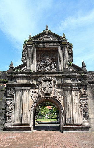
Sight 8: Fort Santiago
Get Ticket*Fort Santiago, built in 1571, is a citadel or castle built by Spanish navigator and governor Miguel López de Legazpi for the newly established city of Manila in the Philippines. The defense fortress is located in Intramuros, the walled city of Manila.
Sight 9: Rizal Shrine
The Rizal Shrine, also known as the Museo ni José Rizal Fort Santiago, is a museum dedicated to the lifework of José Rizal. It is located inside Fort Santiago in Intramuros, Manila, Philippines, beside the Plaza de Armas. Fort Santiago served as barracks for Spanish artillery soldiers during Spain's colonization of the islands. The museum is located in the building where Rizal spent his final night and hid his famous poem Mi último adiós in an oil lamp later given to his sister, Trinidad. The shrine is home to various memorabilia such as the shells he collected in Dapitan, books, manuscripts and artwork.
Sight 10: Plaza de Armas
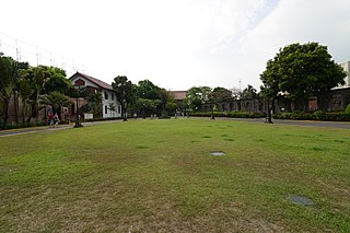
The Plaza de Armas is a public square in Intramuros, Manila. It is the central plaza of Fort Santiago. It is one of three major plazas in Intramuros, the others being the central Plaza de Roma outside the fort grounds and Plaza Moriones, a larger plaza outside Fort Santiago which was once a military promenade before it was closed in the 1863 earthquake that devastated Manila. While Plaza Moriones is outside the walls of Fort Santiago, both plazas are often misconstrued for the other.
Sight 11: Plaza Moriones
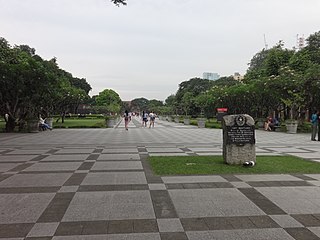
Plaza Moriones is a public square in Intramuros, Manila. Located in front of the entrance to Fort Santiago, it is one of three major plazas in Intramuros, the others being Plaza de Roma located beyond the fort's grounds, and the Plaza de Armas located inside the fort, to which it is often misconstrued for.
Sight 12: Anda Monument
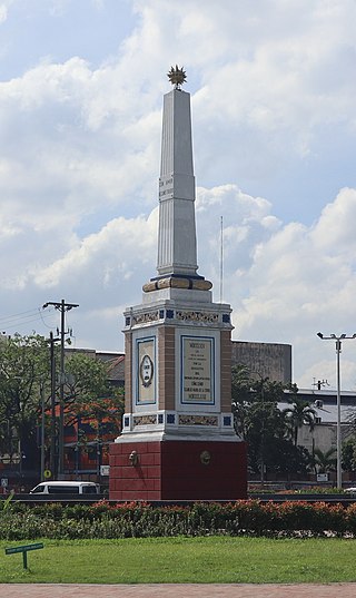
The Anda Monument, often erroneously referred to as the Anda Circle after the roundabout where it is currently located, is an obelisk monument situated on the boundary of Intramuros and Port Area in central Manila, Philippines. It was erected in honor of Simón de Anda y Salazar, Governor-General of the Philippines from 1770 to 1776. The Anda Circle, the roundabout, is an interchange system at the junction of Bonifacio Drive, Mel Lopez Boulevard, Andres Soriano Avenue, and Roberto Oca Street.
Share
How likely are you to recommend us?
Disclaimer Please be aware of your surroundings and do not enter private property. We are not liable for any damages that occur during the tours.
GPX-Download For navigation apps and GPS devices you can download the tour as a GPX file.
