Free Walking Sightseeing Tour #2 in Birgu, Malta
Legend
Guided Free Walking Tours
Book free guided walking tours in Birgu.
Guided Sightseeing Tours
Book guided sightseeing tours and activities in Birgu.
Tour Facts
9.7 km
177 m
Explore Birgu in Malta with this free self-guided walking tour. The map shows the route of the tour. Below is a list of attractions, including their details.
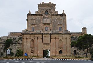
Individual Sights in BirguSight 1: Notre Dame Gate
The Notre Dame Gate, also known as the Notre Dame de la Grace Gate, the Cottonera Gate, the Żabbar Gate or Bieb is-Sultan, is the main gate of the Cottonera Lines, located in Cottonera, Malta. The gate was built in 1675 in the Baroque style, and it is currently used as the headquarters of the heritage organization Fondazzjoni Wirt Artna.
Sight 2: Fort Verdala
Fort Verdala, also known as Verdala Barracks, is a fortified barracks in Cospicua, Malta. It was built by the British in the 1850s within part of the bastions of the 17th century Santa Margherita Lines. The fort was used as a prisoner-of-war camp in both World Wars, and was later known as HMS Euroclydon. It remained in use by the British military until 1977.
Sight 3: Knisja ta' San Pawl
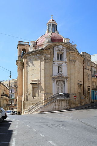
St Paul's Church is a Baroque-Doric 18th century church located in Cospicua, Malta.
Sight 4: Hompesch
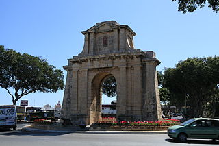
The Hompesch Gate is a commemorative arch in Żabbar, Malta. It was built in 1801 to commemorate the locality's status as a city, which had been granted by Grand Master Ferdinand von Hompesch zu Bolheim on 14 September 1797.
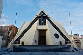
Sight 5: Parish Church of Our Lady of Mount Carmel
The Our Lady of Mount Carmel Church is a late 20th century Parish church in Fgura, Malta. It was designed in 1981 by Architect and Engineer Godfrey Azzopardi and built in 1988. The presbytery was designed a year before its construction by Edward Micallef. The building is a listed monument and an active Roman Catholic Church.
Wikipedia: Our Lady of Mount Carmel Parish Church, Fgura (EN), Website
Sight 6: Ħal Tarxien Temples

The Tarxien Temples are an archaeological complex in Tarxien, Malta. They date to approximately 3150 BC. The site was accepted as a UNESCO World Heritage Site in 1992 along with the other Megalithic temples on the island of Malta.
Sight 7: Parish Church of Christ the King
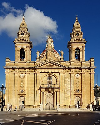
The Basilica of Christ the King is a Roman Catholic parish church located in Paola, Malta.
Sight 8: Ħal-Saflieni Hypogeum
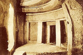
The Hypogeum of Ħal Saflieni is a Neolithic subterranean structure dating to the Saflieni phase in Maltese prehistory, located in Paola, Malta. It is often simply referred to as the Hypogeum, literally meaning "underground" in Greek. The Hypogeum is thought to have been a sanctuary and necropolis, with the estimated remains of more than 7,000 people documented by archeologists, and is among the best preserved examples of the Maltese temple building culture that also produced the Megalithic Temples and Xagħra Stone Circle.
Sight 9: Chinese Garden
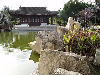
The Chinese Garden of Serenity is a public Chinese garden in Santa Luċija, Malta. Construction of the Garden of Serenity began in September 1996 as a gift to Malta from the People's Republic of China. The Prime Minister, Alfred Sant, opened it on 7 July 1997.
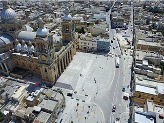
Sight 10: Luqa Church
The Parish Church of St Andrew is a Roman Catholic parish church located in Luqa, Malta.
Sight 11: Monument ta' Hal Luqa
Luqa is a town located in the Southern Region of Malta, 4.3 km away from the capital Valletta. With a population of 5,945 as of March 2014, it is a small but densely populated settlement which is typical of Malta's older towns and villages. Luqa is centered around a main square which contains a church dedicated to St. Andrew. The patron saint's traditional feast is celebrated on the first Sunday of July, with the liturgical feast being celebrated on 30 November. The Malta International Airport is located in Luqa.
Share
Disclaimer Please be aware of your surroundings and do not enter private property. We are not liable for any damages that occur during the tours.
GPX-Download For navigation apps and GPS devices you can download the tour as a GPX file.
