Free Walking Sightseeing Tour #1 in Trakai, Lithuania
Legend
Tour Facts
3 km
58 m
Explore Trakai in Lithuania with this free self-guided walking tour. The map shows the route of the tour. Below is a list of attractions, including their details.
Individual Sights in TrakaiSight 1: Trakų Švč. Dievo Motinos Gimimo cerkvė

Trakai St. The Church of the Birth of Our Lady stands in Trakai. Belongs to Trakai St. To the birth of Our Lady.
Wikipedia: Trakų Švč. Dievo Motinos Gimimo cerkvė (LT), Website
Sight 2: St. Mary Church

St. Mary Church in Trakai, Lithuania, is a Roman Catholic church. It was founded by Vytautas the Great in 1409 and constructed in gothic style. Later it was significantly altered during the Baroque period, and its current appearance is mostly defined by these alterations. The main altarpiece contains the icon, The Mother of God of Trakai.
Wikipedia: Church of the Visitation of the Blessed Virgin Mary, Trakai (EN), Website
Sight 3: Trakai Peninsula Castle

Trakai Peninsula Castle is one of the castles in Trakai, Lithuania. It is located on a peninsula between southern Lake Galvė and Lake Luka. Built around 1350–1377 by Kęstutis, Duke of Trakai, it was an important defensive structure protecting Trakai and Vilnius, capital of the Grand Duchy of Lithuania, against attacks of the Teutonic Knights. Much of the castle was destroyed in the 17th century. Remaining walls and towers are preserved and protected by the Trakai Historical National Park.
Sight 4: Trakų kenesa

Trakai Kenesa is the kenesa (synagogue) of the Qaraite Jewish community in Trakai, Lithuania, and a rare example of one of the surviving kenesas of the former Polish–Lithuanian Commonwealth. It was built in the 18th century, restored in the 1890s and is still in use.
Sight 5: Trakai mound

Trakai Mound, Pilies Hill, Auka Hill – a mound in the territory of Trakai district municipality, in the northern part of Trakai, is reached near the Trakai Historical National Park administration building by turning Kęstutis Street to the northeast, 200 m away is behind the front of the peninsula castle.
Sight 6: Varnių (Varnikių) piliakalnis
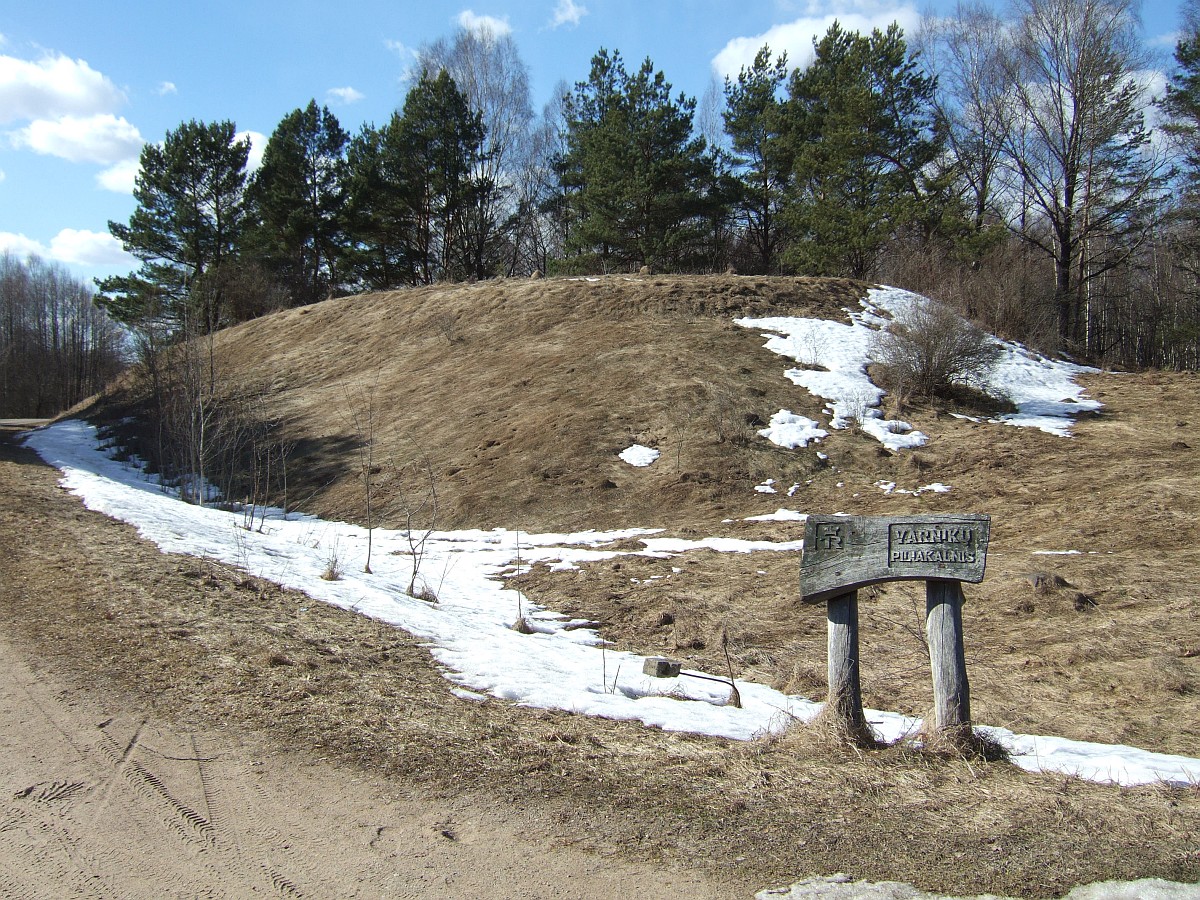
Varnikai Mound, Veršupka – a mound in the territory of Trakai district municipality, Trakai eldership. Accessible from highway 4727 Trakai–Lentvaris–Brick Vokė , after Ostruvka turning north by highway towards Varnikai, 2.9 km away is to the right north of the highway, when it turns to the west.
Share
Disclaimer Please be aware of your surroundings and do not enter private property. We are not liable for any damages that occur during the tours.
GPX-Download For navigation apps and GPS devices you can download the tour as a GPX file.