Self-guided Sightseeing Tour #1 in Flores, Guatemala
Legend
Tour Facts
2 km
47 m
Experience Flores in Guatemala in a whole new way with our free self-guided sightseeing tour. This site not only offers you practical information and insider tips, but also a rich variety of activities and sights you shouldn't miss. Whether you love art and culture, want to explore historical sites or simply want to experience the vibrant atmosphere of a lively city - you'll find everything you need for your personal adventure here.
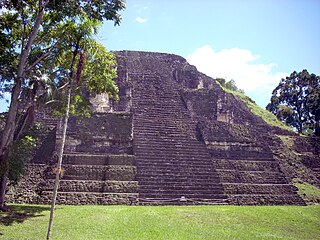
Activities in FloresIndividual Sights in FloresSight 1: Pyramid of the Lost World 5C-54
The Mundo Perdido is the largest ceremonial complex dating from the Preclassic period at the ancient Maya city of Tikal, in the Petén Department of northern Guatemala. The complex was organised as a large E-Group astronomical complex consisting of a pyramid aligned with a platform to the east that supported three temples. The Mundo Perdido complex was rebuilt many times over the course of its history. By AD 250–300 its architectural style was influenced by the great metropolis of Teotihuacan in the Valley of Mexico, including the use of the talud-tablero form. During the Early Classic period the Mundo Perdido became one of the twin foci of the city, the other being the North Acropolis. From AD 250 to 378 it may have served as the royal necropolis. The Mundo Perdido complex was given its name by the archaeologists of the University of Pennsylvania.
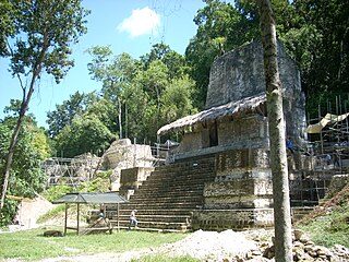
Sight 2: Plaza of the Seven Temples
The Plaza of the Seven Temples is an architectural complex in the ruins of the Maya city of Tikal, in the Petén Department of northern Guatemala. It is to the south of Temple III and to the west of the South Acropolis; it is 300 metres (980 ft) to the southwest of the Great Plaza. The Plaza of the Seven Temples is situated directly to the east of the Mundo Perdido Complex and takes its name from a row of seven small temples dating to the Late Classic Period. The plaza has a surface area of approximately 25,000 square metres (270,000 sq ft), making it one of the three largest plazas in the city.
Sight 3: Temple of the Jaguar Priest, Temple III
Tikal Temple III, also known as the Temple of the Jaguar Priest, was one of the principal temple pyramids at the ancient Maya city of Tikal, in the Petén Department of modern Guatemala. The temple stands approximately 55 metres (180 ft) tall. The summit shrine of Temple III differs from those of the other major temples at Tikal in that it only possesses two rooms instead of the usual three. The pyramid was built in the Late Classic Period, and has been dated to 810 AD using the hieroglyphic text on Stela 24, which was raised at the base of its access stairway. Stela 24 is paired with the damaged Altar 6, in a typical stela-altar pair.
Sight 4: Temple II
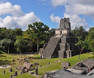
Tikal Temple II is a Mesoamerican pyramid at the Maya archaeological site of Tikal in the Petén Department of northern Guatemala. The temple was built in the Late Classic Period in a style reminiscent of the Early Classic. Temple II is located on the west side of the Great Plaza, opposite Temple I. Temple II was built by the king Jasaw Chan Kʼawiil I in honour of his wife, Lady Lahan Unen Moʼ. Temple II had a single wooden sculpted lintel that bears the portrait of a royal woman who may have been the wife of Jasaw Chan K'awiil I, who was entombed beneath Temple I. Lady Lahan Unen Moʼ, whose name means "Twelve Macaw Tails", was also important for being the mother of Jasaw Chan Kʼawill I's heir. In fact her son Yikʼin Chan Kʼawiil oversaw the completion of Temple II when he became king.
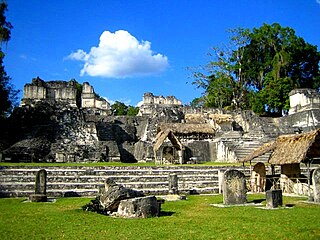
Sight 5: North Acropolis
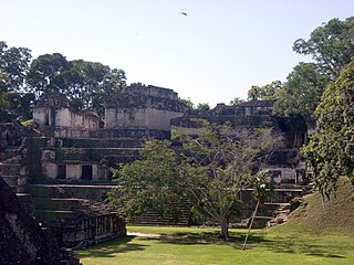
Get Ticket*The North Acropolis of the ancient Maya city of Tikal in Guatemala is an architectural complex that served as a royal necropolis and was a centre for funerary activity for over 1300 years. The acropolis is located near the centre of the city and is one of the most studied of Maya architectural complexes. Excavations were carried out from 1957 to 1969 by the University of Pennsylvania, directed by Edwin M. Shook and William Coe.
Sight 6: Temple I
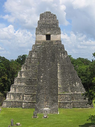
Get Ticket*Tikal Temple I is the designation given to one of the major structures at Tikal, one of the largest cities and archaeological sites of the pre-Columbian Maya civilization in Mesoamerica. It is located in the Petén Basin region of northern Guatemala. It also is known as the Temple of the Great Jaguar because of a lintel that represents a king sitting upon a jaguar throne. An alternative name is the Temple of Ah Cacao, after the ruler buried in the temple. Temple I is a typically Petén-styled limestone stepped pyramid structure that is dated to approximately 732 AD.
Sight 7: Central Acropolis
Get Ticket*The Central Acropolis of the ancient Maya city of Tikal is an architectural complex located immediately to the south of the Great Plaza. Tikal is one of the most important archaeological sites of the pre-Columbian Maya civilization and is located in the Petén Department of northern Guatemala. The complex served dual administrative and residential purposes. The Central Acropolis was first established in the Late Preclassic period of Mesoamerican chronology, and it remained in use until approximately 950 AD.
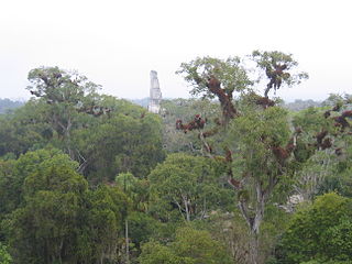
Sight 8: Temple V
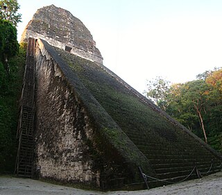
Tikal Temple V is the name given by archaeologists to one of the major pyramids at Tikal. Tikal is one of the most important archaeological sites of the pre-Columbian Maya civilization and is located in the Petén Department of northern Guatemala.
Share
How likely are you to recommend us?
Disclaimer Please be aware of your surroundings and do not enter private property. We are not liable for any damages that occur during the tours.
GPX-Download For navigation apps and GPS devices you can download the tour as a GPX file.
