Self-guided Sightseeing Tour #1 in Municipal Unit of Mykines, Greece
Legend
Tour Facts
1.7 km
142 m
Experience Municipal Unit of Mykines in Greece in a whole new way with our self-guided sightseeing tour. This site not only offers you practical information and insider tips, but also a rich variety of activities and sights you shouldn't miss. Whether you love art and culture, want to explore historical sites or simply want to experience the vibrant atmosphere of a lively city - you'll find everything you need for your personal adventure here.
Individual Sights in Municipal Unit of MykinesSight 1: Mycenae
Mycenae is an archaeological site near Mykines in Argolis, north-eastern Peloponnese, Greece. It is located about 120 kilometres south-west of Athens; 11 kilometres north of Argos; and 48 kilometres south of Corinth. The site is 19 kilometres inland from the Saronic Gulf and built upon a hill rising 900 feet above sea level.
Sight 2: Lion Gate
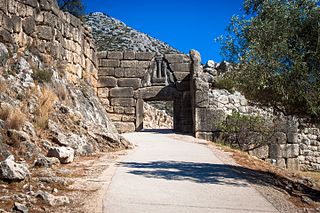
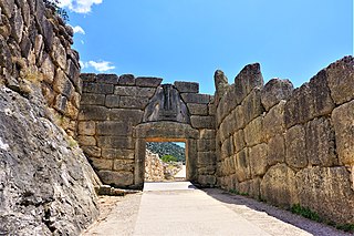
Lion Gate is the popular modern name for the main entrance of the Bronze Age citadel of Mycenae in southern Greece. It was erected during the thirteenth century BC, around 1250 BC, in the northwestern side of the acropolis. In modern times, it was named after the relief sculpture of two lions or lionesses in a heraldic pose that stands above the entrance.
Sight 3: Grave Circle A
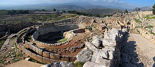
Grave Circle A is a 16th-century BC royal cemetery situated to the south of the Lion Gate, the main entrance of the Bronze Age citadel of Mycenae in southern Greece. This burial complex was initially constructed outside the walls of Mycenae and ultimately enclosed in the acropolis when the fortification was extended during the 13th century BC. Grave Circle A and Grave Circle B, the latter found outside the walls of Mycenae, represents one of the significant characteristics of the early phase of the Mycenaean civilization.
Sight 4: Ταφικός κύκλος B΄
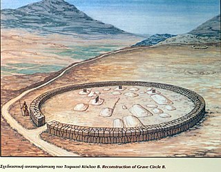
Grave Circle B in Mycenae is a 17th–16th century BCE royal cemetery situated outside the late Bronze Age citadel of Mycenae, southern Greece. This burial complex was constructed outside the fortification walls of Mycenae and together with Grave Circle A represent one of the major characteristics of the early phase of the Mycenaean civilization.
Sight 5: Kato Phournos Tomb
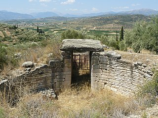
Tomb of Kato Phournos is called a tholos tomb in Mycenae. The tomb was named after the site of the same name, which in turn was named after the Tholos tomb itself, which the farmers used to call Phournos. The Tomb of Tholos is located on the western slope of Panagitsa Hill about 600 m west of the upper town of Mycenae. According to Alan Wace's classification, it belongs to the second Tholos group and dates to the Late Helladic period. It was built between 1460 and 1400 BC.
Share
Disclaimer Please be aware of your surroundings and do not enter private property. We are not liable for any damages that occur during the tours.
GPX-Download For navigation apps and GPS devices you can download the tour as a GPX file.
