Free Walking Sightseeing Tour #2 in Witten, Germany
Legend
Tour Facts
4.6 km
207 m
Explore Witten in Germany with this free self-guided walking tour. The map shows the route of the tour. Below is a list of attractions, including their details.
Individual Sights in WittenSight 1: Schleusenwärterhaus

The Royal Lock Warehouse is a lock guardhouse on the Ruhr in Heven, Witten, near the Herbeder lock. It is listed as a monument.
Sight 2: Vereinigungsstollen

The Vereinigungsstollen is a former tunnel in Witten-Hardenstein, Germany. The tunnel was also known as the Compagniestollen or the Unification Mining Tunnel. After completion, the tunnel had a total length of around 375 metres and a maximum height of 1.8 metres. The tunnel is still used today to drain the old mine field.
Sight 3: St.-Johannes-Erbstollen

The St.-Johannes-Erbstollen is a former Erbstollen in Witten in the districts of Hardenstein and Vormholz. The tunnel is located west of the Muttental. The tunnel was also known as the Tiefer Johannis Stollen, St. Johannes Erbstolln, St. Johannis-Erbstollen, Johannis Erbstolln and Johannes Erbstolln. Its lower part runs through the valley of an unnamed stream, which is locally called Deipenbecke or simply Hardensteiner Bach. The St. Johannes Erbstollen was the most important tunnel in the region and was used to drain water and ventilate the surrounding mines, which were mining on hard coal. The Erbstollen belonged to the Märkisches Bergamtsbezirk.
Sight 4: Hardenstein Castle
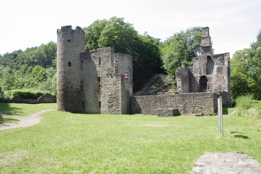
Hardenstein Castle is a ruined castle in North Rhine-Westphalia, Germany. The remains lie east of Herbede on the Ruhr River, surrounded by mountains, and are not easily accessible. Nearby ruins show that the castle was once part of an important mining centre, probably dating to the Middle Ages; the earliest records, from the 16th century, support this. The castle features in the legend of the Nibelungs.
Sight 5: Westlicher Tagetrieb Frielinghaus

The Frielinghaus colliery in the Witten district of Vormholz-Hardenstein is a former coal mine. The colliery was also known as the Frielinghaus Gerichts Herbede colliery. From 1832 onwards, the colliery was also known as the Frielinghaus Tiefbau colliery, Frielinghausen colliery or Frilinghausen colliery. Parts of the mine are now part of the Muttental Mining Hiking Trail.
Sight 6: Schacht Margarethe

The Hermann colliery is a former coal mine in Witten-Muttental, Germany. The mine was created as a result of the re-leasing of a field section of the Österbank colliery.
Sight 7: Göpelschacht Moses

The Moses Göpenschacht is part of the Muttental in Witten in Vormholz. The former Göpel shaft is now part of the Muttental mining hiking trail.
Sight 8: Maschinenhaus

The Renate colliery is a former coal mine in the Witten district of Vormholz. The colliery was only in operation for a few years as a small colliery, the owner of the small colliery was the Renate Bergbaugesellschaft mbH.
Sight 9: Stollen Stettin
The Zeche Neuglück & Stettin in Witten-Muttental is a former mine, also known as the Zeche Stettin & Neuglück. It was created in the Stadtforst Mutteltal as a result of the Niemeyersche Karte, where there is now a fire station and is west of today's Berghauser Straße. The Stettin tunnel is now a component of the Bergbauwanderweg Muttental Mining trail.
Sight 10: Bergbau-Ausstellung Herberholz
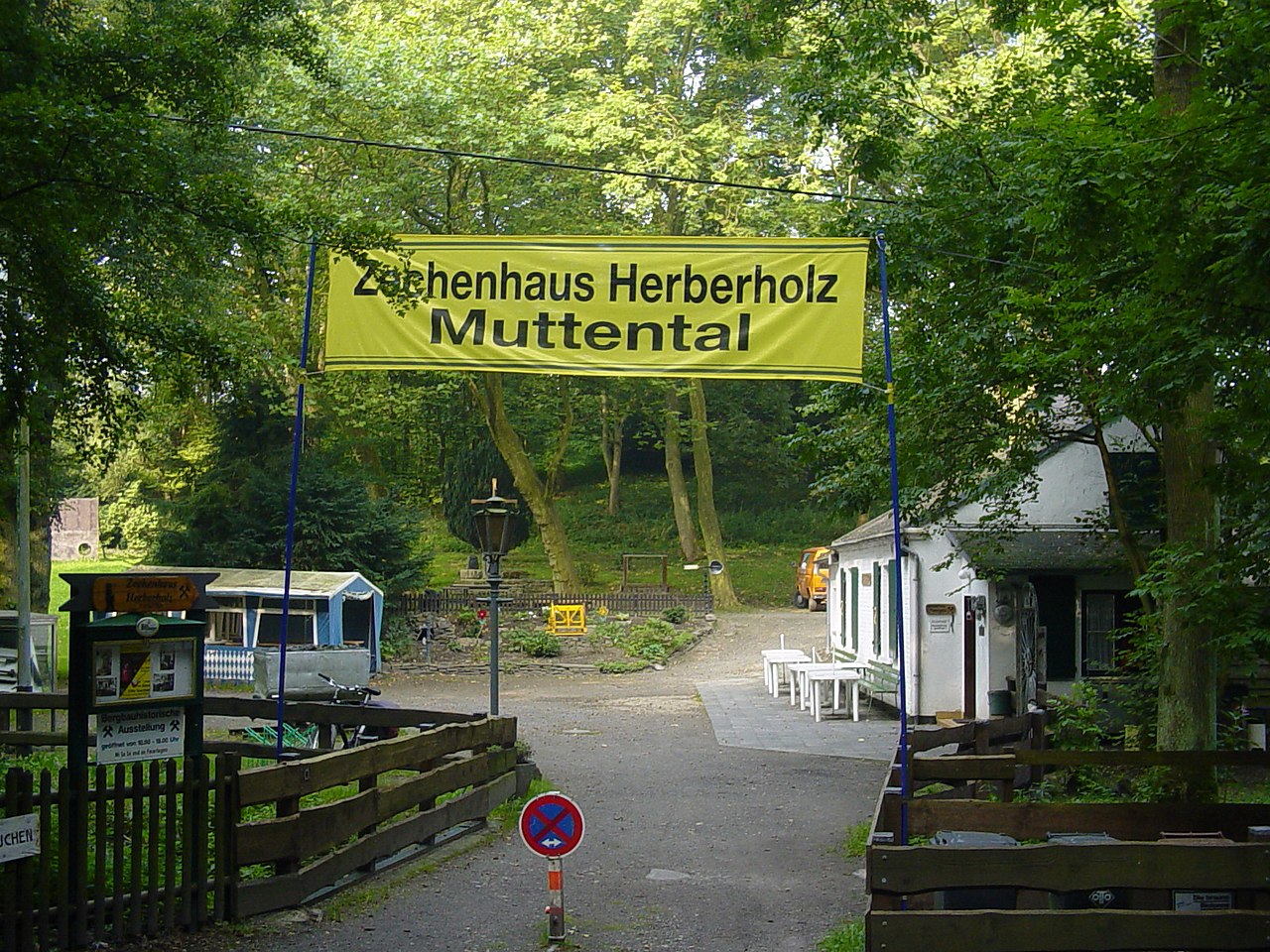
The Herberholz colliery is a former coal mine in the Vormholz district of Witten, Germany. The colliery was also known as the United Herberholz Colliery and was created from the consolidation of several mine mines. The consolidation of the collieries was carried out by the Obersteiger Herberholz, after whom the consolidated colliery was named. The mine belonged to the Brandenburg mining district and there to the Hardenstein mining district.
Sight 11: Bethaus der Bergleute

The Miners' House of Prayer is a sandstone building in the Muttental valley of the city of Witten on the southern edge of the Ruhr area.
Share
Disclaimer Please be aware of your surroundings and do not enter private property. We are not liable for any damages that occur during the tours.
GPX-Download For navigation apps and GPS devices you can download the tour as a GPX file.