Free Walking Sightseeing Tour #1 in Rheine, Germany
Legend
Tour Facts
2.6 km
25 m
Explore Rheine in Germany with this free self-guided walking tour. The map shows the route of the tour. Below is a list of attractions, including their details.
Individual Sights in RheineSight 1: Hermannsweg
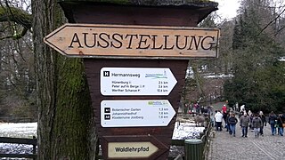
The Hermannsweg is a 156 kilometres (97 mi) long hiking trail which follows the ridge of the Teutoburg Forest, running from Rheine to Velmerstot in Germany. It is marked by signposts showing a white H on a black background. The Hermannsweg has been named for Arminius, a Cherusci chief who defeated the Romans in the Battle of the Teutoburg Forest in 9 AD. Together with the 70 kilometres (43 mi) long Eggeweg, this long-distance hiking trail forms the Hermannshöhen. It is maintained by the Teutoburger-Wald-Verein e.V. located in Bielefeld.
Sight 2: Falkenhof-Museum
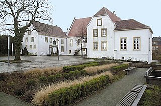
Falkenhof is the name of a former aristocratic residence in Rheine. The later Falkenhof originated from a Carolingian royal estate, which was probably established at the end of the 8th or beginning of the 9th century. This royal estate was called Villa Reni and is considered the nucleus of today's city of Rheine. The first documented mention of Villa Reni in a deed of donation by Louis the Pious dates back to 838. The foundation of the royal estate took place against the background of the Frankish missionary and occupation policy in the course of Charlemagne's Saxon Wars.
Sight 3: St. Dionysius
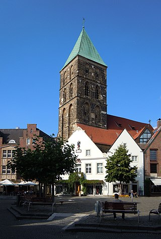
The Roman Catholic parish church of St. Dionysius in Rheine, also known here simply as the town church, is a late Gothic hall church from the period from about 1400 to 1520. It is the most traditional place of worship in the city.
Sight 4: Alter jüdischer Friedhof
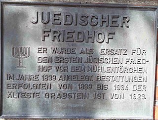
The Jewish Cemetery in Rheine, Lingener Straße, also known as the Old Jewish Cemetery, is located in the town of Rheine in the district of Steinfurt in North Rhine-Westphalia, Germany. As a Jewish cemetery, it is an architectural monument. In the cemetery in Lingener Strasse, 65 gravestones have been preserved.
Wikipedia: Jüdischer Friedhof (Rheine, Lingener Straße) (DE)
Sight 5: St. Antonius-Basilika
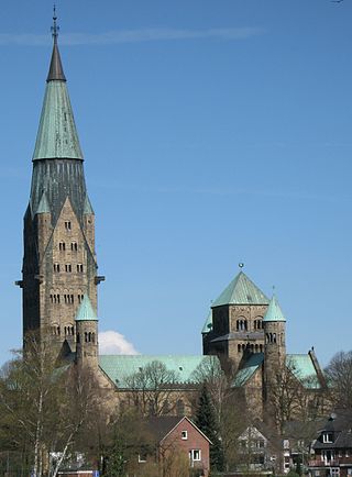
St. Anthony's Basilica is a neo-Romanesque church building in Rheine - Eschendorf. The church was built between 1899 and 1905 in the style of a Romanesque imperial cathedral and dedicated to Saint Anthony of Padua. It lies to the right of the Ems on Osnabrücker Straße and is the parish church of the Catholic parish of St. Antonius in Rheine. With 650 seats, a total length of 90 meters and a maximum width of 39 meters, the representative building is the largest church in the cityand dominates the image of the district with its imposing dimensions. The St. Antonius Basilica is considered to be one of the most elaborate and important church buildings of late historicism in Germany.
Share
Disclaimer Please be aware of your surroundings and do not enter private property. We are not liable for any damages that occur during the tours.
GPX-Download For navigation apps and GPS devices you can download the tour as a GPX file.
