Self-guided Sightseeing Tour #2 in Osnabrück, Germany
Legend
Tour Facts
4.5 km
65 m
Experience Osnabrück in Germany in a whole new way with our free self-guided sightseeing tour. This site not only offers you practical information and insider tips, but also a rich variety of activities and sights you shouldn't miss. Whether you love art and culture, want to explore historical sites or simply want to experience the vibrant atmosphere of a lively city - you'll find everything you need for your personal adventure here.
Individual Sights in OsnabrückSight 1: St. Katharinen
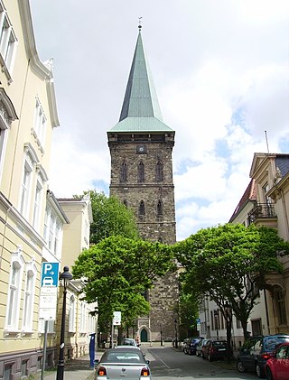
St. Catherine's Church, also known as the St. Katharinenkirche in German, is a late Gothic hall Evangelical church in the old town of Osnabrück, Germany. Its tower, which can be seen from afar and has shaped the cityscape for centuries, is 103 metres (338 ft) high.
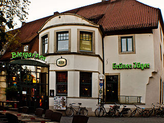
Sight 2: Grüner Jäger
The Grüner Jäger is one of the oldest pubs in Osnabrück. In addition, the oldest regulars' table in Germany has been meeting there since 1894.
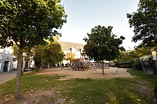
Sight 3: Adolf-Reichwein-Platz
Adolf-Reichwein-Platz is located in Osnabrück's city centre. The square was named after the educator, SPD politician and resistance fighter Adolf Reichwein.
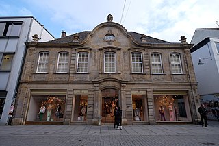
Sight 4: Haus Berghoff
The building at Große Straße 43 in Osnabrück is a listed residential building. It is also called Haus Berghoff after its builder.
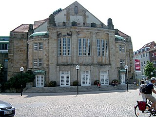
Sight 5: Theater am Domhof
Theater Osnabrück is a German theatre in Osnabrück, Germany. It operates under the auspices of the Städtische Bühnen Osnabrück gGmbH. The primary performance venues are the Theater am Domhof and the emma-theater.
Sight 6: Forum am Dom - Domschatzkammer und Diözesanmuseum
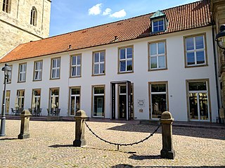
The Cathedral Treasury and Diocesan Museum is the museum of the Diocese of Osnabrück. The museum is located right next to St. Peter's Cathedral.
Sight 7: Dom Sankt Peter
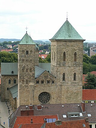
St. Peter's Cathedral in Osnabrück, Germany is the cathedral of the Roman Catholic Diocese of Osnabrück. The cathedral is a late Romanesque building and dominates the city's skyline.
Wikipedia: St. Peter's Cathedral, Osnabrück (EN), Heritage Website
Sight 8: Hexengang
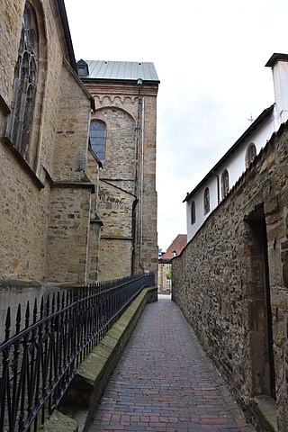
The Hexengang or Klapperhagen is a narrow alley at the cathedral in Osnabrück. It leads from the Große Domsfreiheit between the Small Church and the cathedral. On the last stretch towards the Hase, there is a building above the alley, so that it ends from a small portal on the Conrad-Bäumer-Weg road. Due to the high walls that surround the alley, the corridor seems very dark and oppressive.
Sight 9: Bischöfliche Kanzlei
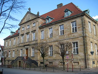
The Episcopal Chancellery is a listed building in Osnabrück (Lower Saxony). The building, which was built between 1782 and 1785, ushered in the architectural style of classicism in Osnabrück. It was the seat of the chancellery – the government – in the Bishopric of Osnabrück. After the end of the Bishopric in 1802, it served as a state and judicial chancellery until the Diocese of Osnabrück bought back the building in 1896. The headquarters of the Roman Catholic Diocese of Osnabrück has its headquarters there.
Sight 10: Löwenpudel (Nachbildung)
The Lion Poodle is a statue in front of St. Peter's Cathedral in the Lower Saxony city of Osnabrück. It shows a lion sitting on a pedestal the size of a man, which looks like a poodle. Severely damaged by the weather, a replica created by the sculptor Lukas Memken (1860–1934) has stood on the pedestal since 1925. The former stone is in the city's cultural history museum, although this was probably not the original either.
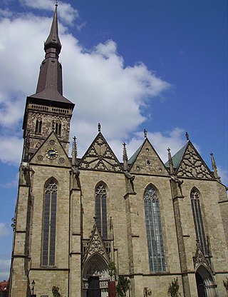
Sight 11: St. Marien
St. Marien is a Lutheran parish and market church in Osnabrück, Germany. It is one of the most artistically and historically significant buildings in the North German city. A previous Romanesque church was mentioned in records as early as 1177. However, the history of the church's construction began some time before it was first mentioned in writing. Archaeological traces suggest the existence of a predecessor building in the 10th century. Construction of the Gothic hall church which exists today started in the 13th century and was completed between 1430 and 1440.
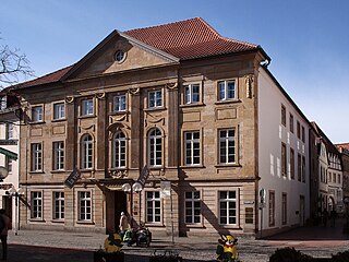
Sight 12: Haus Tenge
Haus Tenge is a listed classicist residential and commercial building with stonework in Osnabrück (Lower Saxony). Steel entrepreneur Jürgen Großmann ran the gourmet restaurant "la vie" there until 2018, which was most recently awarded three Guide Michelin stars.
Sight 13: Fritz-Wolf-Denkmal
Works of art and monuments in Osnabrück lists panorama-free sculptures, objects and monuments in the Lower Saxony city of Osnabrück. Monuments that commemorate a certain person or a certain event are mentioned, as well as fountains, sculptures, memorial stones and plaques in public spaces.
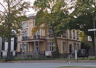
Sight 14: Die Villa_
The Villa Schlikker, officially called the Villa_Forum for Remembrance Culture and Contemporary History since 2024, or Die Villa_ for short, is a former industrialist's villa in Osnabrück, which, as part of the Museum of Cultural History with the Felix Nussbaum House and the Excise House, belongs to the Osnabrück Museum Quarter (MQ4) on Heger-Tor-Wall/Lotter Straße. The building, built in 1900, was the seat of the local NSDAP party headquarters during the National Socialist era and bore the name "Adolf Hitler House", and was called the "Brown House" by the population. After the end of the Second World War, it was used by the British occupying forces until it passed to the city of Osnabrück, which set it up as a natural history and cultural history museum.
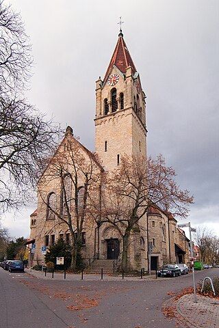
Sight 15: Bergkirche
The Osnabrück Bergkirche is located in the Westerberg district. It was consecrated in 1893 as the first Protestant Reformed church in Osnabrück.
Sight 16: Stüvehaus
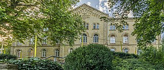
The Stüvehaus was built from 1862 to 1864 as a municipal hospital in Osnabrück, when the previous building on the Große Gildewart became too small. After today's Stadthaus 1 was built, the hospital moved into this building. The Stüvehaus was subsequently used in various ways and today houses the Osnabrück adult education centre and a Brazilian restaurant.
Sight 17: Akzisehaus
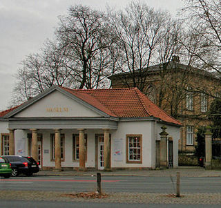
The Akzisehaus is a building in the Lower Saxony city of Osnabrück in the immediate vicinity of the Heger Gate and the museum complex consisting of the Felix Nussbaum House and the Museum of Cultural History.
Sight 18: Waterloo-Tor
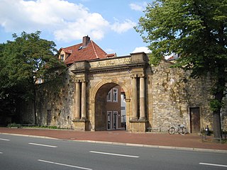
Waterloo-Tor is a war memorial in Osnabrück, Germany, commemorating the Battle of Waterloo. Along with its surrounding area the Waterloo-Tor is usually referred to as “Heger Tor” by residents of Osnabrück; the name “Waterloo-Tor” is barely used by locals.
Sight 19: Bucksturm
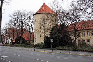
The Bucksturm is a listed historical structure in Osnabrück, Germany.
Sight 20: Bürgergehorsam
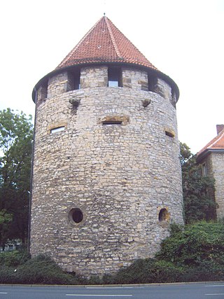
Der Bürgergehorsam ist ein historischer Wehrturm in Osnabrück.
Sight 21: Ebert-Erzberger-Rathenau-Denkmal
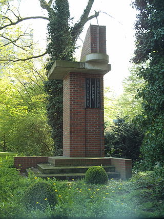
The Ebert-Erzberger-Rathenau Memorial is a memorial designed by Justus Haarmann in the city of Osnabrück. It was erected in honour of the leading politicians of the Weimar Republic Friedrich Ebert, Matthias Erzberger and Walther Rathenau from the Osnabrück local group of the Reichsbanner Schwarz-Rot-Gold. The memorial, which is located between today's Erich-Maria-Remarque-Ring and Herrenteichswall, is a newly built copy of the original memorial, which was destroyed by the National Socialists in 1933.
Sight 22: ehemaliger Hannoverscher Bahnhof
The Hannoversche Bahnhof is the former main station of the city of Osnabrück. The train station on today's Wittekindstraße went into operation with the Hannoversche Westbahn towards Löhne on November 22, 1855. Until the decommissioning of passenger transport in 1895, the Hanoverian train station was the most important train station in the city area of Osnabrück. Due to the crossing situation with the Wanne-Eickel-Hamburg railway line, a few hundred meters east of the Hanover train station was built there. The freight traffic was operated in 1913 until the central goods handling station in the Fledder district was completed. The reception building served as an administration building until 2004, but has now been sold.
Share
How likely are you to recommend us?
Disclaimer Please be aware of your surroundings and do not enter private property. We are not liable for any damages that occur during the tours.
GPX-Download For navigation apps and GPS devices you can download the tour as a GPX file.
.jpg)
