Self-guided Sightseeing Tour #1 in Hamelin, Germany
Legend
Tour Facts
1.1 km
5 m
Experience Hamelin in Germany in a whole new way with our free self-guided sightseeing tour. This site not only offers you practical information and insider tips, but also a rich variety of activities and sights you shouldn't miss. Whether you love art and culture, want to explore historical sites or simply want to experience the vibrant atmosphere of a lively city - you'll find everything you need for your personal adventure here.
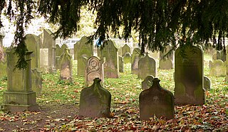
Individual Sights in HamelinSight 1: Jüdischer Friedhof
The Jewish cemetery in Hamelin is a protected cultural monument. On it are 173 gravestones for Jewish deceased from Hamelin and the surrounding area. The oldest gravestone dates from 1741, the youngest from 1936.
Wikipedia: Jüdischer Friedhof (Hameln) (DE), Heritage Website
Sight 2: Pied Piper's House
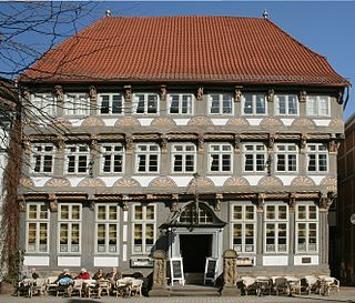
The Pied Piper's House or Rattenfängerhaus is a half-timbered building in Hamelin. It is named after an inscription on its side which purports to be an eyewitness account of the events of the Pied Piper of Hamelin story, describing the departure of the Hamelin children on 26 June 1284. An English translation given on a plaque reads:A.D. 1284 - on the 26th of June - the day of St. John and St. Paul - 130 children - born in Hamelin - were led out of the town by a piper wearing multicoloured clothes. After passing the Calvary near the Koppenberg they disappeared forever.
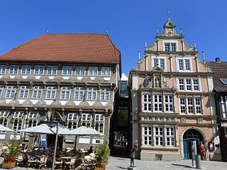
Sight 3: Museum Hameln
The Museum Hameln is located in two buildings in the historic old town of Hameln, the Leisthaus and the neighboring Stiftsherrenhaus. The two buildings in Osterstraße are among the most important buildings from the Weser Renaissance period in Hamelin.
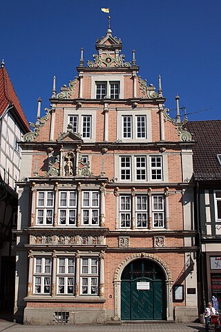
Sight 4: Leisthaus
The Leisthaus is one of the most famous houses in Hamelin's old town and is one of the most magnificent buildings of the Weser Renaissance. It is located at Osterstraße 9 in today's pedestrian zone and is a listed building.
Sight 5: Stiftsherrenhaus
The Stiftsherrenhaus is one of the most famous houses in Hamelin's old town and is located in Osterstraße in the middle of the pedestrian zone. It is one of the most magnificent buildings of the Weser Renaissance and is a listed building.
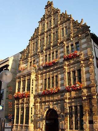
Sight 6: Hochzeitshaus
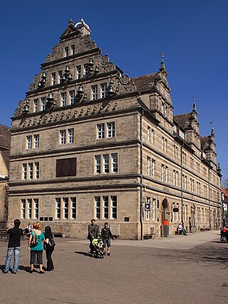
The Wedding House in Hamelin is an important Weser Renaissance building in Lower Saxony, which was built of Süntel sandstone. It is considered the last stone building to be built in this style in Hamelin and is a listed building. The construction period was from 1610 to 1617.
Sight 7: Marktkirche St. Nicolai
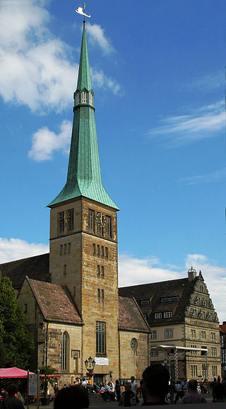
The Evangelical-Lutheran market church of St. Nicolai, which dates back to the 13th century, is the second oldest church in Hamelin after the St. Bonifatius Cathedral and, together with the wedding house, forms the centre of Hamelin's old town.
Wikipedia: Marktkirche (Hameln) (DE), Website, Heritage Website
Share
How likely are you to recommend us?
Disclaimer Please be aware of your surroundings and do not enter private property. We are not liable for any damages that occur during the tours.
GPX-Download For navigation apps and GPS devices you can download the tour as a GPX file.
