Free Walking Sightseeing Tours in Dresden, Germany
Legend
Self-guided Tours
Paid Tours & Activities
Guided Free Walking Tours
Book free guided walking tours in Dresden.
Guided Sightseeing Tours
Book guided sightseeing tours and activities in Dresden.
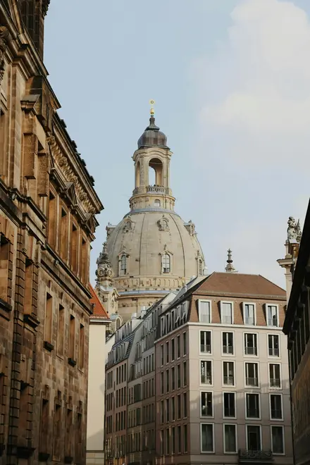
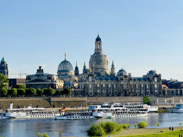
Are you ready for an unforgettable time in Dresden, Germany? Then you've come to the right place with our sightseeing tours. Whether you prefer a guided free walking tour with insider knowledge or enjoy the freedom of a self-guided route, you'll find exactly what you're looking for. Click on a tour and find out more about the highlights that await you!
Activities in DresdenIndividual Sights in Dresden 0$
English
English
2 hours 15 minutes
5/5 stars, 243 ratings
5/5 stars, 243 ratings
Baroque royalty meets socialist concrete - explore Dresden’s architectural Cold War.
Show on GuruWalk* 0$
English
English
2 hours 15 minutes
4.9/5 stars, 176 ratings
4.9/5 stars, 176 ratings
Join me on an unforgettable journey through Dresden’s Old City, where history, art, and legends come to life. As an experienced guide with a background in history, I will take you beyond the...
Show on GuruWalk* 0$
English
English
2 hours 15 minutes
4.8/5 stars, 799 ratings
4.8/5 stars, 799 ratings

Dresden, beautifully set at the river Elbe, is one of Germany's most beautiful cities. It is hard to imagine that most of it was painstakingly reconstructed following the severe bombings during...
Show on GuruWalk* 0$
English and Spanish
English and Spanish
2 hours
4.7/5 stars, 22 ratings
4.7/5 stars, 22 ratings

Discover the charm of Dresden's old town with our Free Tour, where we have been sharing the city's rich history for over six years. Join us on a two-hour tour of the most iconic places, starting...
Show on GuruWalk* 0$
English
English
2h - 2h 30m
9.2/10 stars, 579 ratings
9.2/10 stars, 579 ratings

Get to know the ancient pearl of European Baroque with a Free Walking Tour of Dresden, where you'll wander through the centre of a city hit by the Second World War.
Show on Civitatis* 44 sights
7.3 km
7.3 km
186 m
183 m
183 m
- Festtagstür der Jakobikirche
- Annenkirche
- Fernmeldemuseum Dresden
- Queckbrunnen
- Stadtbezirksamt Altstadt
- Schauspielhaus
- Käseglocke
- DenkRaum Sophienkirche
- Cholerabrunnen
- Porzellansammlung
- Türckische Cammer
- Kupferstich-Kabinett
- Historisches Grünes Gewölbe
- Der Weg der Roten Fahne
- Kulturpalast
- Dresden City Museum
- Landhaus
- Albertinum
- Galerie Neue Meister
- Brühlscher Garten
- Delphinbrunnen
- Skulpturensammlung
- Coselpalais
- Church of Our Lady
- Neumarkt
- Friedensbrunnen
- Transport Museum
- Long Arcade
- Procession of Princes
- Münzkabinett
- George gate
- Alojs Andritzki
- Napoleonstein
- Kathedrale Ss. Trinitatis
- Hausmannsturm
- Altstädtische Hauptwache
- Gemäldegalerie Alte Meister
- Mathematisch-Physikalischer Salon
- Carl-Maria-von-Weber-Denkmal
- Semperoper
- Statue of King John
- Italienisches Dörfchen
- Dresdner Brettl
- Augustusbrücke
44 sights
9.3 km
9.3 km
134 m
125 m
125 m
- Staudengarten
- Albertbrücke
- Große Liegende
- Albert Hirsch
- Neue Synagoge Dresden
- Albertinum
- Galerie Neue Meister
- Brühlscher Garten
- Sphinx
- Delphinbrunnen
- Skulpturensammlung
- Coselpalais
- Church of Our Lady
- Neumarkt
- Friedensbrunnen
- Transport Museum
- Procession of Princes
- Long Arcade
- Münzkabinett
- George gate
- Hausmannsturm
- Altstädtische Hauptwache
- Porzellansammlung
- Zwingergarten
- Stadtbezirksamt Altstadt
- Schauspielhaus
- Käseglocke
- DenkRaum Sophienkirche
- Cholerabrunnen
- Türckische Cammer
- Kupferstich-Kabinett
- Neues Grünes Gewölbe
- Der Weg der Roten Fahne
- Kulturpalast
- Dresden City Museum
- Landhaus
- Trümmerfrau
- Dinglingerbrunnen
- Goldener Rathausmann
- Kreuzkirche
- Ernst-Julius-Otto-Denkmal
- Figur vom zerstörten Trompeterschlösschen
- Annenkirche
- Sternplatz
19 sights
4.7 km
4.7 km
137 m
131 m
131 m
- Festtagstür der Jakobikirche
- Stadtbezirksamt Altstadt
- Queckbrunnen
- Fernmeldemuseum Dresden
- Mathematisch-Physikalischer Salon
- Gemäldegalerie Alte Meister
- Carl-Maria-von-Weber-Denkmal
- Semperoper
- Altstädtische Hauptwache
- Statue of King John
- Italienisches Dörfchen
- Dresdner Brettl
- Alojs Andritzki
- Frederick Augustus I of Saxony Monument
- Kathedrale Ss. Trinitatis
- George gate
- Brühlscher Garten
- Delphinbrunnen
- Augustusbrücke
6 sights
1.5 km
1.5 km
11 m
9 m
9 m
- Dresdner Mühle
- Matthäus-Kirche
- Hochreliefbrunnen
- Palais Brühl-Marcolini
- Anton dem Guitigen
- Neptunbrunnen
9 sights
2.3 km
2.3 km
34 m
43 m
43 m
- Ernst-Julius-Otto-Denkmal
- Kreuzkirche
- Goldener Rathausmann
- Dinglingerbrunnen
- Albertinum
- Sphinx
- Brühlscher Garten
- Neue Synagoge Dresden
- Helene Herzberg geb. Waldhorn
13 sights
4.7 km
4.7 km
69 m
67 m
67 m
- Museum für Völkerkunde Dresden
- Blockhaus
- Goldener Reiter
- Museum of Saxon Folk Art with Puppet Theater Collection
- Jägerhof
- Neustädter Markthalle
- Kleines Haus
- Staudengarten
- Albertbrücke
- Joseph Fränkel
- Pferdekopfbrunnen
- Martin-Luther-Kirche
- Pfunds Molkerei
6 sights
2.3 km
2.3 km
76 m
130 m
130 m
- Sternwarte
- Leonhardi-Museum
- Kirche zu Dresden-Loschwitz
- Alte Feuerwache Loschwitz
- Loschwitzer Brücke
- Schillerhäuschen
17 sights
7 km
7 km
63 m
92 m
92 m
- Denkmal der 1. Gardepanzerarmee
- Staatliche Schlösser, Burgen und Gärten Sachsen
- Kraszewski-Museum
- Alaunplatz
- Kunsthofpassage
- Carte Blanche (Travestie)
- Alter Jüdischer Friedhof
- Martin-Luther-Kirche
- Scheune
- Stille Wasser
- Elise Berta Wronkow
- Neustädter Markthalle
- Dreikönigskirche
- Schillerdenkmal
- Erich-Kästner-Museum
- Bahnhof Dresden-Neustadt
- Leipziger Bahnhof
5 sights
2.7 km
2.7 km
22 m
23 m
23 m
- Bürgerwiese
- Güntzwiesen
- Akademie für berufliche Bildung
- Botanischer Garten
- Bedřich Fantl
10 sights
5.6 km
5.6 km
96 m
58 m
58 m
- Leipziger Bahnhof
- Bahnhof Dresden-Neustadt
- Jacob Urbach
- Kunsthofpassage
- Alaunplatz
- Kraszewski-Museum
- Staatliche Schlösser, Burgen und Gärten Sachsen
- Denkmal der 1. Gardepanzerarmee
- Landeskommando Sachsen
- Sowjetischer Garnisonfriedhof
Share
Spread the word! Share this page with your friends and family.
How likely are you to recommend us?
What can we improve?
Why Visit Sights? Self-guided sightseeing tours are a free and safe alternative to bus tours. You can explore Dresden at your own pace, any time! Do something good for your health by walking.