Self-guided Sightseeing Tour #4 in Darmstadt, Germany
Legend
Guided Free Walking Tours
Book free guided walking tours in Darmstadt.
Guided Sightseeing Tours
Book guided sightseeing tours and activities in Darmstadt.
Tour Facts
4 km
76 m
Experience Darmstadt in Germany in a whole new way with our free self-guided sightseeing tour. This site not only offers you practical information and insider tips, but also a rich variety of activities and sights you shouldn't miss. Whether you love art and culture, want to explore historical sites or simply want to experience the vibrant atmosphere of a lively city - you'll find everything you need for your personal adventure here.
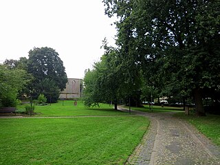
Individual Sights in DarmstadtSight 1: Kapellplatz
Kapellplatz is a park in Darmstadt, Germany.
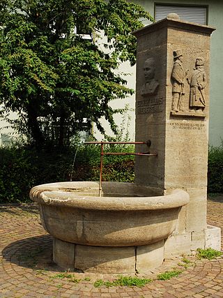
Sight 2: Niebergall-Brunnen
The Niebergall Fountain is a fountain and monument in Darmstadt, Germany.
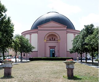
Sight 3: Ludwigskirche
St. Ludwig is the main Catholic church of Darmstadt. Its striking dome rises in an exposed position above the city centre at the end of the boulevard-like Wilhelminenstraße. In the vernacular, the Ludwigskirche is also known as the cheese bell or "Kääsglock".
Wikipedia: St. Ludwig (Darmstadt) (DE), Website, Heritage Website
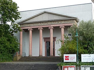
Sight 4: Theater Mollerhaus
The Moller-Haus is a listed event building in Darmstadt, Germany.
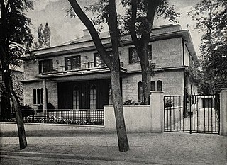
Sight 5: Haus Alexander Koch
Haus Alexander Koch at Annastraße 25 is a villa in Darmstadt, Germany.
Sight 6: Schader Stiftung
Die Schader-Stiftung ist eine gemeinnützige Stiftung bürgerlichen Rechts mit Sitz in Darmstadt. Sie finanziert ihre Fördertätigkeit aus den Erträgen des von Alois M. Schader gestifteten Privatvermögens. Die Schader-Stiftung wurde 1988 gegründet.
Sight 7: Wolfskehl'scher Park
Wolfskehl'sche Park is a small park in Darmstadt, Germany, located on the Galgenberg in the Bessungen district.
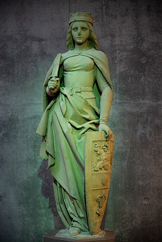
Sight 8: Darmstadtia
The Darmstadtia is a cultural monument in Darmstadt. The former fountain figure represents the patron saint of the city.
Sight 9: Prinz-Emil-Garten
Many of the sights in Darmstadt date back to the times when the city was still an administrative seat of the Upper County of Katzenelnbogen, or from 1568 to 1806 as the residence of the Landgraves of Hesse-Darmstadt and then until 1919 as the capital of the Grand Duchy of Hesse and from 1919 to 1945 of the People's State of Hesse. In particular, the years under Grand Duke Ernst Ludwig, who founded the Darmstadt artists' colony in 1899 and thus shaped Darmstadt into a centre of Art Nouveau. Before that, Georg Möller, from 1810 the chief building officer and court building director of the Grand Duchy, had already decisively shaped the face of the city and this district.
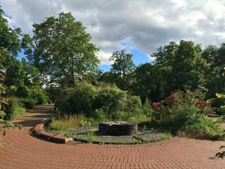
Sight 10: Ingelheimer Garten
The Ingelheimer Garten is a small green space in Darmstadt. The green area with a triangular floor plan was named after the town of Ingelheim am Rhein.
Share
How likely are you to recommend us?
Disclaimer Please be aware of your surroundings and do not enter private property. We are not liable for any damages that occur during the tours.
GPX-Download For navigation apps and GPS devices you can download the tour as a GPX file.
