Self-guided Sightseeing Tour #1 in Bremerhaven, Germany
Legend
Tour Facts
3.8 km
54 m
Experience Bremerhaven in Germany in a whole new way with our free self-guided sightseeing tour. This site not only offers you practical information and insider tips, but also a rich variety of activities and sights you shouldn't miss. Whether you love art and culture, want to explore historical sites or simply want to experience the vibrant atmosphere of a lively city - you'll find everything you need for your personal adventure here.
Individual Sights in BremerhavenSight 1: Wasserstandsanzeiger
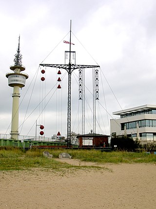
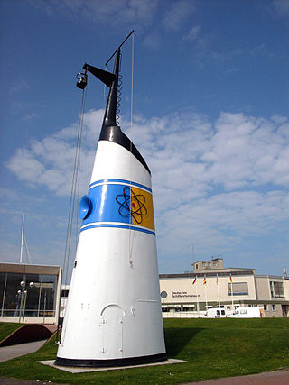
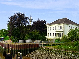
The Bremerhaven water level indicator is located at the southern end of the Weser dike in Mitte (Bremerhaven). He informed ship tours about the tide level in Bremerhaven. Like the Bürgermeister-Smidt-Gedächtniskirche and the "Lange Heinrich" in the past, the water level indicator is (again) a landmark of Bremerhaven.
Sight 2: Tonnenschuppen
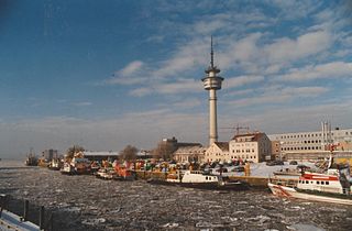
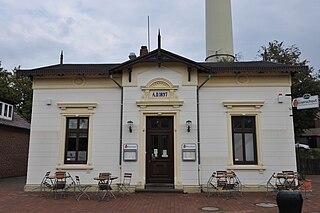
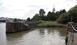
The navigation signs in the Outer Weser are maintained and deployed from the Bremerhaven barrel yard. The Tonnenhof, located at the mouth of the Geeste in Bremerhaven, belonged to the Buoy and Beacon Office of Bremen, founded in 1876, and after the Second World War to the Bremerhaven Water and Shipping Authority (WSA). Since 8 April 2019, it has been part of the newly created Waterways and Shipping Authority Weser-Jade-Nordsee.
Sight 3: Radarturm
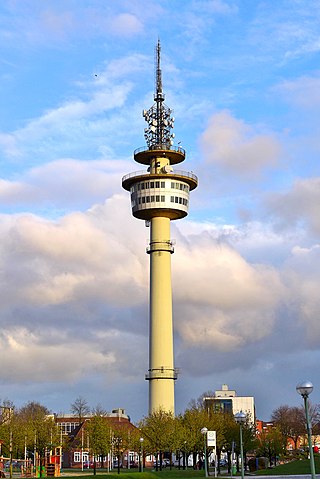
The Bremerhaven Radar Tower is a 106-metre reinforced concrete tower located in Bremerhaven, Germany. The radar tower, which was constructed between 1962 and 1965, accommodates numerous transmitting plants for maritime radio purposes, in addition to its radar equipment. A viewing platform is situated at the 60 metre level, and is accessible to the public.
Sight 4: Zollhaus
The Bremerhaven Customs House in Bremerhaven-Mitte, Van-Ronzelen-Straße/Ludwig-Plate-Platz near the Bremerhaven Directional Radio Tower was built in 1897.
Sight 5: Hans Lüken
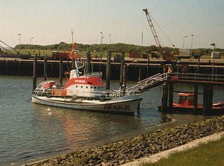
Hans Lüken was a 19-metre-class sea rescue cruiser of the German Maritime Search and Rescue Service (DGzRS), which was built in 1969 by the Schweers shipyard in Bardenfleth under shipyard no. 6409. The DGzRS internal designation was KRS 04.
Sight 6: DIVA
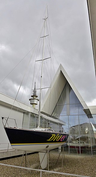
The sailing yacht Diva is an exhibit of the German Maritime Museum in Bremerhaven-Mitte, Hans-Scharoun-Platz 1/3. It was built in 1985.
Sight 7: Deutsches Schifffahrtsmuseum
The German Maritime Museum is a museum in Bremerhaven, Germany. It is part of the Gottfried Wilhelm Leibniz Scientific Community. The main museum building was opened on 5 September 1975 by then-president of Germany Walter Scheel, though scientific work already had started in 1971.
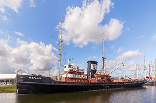
Sight 8: Seefalke
The Seefalke is a former salvage tug built in 1924 at the Tecklenborg shipyard for the W. Schuchmann shipping company. It is an exhibit of the German Maritime Museum in Bremerhaven. The tug has been a listed building since 2005 as part of the cultural monument "German Maritime Museum and Museum Fleet".
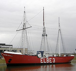
Sight 9: Elbe 3
The Bürgermeister Abendroth is a German lightship commissioned in 1909 under the name Eider.
Sight 10: U-Boot Wilhelm Bauer
, Website
Sight 11: Klimahaus Bremerhaven
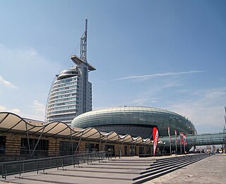
The Klimahaus Bremerhaven is a scientific exhibition house in Bremerhaven. It is located at the Old Harbour and is part of the Havenwelten; its shape resembles a boat. The exhibition offers the possibility of a virtual journey around the world in a north-south direction at about the geographical longitude of the starting point, 8°34′30" east of Greenwich, and in extension over the South Pole in a northerly direction along the 171st to 172nd degree west longitude. The approximately 11,500 square metre world of knowledge and experience takes up the topic of climate and climate change in various exhibition areas. Klaus Meier has been the new operator of the exhibition house since January 2024. While Arne Dunker headed the Klimahaus from 2004 to 2023, Ingrid Hayen took over the management at the turn of the year.
Sight 12: Bürgermeister-Smidt-Gedächtniskirche
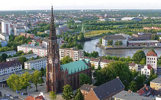
The Bürgermeister-Smidt-Gedächtniskirche in Bremerhaven belongs to a congregation of the United Churches consisting of Lutherans and Reformed. Belonging to the Bremen Evangelical Church from the beginning, it is still the only congregation of this regional church in Bremerhaven. The correct name of the "Great Church" is United Protestant Community to the Bürgermeister-Smidt-Gedächtniskirche. Since 1927, Bremerhaven's main church, like the main shopping street, has been named after Mayor Johann Smidt.
Wikipedia: Bürgermeister-Smidt-Gedächtniskirche (DE), Website
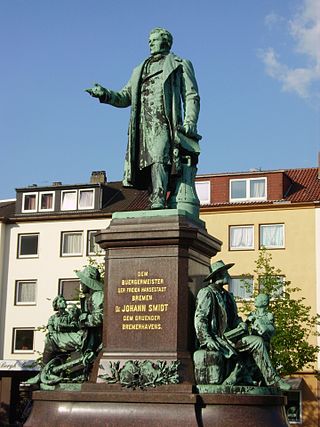
Sight 13: Bürgermeister-Smidt-Denkmal
The Mayor Smidt Monument in Bremerhaven-Mitte, Theodor-Heuss-Platz, was erected in 1888.
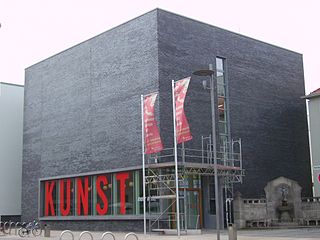
Sight 14: Kunstmuseum
The Kunstmuseum Bremerhaven, combined with the Kunsthalle Bremerhaven of the Kunstverein Bremerhaven in the seaside city of Bremerhaven, is an art museum in the Bremerhaven-Mitte district at Karlsburg 1 near Theodor-Heuss-Platz.
Sight 15: Kabinett für aktuelle Kunst
Das Kabinett für aktuelle Kunst ist ein Raum für zeitgenössische Kunst in Bremerhaven, in dem wechselnde Ausstellungen der internationalen Avantgarde gezeigt werden.
Sight 16: Villa Seebeck
The Villa Seebeck in Bremerhaven-Mitte, Deichstraße 15, corner of Fischplatz, was built in 1908 according to plans by Johann Allers.
Sight 17: Wencke-Dock
The Wencke Dock in Bremerhaven-Mitte, Deichstraße, was built around 1860.
Sight 18: Alte Geestebrücke
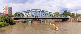
The Old Geeste Bridge is a swing bridge in Bremerhaven-Geestemünde on the Fährstraße. It has been running over the Geeste since 1904.
Sight 19: Busse-Denkmal
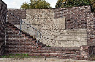
The Busse Monument is a memorial in Bremerhaven, district of Geestemünde, on the left bank of the Geeste at the foot of the eastern bridgehead of the Old Geeste Bridge. It was built in 1936 according to a design by the Hamburg architect Fritz Höger. It commemorates the commissioning of the fishing trawler Sagitta by the shipowner Friedrich Busse in 1885, which marked the beginning of modern deep-sea fishing in Germany.
Sight 20: Historisches Museum Bremerhaven
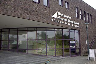
The Historical Museum Bremerhaven – formerly the Morgenstern Museum – is located between the Old Geeste Bridge and the Kennedy Bridge on the south bank of the Geeste and shows the history of Bremerhaven and its surroundings.
Share
How likely are you to recommend us?
Disclaimer Please be aware of your surroundings and do not enter private property. We are not liable for any damages that occur during the tours.
GPX-Download For navigation apps and GPS devices you can download the tour as a GPX file.
