Free Walking Sightseeing Tour #1 in Lens, France
Legend
Tour Facts
5.3 km
40 m
Explore Lens in France with this free self-guided walking tour. The map shows the route of the tour. Below is a list of attractions, including their details.
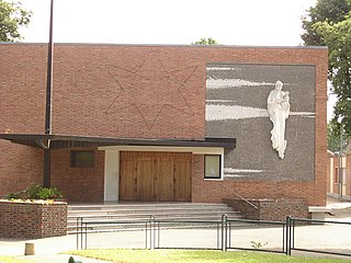
Sight 1: Église Sainte-Élisabeth
The Church of St. Elizabeth, locally known as the Polish Church, or the Church of the Millennium, is a Roman Catholic church in the city of Lens (Pas-de-Calais), located on rue du Père-Joseph-Puchala and 21 route de Béthune, near the Filieris health center. It depends on the diocese of Arras and is dedicated to Saint Elizabeth.
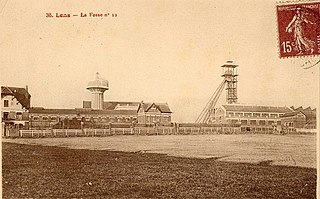
Sight 2: Monument aux Morts de la Compagnie des Mines de Lens
Pit No. 12 known as Saint-Édouard or Édouard Bollaert of the Compagnie des mines de Lens is a former colliery in the Nord-Pas-de-Calais mining basin, located in Loos-en-Gohelle, near the borders with Lens. Work began in 1891, and the pit began production on January 1, 1894. Vast cities, then a church and schools were built to the south of the pit, on the territory of Lens. A No. 12 bis ventilation pit was started 646 metres south of pit No. 12 in the mid-1900s. The pit was destroyed during the First World War. It was rebuilt in the architectural style of the post-war mines of Lens. The same is true for housing estates, schools, churches, and various official housing. A war memorial was also erected. Pit Nos. 15 - 15 bis was attached to Pit No. 12 in 1937, and Pits Nos. 14 and 14 bis were added the following year.
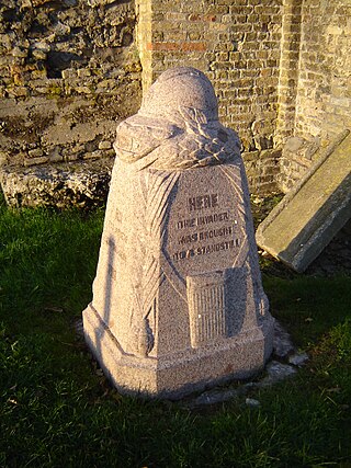
Sight 3: Borne Vauthier Demarcation Stone №38
Western Front demarcation stones, also known as Bornes du Front and Bornes Vauthier, are monuments erected in France and Belgium to mark the limit of the German advance during the First World War. The stones were the idea of sculptor Paul Moreau-Vauthier, a veteran of the war, and were erected between 1921 and 1930. The total number of stones erected is unclear but it is thought that there were 118 official stones, of which 93 survive. The stones identify the army that held that sector in 1918 and are engraved with the text "Here the invader was brought to a standstill 1918" in English, Dutch, and French.
Sight 4: Louvre Lens
The Louvre-Lens is an art museum located in Lens, France, approximately 200 kilometers north of Paris. It displays objects from the collections of the Musée du Louvre that are lent to the gallery on a medium- or long-term basis. The Louvre-Lens annex is part of an effort to provide access to French cultural institutions for people who live outside of Paris. Though the museum maintains close institutional links with the Louvre, it is primarily funded by the Nord-Pas-de-Calais region.
Sight 5: Centre de conservation du Louvre
The Louvre Conservation Centre is a cultural facility located in Liévin that has two objectives: it is intended to preserve the works of the Louvre Museum considered to be in danger in the event of hundred-year floods of the Seine. Even though there have been no major floods for about sixty years, 5 major floods occurred in the twentieth century: in 1910, 1920, 1924, 1945 and 1955. In June 2016, a flood of the Seine forced several Parisian museums, including the Louvre, to urgently move part of their collections kept underground; It is a research centre open to the Louvre's scientific staff, partners, researchers and academics in the context of consultation of works, research programmes or training courses.
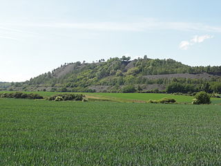
Sight 6: Puits n° 1
The Compagnie des mines de Liévin was a mining company that exploited coal in Liévin, Éleu-dit-Leauwette, Avion and Angres in the Nord-Pas-de-Calais mining basin. The Society was founded on December 1, 1862. After numerous soundings, a No. 1 shaft was started at Liévin in 1858, and began production in 1860.
Sight 7: Chevalement du puits n° 1 bis
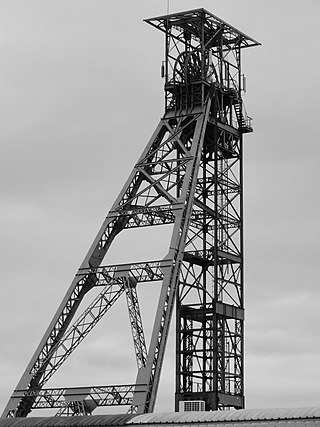
The headframe of shaft No. 1 bis of pit No. 1 - 1 bis - 1 ter of the Liévin mines was built between 1922 and 1923 on this colliery in the Nord-Pas-de-Calais mining basin in Liévin. It replaces the one that was destroyed during the First World War.
Wikipedia: Chevalement du puits n° 1 bis de la fosse n° 1 - 1 bis - 1 ter des mines de Liévin (FR)
Share
Disclaimer Please be aware of your surroundings and do not enter private property. We are not liable for any damages that occur during the tours.
GPX-Download For navigation apps and GPS devices you can download the tour as a GPX file.
