Self-guided Sightseeing Tour #2 in Concepcion, Chile
Legend
Tour Facts
4.5 km
34 m
Experience Concepcion in Chile in a whole new way with our free self-guided sightseeing tour. This site not only offers you practical information and insider tips, but also a rich variety of activities and sights you shouldn't miss. Whether you love art and culture, want to explore historical sites or simply want to experience the vibrant atmosphere of a lively city - you'll find everything you need for your personal adventure here.
Individual Sights in ConcepcionSight 1: Plaza Cruz
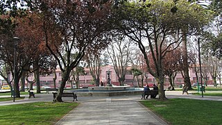
Plaza Cruz is a square located in the Chilean city of Concepción, on the block bounded by General Cruz, Joaquín Prieto, Salas and Angol streets, near the city center.
Sight 2: Cerro Amarillo
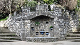
Cerro Amarillo is a hill in the city of Concepción, Chile, located between Rozas and Rengo streets, which covers an area of 3000 m² and has an altitude of 30 meters. On top of it is a park created in 1933, currently administered by the Municipality of Concepción, which includes gardens, promenades and viewpoints surrounded by stone masonry walls.
Sight 3: Catedral de Concepción
The Cathedral of the Most Holy Conception is a Roman Catholic cathedral located in Concepción, Chile.
Wikipedia: Cathedral of the Most Holy Conception, Chile (EN)
Sight 4: Museo de Arte Religioso
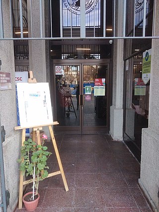
The Museum of Religious Art of the Catholic University of the Most Holy Conception is an institution created in order to preserve ecclesiastical treasures related to the Catholic Church. The Catholic University of the Most Holy Conception (UCSC) is its administrator. It receives an average of 400 visits per month.
Wikipedia: Museo de Arte Religioso de la Universidad Católica de la Santísima Concepción (ES)
Sight 5: Condorito
Sight 6: Plaza de la Independencia
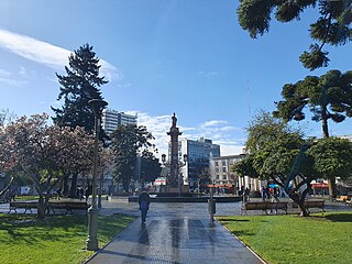
The Plaza de la Independencia is the Plaza de Armas in Concepción, Chile.
Sight 7: Palacio Hirmas
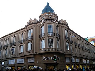
The Hirmas Palace is a construction in the center of the Chilean city of Concepción.
Sight 8: Luz Sobrino Sanz
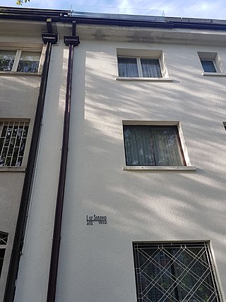
Luz Sobrino was a Chilean architect who carried out important work in the reconstruction of the city of Concepción, after the earthquake of 1939.
Sight 9: Historia de la medicina y la farmacia en Chile
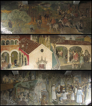
Historia de la medicina y la farmacia en Chile is a mural created in 1957 by the artist Julio Escámez for the former Maluje pharmacy, now the Alemana drugstore, located at 676 Tucapel Street in the city of Concepción. It is one of Escámez's most important works. Until 2015, it was considered a historically preserved building, with a "cultural" category for the city, and was declared a National Monument of Chile, in the category of Historical Monument, through Decree No. 370, dated September 1, 2015.
Wikipedia: Historia de la medicina y la farmacia en Chile (EN)
Sight 10: Educación: pasado, presente y futuro
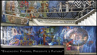
Education: Past, Present and Future is an 86-square-meter mural, painted by Chilean artist Marco Hernández in 2009, located at the entrance to the General Ministerial Secretariat (SEREMI) of Education of the Biobío Region, in the city of Concepción, Chile.
Sight 11: Plaza Perú
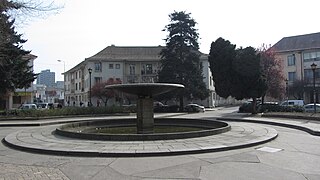
Plaza Perú is a square in the city of Concepción, Chile. It is situated in the University District in front of the main entrance of the Ciudad Universitaria de Concepción, by the Arco Universidad de Concepción and adjacent to the Casa del Arte. Built in 1942, there are several historic buildings surrounding the square, which were built in the 1940s. The plaza is known for being a gathering of students at the University of Concepción and youth in general.
Sight 12: Presencia de América Latina
Presencia de América Latina, also known as Integración de América Latina, is a mural painted by Mexican artist Jorge González Camarena between November 1964 and April 1965. The 300-square-meter mural, painted in acrylics on rough stucco, is located in the lobby of the Casa del Arte of the University of Concepción, in Concepción, Chile. Its principal theme is the unity and brotherhood of the different Latin American cultures.
Sight 13: Casa del Arte José Clemente Orozco (Pinacoteca)
The Casa del Arte José Clemente Orozco is a Chilean art museum on the campus of the University of Concepción, in Concepción. It is situated on the corner of Chacabuco and Larenas, facing the Plaza Perú. The gallery attracts approximately 75,000 visitors a year and houses the country's largest collection of paintings outside the capital city of Santiago, and the most complete collection of Chilean art with some 1,800 works. One of its main features is the mural Presencia de América Latina (1964) by the Mexican artist Jorge González Camarena, which is in the entrance hall.
Sight 14: Homenaje al Espíritu de los Fundadores de la Universidad de Concepción
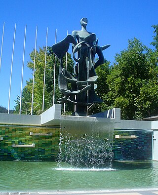
Homage to the spirit of the founders of the University of Concepción is the name given to a bronze sculpture 7 meters high and 13 tons, sculpted by the Chilean sculptor Samuel Román Rojas during 1965 and officially inaugurated at the University of Concepción on January 7, 1966. The work is located in the forum of the University City of Concepción, in Concepción, Chile, and is a tribute to the founders of this house of studies, whose goal was to create the first secular university in the country, free of discrimination based on religious creeds and political ideologies.
Wikipedia: Homenaje al espíritu de los fundadores de la Universidad de Concepción (ES)
Share
How likely are you to recommend us?
Disclaimer Please be aware of your surroundings and do not enter private property. We are not liable for any damages that occur during the tours.
GPX-Download For navigation apps and GPS devices you can download the tour as a GPX file.
.jpg)