Self-guided Sightseeing Tour #3 in (Old) Ottawa, Canada
Legend
Guided Free Walking Tours
Book free guided walking tours in (Old) Ottawa.
Guided Sightseeing Tours
Book guided sightseeing tours and activities in (Old) Ottawa.
Tour Facts
2.2 km
21 m
Experience (Old) Ottawa in Canada in a whole new way with our free self-guided sightseeing tour. This site not only offers you practical information and insider tips, but also a rich variety of activities and sights you shouldn't miss. Whether you love art and culture, want to explore historical sites or simply want to experience the vibrant atmosphere of a lively city - you'll find everything you need for your personal adventure here.
Individual Sights in (Old) OttawaSight 1: St. Barnabas Church,

St. Barnabas, Apostle and Martyr Anglican Church is an Anglican church in the Anglo-Catholic tradition at 70 James Street in Ottawa, Ontario, Canada.
Wikipedia: St. Barnabas, Apostle and Martyr Anglican Church (EN), Website
Sight 2: Centretown United Church

Centretown United Church is an historic church located in Ottawa, Ontario, Canada at 507 Bank Street at Argyle in the Centretown area. It was built in 1906 as the Stewarton Presbyterian Church using Gothic Revival architecture under the architecture of Moses Chamberlain Edey, (designer of Heritage site the Aberdeen Pavilion and the Daly Building. The corner stone was laid by Sir Mortimer Clarke, Lieutenant Governor of Ontario. Centretown United Church is a member church of the United Church of Canada.
Sight 3: First Church of Christ, Scientist

First Church of Christ, Scientist is a Christian Science church in Ottawa, Ontario, Canada.
Wikipedia: First Church of Christ, Scientist (Ottawa) (EN), Website
Sight 4: Église Unie St-Marc

Église Unie St-Marc is a small but historic church in Ottawa, Canada. It is the main church for francophone Protestants in the Ottawa Gatineau region. French speaking Protestants are a very small minority in Canada, but one with a history dating back to early Huguenot settlers.
Sight 5: St John the Evangelist

St. John the Evangelist Anglican Church is an Anglican church in downtown Ottawa, Ontario, Canada, at the corner of Elgin and Somerset streets.
Wikipedia: Anglican Church of St. John the Evangelist (Ottawa) (EN), Website
Sight 6: St. Theresa Roman Catholic Church
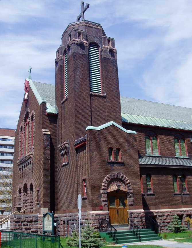
St. Theresa's Catholic Church is a Roman Catholic church on Cartier Street in Ottawa, Ontario, Canada. The church is located in the eastern section of downtown Ottawa, on Somerset Street between Elgin Street and the Rideau Canal.
Wikipedia: St. Theresa's Catholic Church (Ottawa) (EN), Website
Share
How likely are you to recommend us?
Disclaimer Please be aware of your surroundings and do not enter private property. We are not liable for any damages that occur during the tours.
GPX-Download For navigation apps and GPS devices you can download the tour as a GPX file.