Free Walking Sightseeing Tour #3 in Brisbane City, Australia
Legend
Guided Free Walking Tours
Book free guided walking tours in Brisbane City.
Guided Sightseeing Tours
Book guided sightseeing tours and activities in Brisbane City.
Tour Facts
5.1 km
128 m
Explore Brisbane City in Australia with this free self-guided walking tour. The map shows the route of the tour. Below is a list of attractions, including their details.
Activities in Brisbane CityIndividual Sights in Brisbane CitySight 1: Old Museum
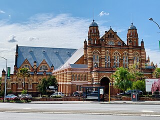
The Old Museum Building is a heritage-listed former exhibition building, former museum and now performance venue in Bowen Hills, Brisbane, Queensland, Australia. It is made from 1.3 million red bricks and bordered by Gregory Terrace and the Exhibition Grounds.
Sight 2: Chinatown
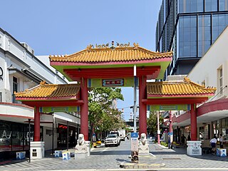
Chinatown, Brisbane is a precinct in Fortitude Valley, Brisbane, Australia. It is centred on Chinatown Mall, a pedestrian street which occupies all of Duncan Street. The Mall runs parallel to Brunswick Street Mall, and connects Wickham Street and Ann Street. The precinct is the location of Chinese restaurants and shops, and is the venue for events including Chinese New Year and Valley Fiesta. Street signs in the area are written in both English and Chinese. It is also home to many restaurants offering Chinese, Korean, Indonesian, Japanese, Thai and Vietnamese cuisines. Its pan-Asian nature is also emphasized through the hosting of many Asian festivals including the annual Indian festival, Diwali.
Sight 3: Centenary Place
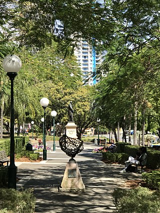
Centenary Place is a heritage-listed park at 85 Wickham Street, Fortitude Valley, City of Brisbane, Queensland, Australia. It is also known by some as Centenary Park even though this is not the name it was given at the ceremonial dedication. It was designed by Henry Moore. It was added to the Queensland Heritage Register on 6 August 2007.
Sight 4: Roma Street Parklands
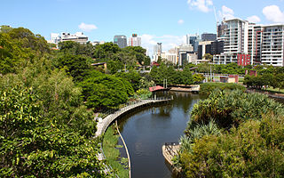
Roma Street Parkland covers 11 hectares in the centre of the City of Brisbane, Queensland, Australia. The Roma Street Parkland is adjacent to the former Brisbane Transit Centre and the Roma Street railway station from which it takes its name. There is pedestrian access to the Roma Street Parkland from the Roma Street railway station, as well as from Albert Street, and from the section of the Parkland which was formerly called Albert Park on Wickham Terrace.
Sight 5: La Boite Roundhouse Theatre
La Boite Theatre, founded as the Brisbane Repertory Theatre Society, is an Australian theatre company based in Brisbane, Queensland. La Boite was established in 1925 and is Australia’s longest continuously running theatre company.
Sight 6: TAFE Hall of Residence
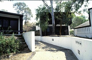
TAFE Hall of Residence is a heritage-listed disused residential college at 95–107 Musk Avenue, Kelvin Grove, City of Brisbane, Queensland, Australia. It was designed by John Dalton and built from 1976 to 1978. It was added to the Queensland Heritage Register on 25 February 2004.
Share
Disclaimer Please be aware of your surroundings and do not enter private property. We are not liable for any damages that occur during the tours.
GPX-Download For navigation apps and GPS devices you can download the tour as a GPX file.
