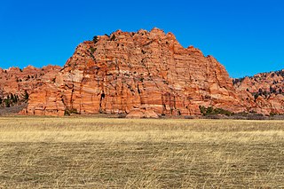
31 Sights in Washington County, United States (with Map and Images)
Legend
Welcome to your journey through the most beautiful sights in Washington County, United States! Whether you want to discover the city's historical treasures or experience its modern highlights, you'll find everything your heart desires here. Be inspired by our selection and plan your unforgettable adventure in Washington County. Dive into the diversity of this fascinating city and discover everything it has to offer.
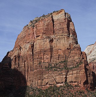
1. Angels Landing
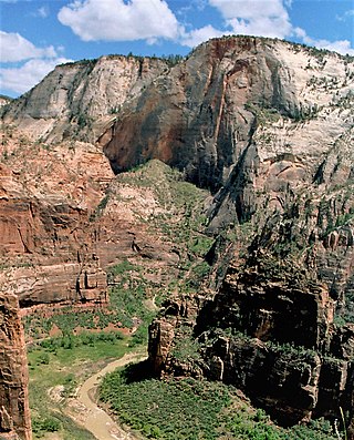
Angels Landing, known previously as the Temple of Aeolus, is a 1,488-foot (454 m) tall rock formation in Zion National Park in southwestern Utah, United States. A renowned trail cut into solid rock in 1926 leads to the top of Angels Landing and provides panoramic views of Zion Canyon.
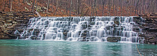
2. Devil's Den State Park
Devil's Den State Park is a 2,500-acre (1,000 ha) Arkansas state park in Washington County, near West Fork, Arkansas in the United States. The park was built by the Civilian Conservation Corps, beginning in 1933. Devil's Den State Park is in the Lee Creek Valley in the Boston Mountains, which are the southwestern part of The Ozarks. The park, with an 8 acres (3.2 ha) CCC-built lake, is open for year-round recreation, with trails for hiking, mountain biking and horseback riding. Devil's Den State Park also has several picnic areas, a swimming pool and cabins, with camping sites ranging from modern to primitive. Fossils of coral and crinoids can be found along the banks and within Lee Creek at Devil's Den State Park.
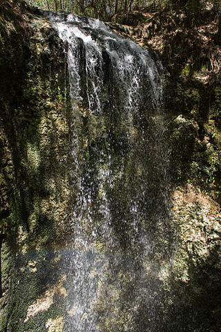
3. Falling Waters State Park
Falling Waters State Park is a 171-acre (69 ha) Florida state park located three miles (5 km) south of Chipley, Washington County in northwestern Florida. The park contains a 73-foot (22 m) waterfall, the highest in the state known as "Falling Waters Falls”.
4. Saint Rose Priory
St. Rose Priory is a house of the Dominican Order located near Springfield, Kentucky. It is the first foundation of that Order in the United States, and the first Catholic educational institution west of the Allegheny Mountains.
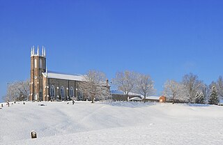
5. Moss Hill Methodist Church
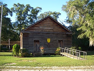
The Moss Hill Church, also known as the Moss Hill Methodist Church and now the Moss Hill United Methodist Church, is located near Vernon in Washington County, Florida, in the United States. The Holmes Valley Methodist Mission was established in 1821–1825. The church was built in 1857.
6. Quirauk Mountain
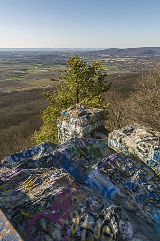
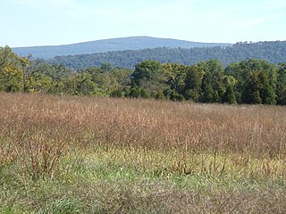
Quirauk Mountain is the highest point on South Mountain. The 2,145-foot (654 m) peak is located in northeastern Washington County, Maryland. It lies just southwest of Fort Ritchie Military Reservation in the village of Cascade and about 1/2 mile southeast of the community of Blue Mountain. The Appalachian Trail and South Mountain State Park are about 1/2 mile to the west of the mountain's summit.
7. Hollenberg Pony Express Station
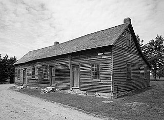
The Hollenberg Pony Express Station, also known as Cottonwood Pony Express Station, is the most intact surviving station of the Pony Express in the United States. It was built by Gerat H. Hollenberg in 1858, to serve travelers on the Oregon and California Trails, and was used by the Pony Express when it was established in 1860. The station is owned by the state of Kansas and is operated by the Kansas Historical Society as Hollenberg Pony Express Station State Historic Site. It was designated a National Historic Landmark in 1961.
8. Round Top
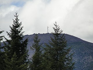
Round Top is the third-highest mountain in Washington County, Oregon with an elevation of 2,982 feet (909 m). It is in the Northern Oregon Coast Range and is located 4.3 miles (7 km) southwest of Timber, and 9 miles (14.5 km) north of South Saddle Mountain. From 1933 to 1946, the summit was the site of a fire lookout tower and cabin.
9. Cooper Mountain
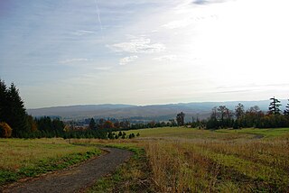
Cooper Mountain is a mountain in Washington County, Oregon, United States. Its summit has an elevation of 764 feet (233 m). The mountain and surrounding area are named for Ohio immigrant Perry Cooper who settled on the mountain.
10. Lambs Knoll
Lambs Knoll is a peak of South Mountain on the border of Washington County and Frederick County in the state of Maryland. The 1,758 feet (536 m) peak is the second tallest on South Mountain in Maryland behind Quirauk Mountain.
11. Doubs Mill Historic District
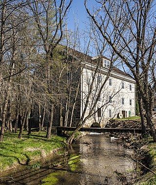
The Doub's Mill Historic District is a national historic district that encompasses a portion of the small community of Beaver Creek, Maryland, dating to the late 18th century and early 19th century. The dominating structure is Doub's Mill, a grain mill built between 1811 and 1821 by John Funk. Using local limestone, the neighborhood displays an unusual consistency of style and construction. In addition to Doub's Mill, there are five other homes and numerous outbuildings, all originally part of the mill complex. The stone structures are built in the German tradition, and one has a date stone inscribed 1782, at which time the area belonged to Henry and Christian Newcomer, Mennonites of Swiss-German origin.
12. United State Highway 36
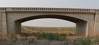
The Plum Bush Creek Bridge, near Last Chance, Colorado, is a concrete rigid frame bridge that is listed on the National Register of Historic Places. It brings US 36 across Plum Bush Creek and is located at milepost 138.16 of US 36. It was designed by Colorado Department of Highways and built by Peter Kiewit Sons Construction Co. in 1938. It was listed on the National Register of Historic Places (NRHP) in 2002.
13. Dundee Lodge
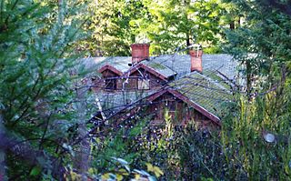
Dundee Lodge is a farm with several buildings built in the 1920s located near Gaston in the U.S. state of Oregon. The rustic property in rural Washington County was added to the National Register of Historic Places in 1985. Also known as the Dee Brook Farm, the property contains three buildings designed by E. E. Green.
14. Mount Olive Road
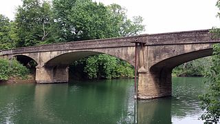
The White River Bridge in Elkins, Arkansas is a historic structure carrying County Road 44 over the White River in eastern Washington County. The bridge is a patented closed-spandrel arch design called the Luten arch, owned by the Luten Bridge Company of Knoxville, Tennessee, which emphasized strengthened piers and abutments, resulting in a reduced need for material. This bridge has three arches, with a total length of 192 feet (59 m). After construction in 1921, farmers in southeast Washington County were better able to bring their products to market in Elkins.
15. Robinson Road
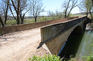
The Illinois River Bridge at Phillips Ford is a historic bridge in rural northern Washington County, Arkansas. It is a double-span closed-spandrel concrete arch bridge built in 1928 by the Luten Bridge Company, and it carries County Road 848 across the Illinois River in the Ozark National Forest south of U.S. Route 412 (US 412). The bridge's arches each span 81 feet (25 m), and the total structure length is 168 feet (51 m). The bridge uses Luten's patented method of reducing material in the bridge by the addition of metal rings to the spandrel walls.
16. Isaac Peak
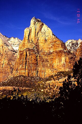
Isaac Peak is a 6,726-foot (2,050 m) rock formation in Zion National Park in Washington County, Utah, United States. Access to Isaac Peak is from the main Park road through Sand Beach Trail. Isaac Peak is part of the Three Patriarchs in between Abraham Peak and Jacob Peak. Between Isaac Peak and Abraham Peak is Isaac Canyon, accessed by climbing up the South Fork of Heaps Canyon.
17. Hune Bridge
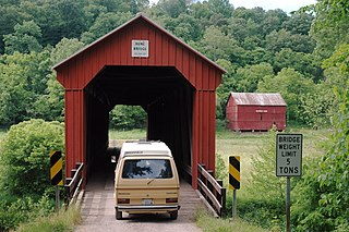
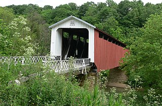
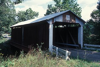
The Hune Covered Bridge is a historic wooden covered bridge in the southeastern part of the U.S. state of Ohio. Located northeast of the community of Dart, it spans the Little Muskingum River in northeastern Lawrence Township in the eastern part of Washington County. Local bridge builder Rollin Meredith erected it in 1879, using the Long-truss style of truss bridge design; the single-span bridge was named for the locally prominent Hune family. Among its design features are a metal roof, abutments of cut stone, and vertical siding. As a Long truss, the Hune Bridge is a valuable example of nineteenth-century architecture: few examples of this complicated style survive to the present day. In 1976, the Hune Bridge was listed on the National Register of Historic Places, both because of its place in local history and because of its historically significant construction.
18. Shinn Covered Bridge
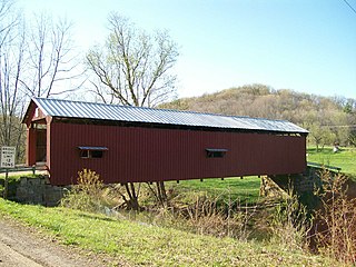
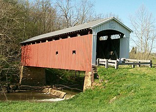
The Shinn Covered Bridge is a historic wooden covered bridge in the southeastern part of the U.S. state of Ohio. Located in the countryside northeast of Bartlett in Washington County, this single-span truss bridge was built in 1886 by local carpenter Charles T. Shinn. Built of weatherboarded walls with stone abutments and a metal roof, the bridge features vertical siding, and its portals have remained vertical and resisted creeping into another shape. The heart of the bridge's structure employs the Burr Truss design, which mixes the king post truss with a wooden arch designed by Andrea Palladio in the sixteenth century. Shinn built his bridge to span the western branch of Wolf Creek in Palmer Township. Measuring 98 feet (30 m) in length, the bridge was constructed soon after the drowning of one of Shinn's children.
19. Harra Bridge
The Harra Covered Bridge is a historic wooden covered bridge in Washington County, Ohio, United States. Located in western Watertown Township, about 2 miles (3.2 km) north of the community of Watertown, the bridge spans the South Branch of Wolf Creek near the intersection of State Route 339 and Township Road 172. Among the bridge's more distinctive features are its cut stone abutments, its metal roof, and the vertical siding. Although it has been open for well over one hundred years, it remains in strong structural condition, and it served daily traffic into the late twentieth century.
20. Cable Mountain
Cable Mountain is a 6,940-foot (2,120 m) elevation Navajo Sandstone summit located in Zion National Park, in Washington County of southwest Utah, United States. Towering 2,600 feet above the floor of Zion Canyon at the Big Bend area, Cable Mountain is situated immediately northeast of The Great White Throne, separated by the chasm of Hidden Canyon. It is set on the east side of the North Fork Virgin River which drains precipitation runoff from this mountain. Its neighbors include Angels Landing, Cathedral Mountain, The Organ, and Observation Point. This mountain's name was officially adopted in 1934 by the U.S. Board on Geographic Names. It is so named in association with the draw-works which used cables to lower timber from the top of the plateau down to the valley bottom from 1901 through 1927. Wood to construct the Zion Lodge came down the cable works. A 7.4-mile trail, much of it an old wagon road, leads to the views from the top.
21. Mount Spry
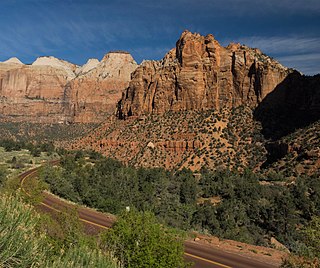
Mount Spry is a small 5,720-ft elevation mountain summit made of Navajo Sandstone located in Zion National Park, in Washington County of southwest Utah, United States. Officially named in 1934, it honors William Spry (1864–1929), the third governor of Utah. The nearest higher peak is The East Temple, 0.34 miles (0.55 km) to the east. Precipitation runoff from the mountain drains into tributaries of the North Fork Virgin River.
22. The Sentinel
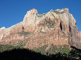
The Sentinel is a 7,120+ ft elevation Navajo Sandstone summit located near the Court of the Patriarchs in Zion National Park, in Washington County of southwest Utah, United States, that is part of the Towers of the Virgin. The national park map lists the elevation as 7,157-feet.
23. Root Covered Bridge
The Root Covered Bridge is a historic wooden covered bridge in the southeastern part of the U.S. state of Ohio. Located off State Route 555 in far northern Decatur Township, Washington County, the bridge was built in 1878 in the Long truss mode of truss bridge construction. Measuring 65 feet (20 m) in its single span, it spans the West Branch of the Little Hocking River.
24. Hildreth Covered Bridge
The Hildreth Covered Bridge, also known as the "Hills Covered Bridge" or "Lafaber's Mill Bridge," is a historic covered bridge in Washington County, Ohio, United States. Located off State Route 26 in Newport Township, about 5 miles (8.0 km) east of the city of Marietta, the bridge historically carried Hills Bridge Road over the Little Muskingum River. Construction of the Hildreth Bridge was a long process: the most significant amount of work was done on the bridge in 1878, but the entire construction process occurred between 1871 and 1881. The identity of its builder is unknown.
25. Bell Bridge
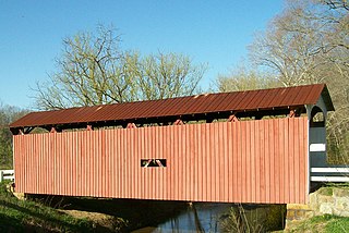
The Bell Covered Bridge is a historic wooden covered bridge in rural Washington County, Ohio, United States. One of several such bridges in the region built by the same man, it remained open to traffic with the exception of periodic repairs, until it was permanently closed on September 12, 2022, and it has been named a historic site.
26. Castle Dome
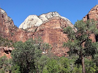
Castle Dome is a 7,054-foot (2,150 m) elevation Navajo Sandstone summit located in Zion National Park, in Washington County of southwest Utah, United States. Castle Dome is situated northwest of Zion Lodge, towering 2,800 feet (850 m) above the lodge and the floor of Zion Canyon. It is set on the west side of the North Fork Virgin River which drains precipitation runoff from this mountain. It is wedged between Behunin Canyon and Heaps Canyon, with the popular Emerald Pools set at the southeast foot of this mountain. Its neighbors include Mount Majestic, Cathedral Mountain, The Great White Throne, Red Arch Mountain, Mountain of the Sun, and Lady Mountain. This feature's name was officially adopted in 1934 by the U.S. Board on Geographic Names.
27. Mountain of the Sun
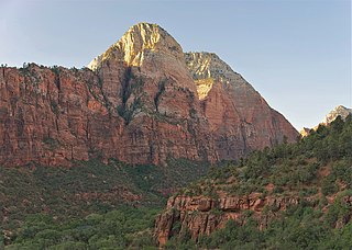
Mountain of the Sun is a 6,722-foot (2,049 m) elevation Navajo Sandstone summit located in Zion National Park, in Washington County of southwest Utah, United States. Mountain of the Sun is situated immediately east of Court of the Patriarchs, and south of Zion Lodge, towering 2,500 feet above the lodge and the floor of Zion Canyon. It is set on the east side of the North Fork of the Virgin River which drains precipitation runoff from this mountain. Its neighbors include The Sentinel, Mount Spry, The East Temple, and Mount Moroni. This feature's name was officially adopted in 1934 by the U.S. Board on Geographic Names.
28. Ottumwa Subdivision
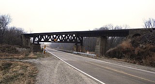
CM and StP Railroad Underpass is a historic structure located southwest of Washington, Iowa, United States. It was listed on the National Register of Historic Places in 1998. The Warren deck truss bridge is a rare example of this type of bridge in Iowa, and the oldest still in existence. Given the relatively flat nature of Iowa's rivers and streams this bridge type was rarely built in the state, and was mostly built for railroad use. This bridge, completed in 1903 by the Chicago, Milwaukee, St. Paul & Pacific Railroad, crosses a county highway bridge and the west fork of Crooked Creek.
29. Mountain of Mystery
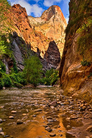
Mountain of Mystery is a 6,565-foot (2,001 m) Navajo Sandstone summit located in Zion National Park, in Washington County of southwest Utah, United States. Mountain of Mystery is situated above The Narrows, towering over 2,100 feet above the floor of Zion Canyon and the North Fork Virgin River which drains precipitation runoff from this mountain. This peak rises above Orderville Canyon on its north side, and Mystery Canyon on the south. Its neighbors include Mount Majestic, Cathedral Mountain, Observation Point, Cable Mountain, Angels Landing, and The Organ. This feature's name was officially adopted in 1934 by the U.S. Board on Geographic Names. The first ascent via the Northeast Buttress was made 15 September 2001, by Brian Cabe and Tom Jones.
30. Tabernacle Dome
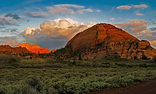
Tabernacle Dome is a 6,430-foot elevation summit located in Zion National Park, in Washington County of southwest Utah, United States. Tabernacle Dome, a formation composed of Navajo Sandstone, is situated at the southeastern end of Cave Valley, 10 mi (16 km) northwest of Springdale, Utah. Its nearest higher neighbor is Cave Knoll, 1.6 mi (3 km) to the north-northwest. Other neighbors include South Guardian Angel, 1.9 mi (3 km) to the east, and North Guardian Angel, 2.2 mi (4 km) to the northeast. Precipitation runoff from this mountain drains into tributaries of the Virgin River. Access to this peak is via the Kolob Terrace Road. This peak's name was officially adopted in 1934 by the U.S. Board on Geographic Names. It is named for its resemblance to the Mormon Tabernacle in Salt Lake City.
31. Cave Knoll
Cave Knoll is a 6,486-foot (1,977 m) summit located in Zion National Park, in Washington County of southwest Utah, United States. Cave Knoll, a formation composed of Navajo Sandstone, is situated in Cave Valley, 11.5 mi (18.5 km) northwest of Springdale, Utah. Its neighbors include Pine Valley Peak, 1.7 mi (3 km) to the northeast, Tabernacle Dome, 1.6 mi (3 km) to the south-southeast, and North Guardian Angel, 2.5 mi (4 km) to the east. Precipitation runoff from this mountain drains into tributaries of the Virgin River. Access to this peak is via the Kolob Terrace Road. This peak's name was officially adopted in 1934 by the U.S. Board on Geographic Names.
Share
How likely are you to recommend us?
Disclaimer Please be aware of your surroundings and do not enter private property. We are not liable for any damages that occur during the tours.
