8 Sights in Ventura County, United States (with Map and Images)
Legend
Welcome to your journey through the most beautiful sights in Ventura County, United States! Whether you want to discover the city's historical treasures or experience its modern highlights, you'll find everything your heart desires here. Be inspired by our selection and plan your unforgettable adventure in Ventura County. Dive into the diversity of this fascinating city and discover everything it has to offer.
Activities in Ventura County1. Mount Pinos
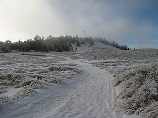
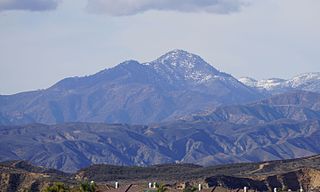
Mount Pinos is a mountain located in the Los Padres National Forest on the boundary between Ventura and Kern counties in California. The summit, at 8,847 feet (2,697 m), is the highest point in Ventura County. The mountain is the highest point of the Transverse Ranges west of Tejon Pass, as well as the southernmost point of the Salinian Block.
2. Winfield Scott
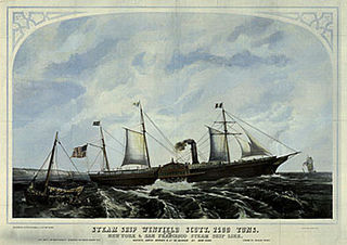
SS Winfield Scott was a sidewheel steamer that transported passengers and cargo between San Francisco, California and Panama in the early 1850s, during the California Gold Rush. After entering a heavy fog off the coast of Southern California on the evening of December 1, 1853, the ship crashed into Middle Anacapa Island. All 450 passengers and crew survived, but the ship was lost.
3. Wreck of the La Jenelle
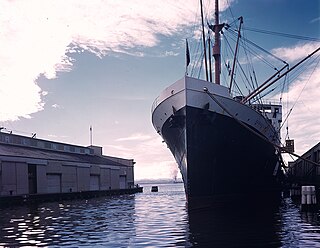
SS Borinquen, the Taino language name for Puerto Rico, was a passenger liner launched 24 September 1930 and delivered to the Atlantic, Gulf & West Indies Steamship Lines (AGWI) in 1931 for operation by its subsidiary the New York & Porto Rico Line. The line operated the ship until it was requisitioned by the War Shipping Administration (WSA) the last day of 1941 for service as a troop transport. The line then operated the ship as agent for the WSA until 6 May 1944 when operation was transferred to the United States Army for support of the Normandy landings with the ship arriving off the beaches on 7 June 1944. Borinquen continued service post war until redelivered to the owners 14 June 1946. The ship was sold in 1949 and became the Arosa Star. After further sales and change in the cruise ship regulations the ship was again sold and grounded as La Jenelle on the California coast in 1970.
4. Frazier Mountain
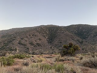
Frazier Mountain is a broad, pine-forested peak in the Transverse Ranges System, within the Los Padres National Forest in northeastern Ventura County, California. At 8,017 feet (2,444 m), Frazier Mountain is the sixteenth-highest mountain in the Transverse Ranges of Southern California.
5. Boney Peak
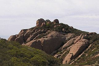
Boney Mountain in Ventura County, California is one of the highest peaks in the Santa Monica Mountains. The prominent mountain visible from Newbury Park, California is 2,825 feet (861 m). It is also known as Boney Peak. The mountain contains four of the highest peaks in the coastal range of the Santa Monica Mountains: Boney Peak, Sandstone Peak, Exchange Peak, and Tri Peaks. The highest summit in the Santa Monica Mountains is Sandstone Peak, situated less than a mile northeast of Boney Peak along the same ridge of volcanic rock. It is the top section of a mass of volcanic rock which solidified around 15 million years ago, and was later uplifted to its dominant position, overshadowing western Conejo Valley. The Chumash Native Americans have a long and deeply spiritual history of interaction at and near the mountain, and the peak is considered a sacred mountain to the Chumash people.
6. Cobblestone Mountain
Cobblestone Mountain is a peak in the Topatopa Mountains, in Ventura County, about 14 mi (23 km) north of Piru, California. At 6,738 feet (2,054 m), it is the highest peak of the Topatopa Mountains. Second highest is Hines Peak. Snow frequently falls on the mountain during winter.
7. San Buenaventura Mission Aqueduct
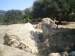
The San Buenaventura Mission Aqueduct was a seven-mile long, stone and mortar aqueduct built in the late 18th and/or early 19th century to transport water from the Ventura River to the Mission San Buenaventura in Ventura, California.
8. Conejo Mountain
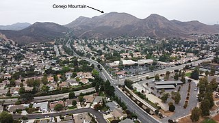
Conejo Mountain is a 1,814-foot-high mountain (553 m) in Ventura County, California, near Camarillo on the eastern boundary of the Oxnard Plain. At the western edge of the Conejo Valley, it is adjacent to the Santa Monica Mountains. Crossing what was once a formidable barrier for travelers, U.S. Route 101 passes through the area on the steep Conejo Grade.
Share
How likely are you to recommend us?
Disclaimer Please be aware of your surroundings and do not enter private property. We are not liable for any damages that occur during the tours.
