21 Sights in San Jose, United States (with Map and Images)
Legend
Welcome to your journey through the most beautiful sights in San Jose, United States! Whether you want to discover the city's historical treasures or experience its modern highlights, you'll find everything your heart desires here. Be inspired by our selection and plan your unforgettable adventure in San Jose. Dive into the diversity of this fascinating city and discover everything it has to offer.
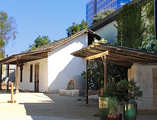
Sightseeing Tours in San JoseActivities in San JoseThe Peralta Adobe, also known as the Luis María Peralta Adobe or the Gonzales-Peralta Adobe, is the oldest building in San Jose, California. The adobe was built in 1797 by José Manuel Gonzeles, one of the founders of San Jose, and is named after Luis María Peralta, its most famous resident.
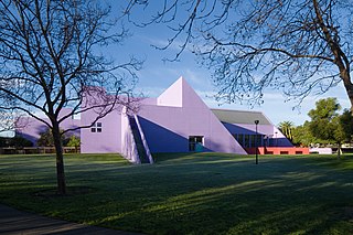
Children's Discovery Museum of San Jose (CDM) is a cultural institution serving children, families, and schools in the Silicon Valley/San Francisco Bay Area. A member of the Association of Children's Museums and the Association of Science-Technology Centers, Children's Discovery Museum is located in downtown San Jose, California on Woz Way. The street is named after Steve Wozniak, co-founder of Apple Computer whose nickname is "Woz." Wozniak was the single largest private donor during the original capital campaign that funded the museum.
Wikipedia: Children's Discovery Museum of San Jose (EN), Website
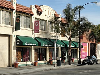
The San Jose Museum of Quilts & Textiles is an art museum in Downtown San Jose, California, USA. Founded in 1977, the museum is the first in the United States devoted solely to quilts and textiles as an art form. Holdings include a permanent collection of over 1,000 quilts, garments and ethnic textiles, emphasizing artists of the 20th- and 21st-century, and a research library with over 500 books concerning the history and techniques of the craft.
Wikipedia: San Jose Museum of Quilts & Textiles (EN), Website
4. The Tech Interactive
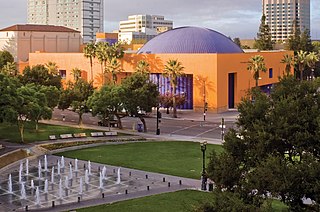
The Tech Interactive is a science and technology center that offers hands-on activities, labs, design challenges and other STEAM education resources. It is located in downtown San Jose, California, adjacent to the Plaza de César Chávez.
5. Cathedral Basilica of Saint Joseph
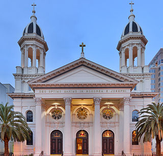
The Cathedral Basilica of St. Joseph is a historic Catholic church in Downtown San Jose that serves as the cathedral for the Diocese of San José in California, with the distinction of minor basilica.
Wikipedia: Cathedral Basilica of St. Joseph (San Jose) (EN), Website
6. Happy Hollow Park and Zoo

Happy Hollow Park & Zoo is a small 16-acre (6.5 ha) zoo and amusement park in San Jose, California, which originally opened in 1961. It was closed in 2008 for major renovations, and opened its gates again on March 20, 2010.
7. San Jose Civic
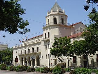
The San Jose Civic is a former arena, currently operating as a theatre and concert venue, located in downtown San Jose, California. The venue is owned by the City of San Jose, is managed by Team San Jose and is booked by Nederlander Concerts. The auditorium seats 3,036 which can be expanded up to 3,326 in a general admission setting.
8. Plaza de César E. Chávez
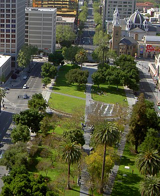
The Plaza de César Chávez is an urban plaza and park in Downtown San Jose, California. The plaza's origins date to 1797 as the plaza mayor of the Spanish Pueblo de San José de Guadalupe, making it the oldest public space in Northern California. The plaza was rededicated after Californian civil rights activist César Chávez in 1993.
9. Municipal Rose Garden
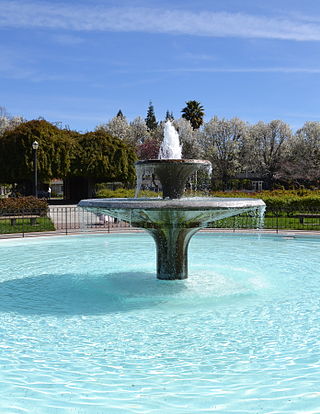
The San Jose Municipal Rose Garden is a historic rose garden in San Jose, California, in the Rose Garden District. Founded in 1927, the garden is exclusively dedicated to roses and features more than 3,500 shrubs representing 189 rose varieties.
10. Institute of Contemporary Art San José
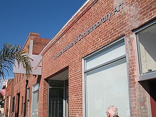
The Institute of Contemporary Art San José (ICA) is a nonprofit art center and gallery founded in 1980, and located in the SoFA District of Downtown San Jose, California, U.S. It supports contemporary artists working in painting, printmaking, sculpture, photography, new media works and site-specific installations. ICA San José is member and community supported. The art center offers rotating art exhibitions with free admission, along with public programs, education programs, and community events.
Wikipedia: Institute of Contemporary Art San José (EN), Website
11. History Park at Kelley Park
History Park at Kelley Park in San Jose, California, USA is designed as an indoor/outdoor museum, arranged to appear as a small US town might have in the early 1900s (decade). Since its inauguration in 1971, 32 historic buildings and other landmarks have either been moved from their original San Jose locations or are represented by replicas.
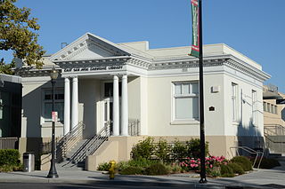
12. East San José Carnegie Branch Library
The East San José Carnegie Branch Library is a Carnegie library in San Jose, California. It opened in 1908 and is the last Carnegie library in Santa Clara County still operating as a public library. It is a part of the San José Public Library.
Wikipedia: East San José Carnegie Branch Library (EN), Website, Heritage Website
13. Japanese Friendship Garden
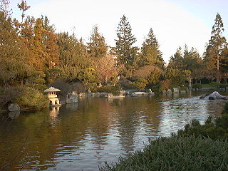
The Japanese Friendship Garden is a walled section of Kelley Park in San Jose, California, United States. Dedicated in October 1965, it is patterned after Japan's famous Korakuen Garden in Okayama and spans six acres. Its three main ponds were stocked with koi sent from Okayama in 1966. The ponds are at different elevations in the park, and are inter-connected by streams.
Wikipedia: Japanese Friendship Garden (San Jose) (EN), Website, Tripadvisor, Yelp
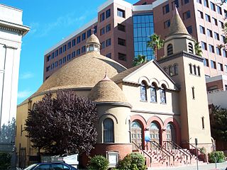
14. The First Unitarian Church of San José
The First Unitarian Church of San Jose is located at 160 North Third Street in downtown San Jose, California, across from St. James Park, and was designed in "Richardsonian Romanesque" style by architect George Page, who also designed the Hayes Mansion. Local historian Linda Larson Boston called the building, “One of a handful of American churches patterned after Unitarian churches of Transylvania, it features a large triple-arched stained glass window on the facade, multiple domes and cupolas, and both round and square towers,” in her pamphlet, Highlights of San Jose, California’s St. James Park and Environs. The congregation purchased the site in 1888, and the cornerstone was laid in a ceremony on September 23, 1891. The building is registered on both the list of National Register of Historic Places and the list of California Historical Landmarks.
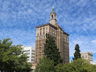
15. Bank of Italy Building
The Bank of Italy Building is a 14-story, 77.72 m (255.0 ft) Renaissance Revival high-rise built in 1925 in downtown San Jose, California. This building became the second home to the first branch of the Bank of Italy, founded in San Francisco in 1904, which later became the Bank of America. The first location of the Bank of Italy in San Jose, was on the corner of Santa Clara St. and Lightson Alley, near the intersection with Market Street. Restaurants and other businesses occupy the original building, which has been heavily remodeled. A reconstruction of the original building is at History Park in San Jose.
Wikipedia: Bank of Italy Building (San Jose, California) (EN)
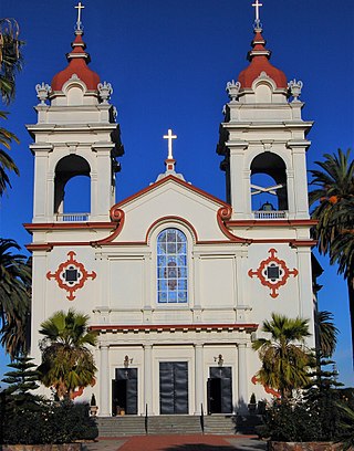
16. Five Wounds Portuguese National Church
Five Wounds Portuguese National Church is the parish church of the Latin Church of the Roman Catholic Church in San Jose, California, in the Little Portugal neighborhood of East San Jose. The church was founded on November 8, 1914.
Wikipedia: Five Wounds Portuguese National Church (EN), Website
17. Downtown Historic District
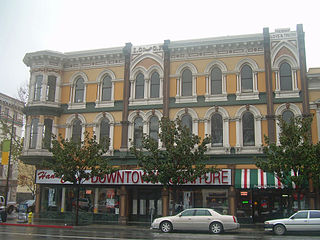
The Downtown Historic District of San Jose, California is a designated U.S. Historic District area of the city roughly the size of one square block. It is bounded by S. First Street to the west, E. San Fernando Street to the south, S. Third Street to the east, and E. Santa Clara Street to the north, but also includes the south side of E. Santa Clara Street between Third and Fourth Streets.
Wikipedia: Downtown Historic District (San Jose, California) (EN)
18. Santa Clara County Fairgrounds
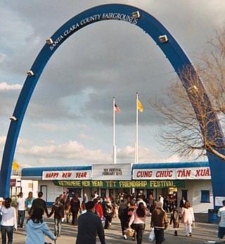
The Santa Clara County Fairgrounds is an event venue in San Jose, California. The 165-acre (67 ha) fairgrounds has been owned by the County of Santa Clara since 1940 and is operated by the Santa Clara County Fairgrounds Management Corporation, a public-benefit nonprofit corporation.
19. Holy Cross Church
Holy Cross Church is a Catholic church in the Northside neighborhood of San Jose, California, United States, that serves the Holy Cross Parish of the Diocese of San Jose. The parish is staffed by the Missionaries of St. Charles Borromeo (Scalabrinians). Holy Cross does not have a parochial school, though it hosts Confraternity of Christian Doctrine (CCD) programs for students of public schools.
Wikipedia: Holy Cross Church (San Jose, California) (EN), Website
20. Pellier Park
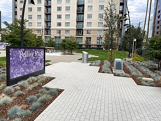
Pellier Park, is a city park covering 0.5 acres (0.20 ha) in San Jose, California, United States, located in close proximity to San Pedro Square. This park holds historical significance as it was once home to City Gardens, a nursery founded by Louis Pellier (1817–1872), who is known as the pioneer of California's prune industry. In October 1850, Pellier established the City Gardens, where with the assistance of his brothers Pierre and Jean, he introduced the French prune, also known as "la petite prune d'Agen," which translates to "the little Agen plum," to California during the winter of 1856. The California Historical Landmark No. 434 now marks the location of the City Gardens site. The park dedicated to California's "Prune King" was officially reopened in a public ceremony on October 18, 2023.
21. Guadalupe River Park & Gardens
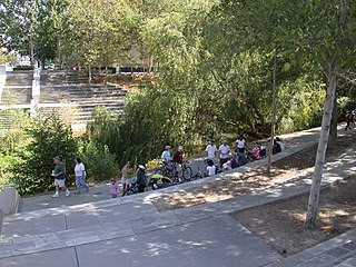
The Guadalupe River Park & Gardens is a 1.5 km² botanical garden and city park, managed by the company "Friends of Guadalupe River Park & Gardens", in collaboration with the City of San Jose, California, United States.
Share
How likely are you to recommend us?
Disclaimer Please be aware of your surroundings and do not enter private property. We are not liable for any damages that occur during the tours.
