22 Sights in New Haven, United States (with Map and Images)
Legend
Welcome to your journey through the most beautiful sights in New Haven, United States! Whether you want to discover the city's historical treasures or experience its modern highlights, you'll find everything your heart desires here. Be inspired by our selection and plan your unforgettable adventure in New Haven. Dive into the diversity of this fascinating city and discover everything it has to offer.
Sightseeing Tours in New Haven1. Yale Center for British Art
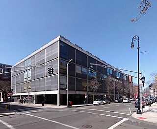
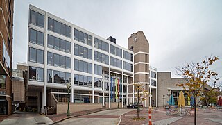
The Yale Center for British Art at Yale University in central New Haven, Connecticut, houses the largest and most comprehensive collection of British art outside the United Kingdom. The collection of paintings, sculpture, drawings, prints, rare books, and manuscripts reflects the development of British art and culture from the Elizabethan period onward.
2. Five Mile Point Light
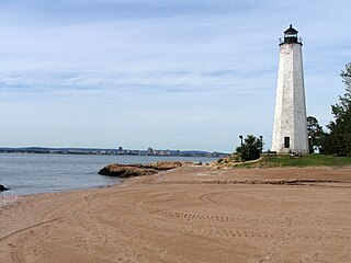
Five Mile Point Light, also known as Five Mile Point Lighthouse or Old New Haven Harbor Lighthouse, is a U.S. lighthouse in Long Island Sound on the coast of New Haven, Connecticut. Located at the entrance to New Haven Harbor, the beacon's name derives from its proximity to Downtown New Haven, about five miles (8 km) away. The original lighthouse consisted of a 30-foot (9.1 m) octagonal wooden tower built in 1805 by Abisha Woodward. In 1847, a new 80-foot (24 m) octagonal tower was constructed by Marcus Bassett with East Haven brownstone. This new beacon was illuminated by 12 lamps with reflectors which were positioned 97 feet (30 m) above sea level. Also constructed at this time was a 2+1⁄2-story brick house which supplanted the previous, deteriorating keeper's dwelling. A fourth-order Fresnel lens replaced the lamps in 1855 and a fog bell was added in the 1860s. The Five Mile Point Light was deactivated in 1877 when the nearby Southwest Ledge Light was completed. Currently, the lighthouse is contained within Lighthouse Point Park and, along with the keeper's house, was listed on the National Register of Historic Places in 1990.
3. Wooster Square
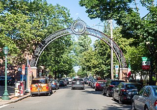
Wooster Square is a neighborhood in the city of New Haven, Connecticut, to the east of downtown. The name refers to a park square located between Greene Street, Wooster Place, Chapel Street and Academy Street in the center of the neighborhood. Wooster Square is also known as Little Italy: a bastion of Italian American culture and cuisine, and is home to some of New Haven's, best-known pizza eateries, including Frank Pepe Pizzeria Napoletana and Sally's Apizza. The square and much of the neighborhood are included in the Wooster Square Historic District, which was listed on the National Register of Historic Places in 1971.
4. Hillhouse Avenue Historic District
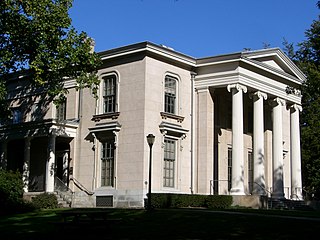
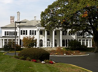
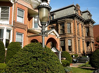
Hillhouse Avenue is a street in New Haven, Connecticut, famous for its many nineteenth century mansions, including the president's house at Yale University. Both Charles Dickens and Mark Twain have described it as "the most beautiful street in America." Much of the avenue is included in the Hillhouse Avenue Historic District, which extends to include houses on adjacent streets.
5. Long Wharf Theatre
Long Wharf Theatre is a nonprofit institution in New Haven, Connecticut, a pioneer in the not-for-profit regional theatre movement, the originator of several prominent plays, and a venue where many internationally known actors have appeared.
6. Whitney Avenue Historic District
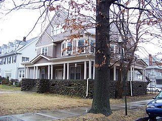
The Whitney Avenue Historic District is a historic district in the East Rock neighborhood of New Haven, Connecticut. It is a 203-acre (82 ha) district which included 1,084 contributing buildings when it was listed on the National Register of Historic Places in 1989.
Wikipedia: Whitney Avenue Historic District (EN), Heritage Website
7. Southwest Ledge Light
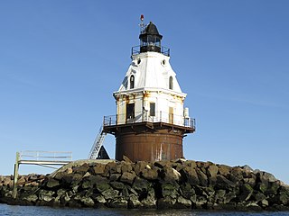
Southwest Ledge Light is an active lighthouse marking the main entrance channel to the harbor of New Haven, Connecticut. Completed in 1877, it was one of the first to be built on a cylindrical iron foundation, an innovation by Maj. George H. Elliot to address shifting ice that is regarded to be very important in lighthouse design. The lighthouse was listed on the National Register of Historic Places in 1990 as Southwest Ledge Lighthouse.
8. Prospect Hill Historic District
The Prospect Hill Historic District is an irregularly-shaped 185-acre (75 ha) historic district in New Haven, Connecticut. The district encompasses most of the residential portion of the Prospect Hill neighborhood.
Wikipedia: Prospect Hill Historic District (New Haven, Connecticut) (EN), Heritage Website
9. Edgewood Park Historic District
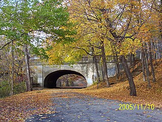
Edgewood Historic District is a historic district located in the west-central portion of New Haven, Connecticut. It was listed on the National Register of Historic Places in 1986. A predominantly residential area roughly bisected by Edgewood Avenue, a broad boulevard which features a large central esplanade and forms the principal east-west artery through the heart of the district. The area includes 232 contributing buildings, 4 other contributing structures, and 1 contributing object. Most of these were built between about 1888 and 1900, and represent the city's first neighborhood planned under the tenets of the City Beautiful movement. They are generally either Queen Anne or Colonial Revival in style, and are set on larger lots.
Wikipedia: Edgewood Park Historic District (EN), Heritage Website
10. Westville Village Historic District
Westville Village Historic District is a historic district representing most of the commercial center of the Westville neighborhood of New Haven, Connecticut. This center developed in the 19th century as an industrial mill village distinct from the city center, and retains many architectural features of that period. The district was listed on the National Register of Historic Places in 2003, and its boundaries were increased slightly in 2006.
Wikipedia: Westville Village Historic District (EN), Heritage Website
11. Ninth Square Historic District
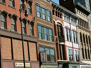
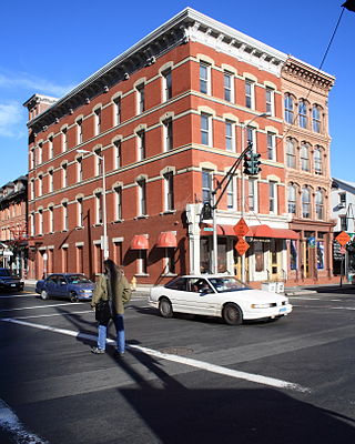
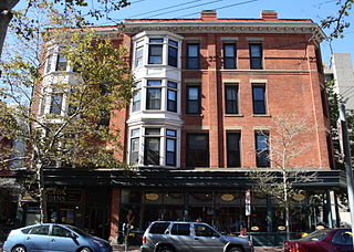
The Ninth Square Historic District encompasses a historically diverse and well-preserved part of the commercial area of Downtown New Haven, Connecticut. The district is bounded by Church, Court, State, and Crown Streets, and is centered on the intersection of Chapel and Orange Streets. The buildings in the district are mostly late-19th and early 20th commercial buildings, and includes a number of commercial buildings from the first half of the 19th century, a rarity in most of Connecticut's urban downtown areas. The district was listed on the National Register of Historic Places in 1984.
Wikipedia: Ninth Square Historic District (EN), Heritage Website
12. Lighthouse Point Carousel
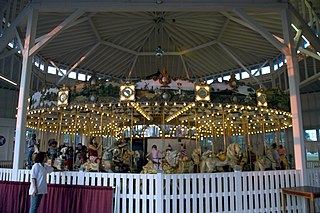
The Lighthouse Point Carousel is located in the East Shore section of New Haven, Connecticut in Lighthouse Point Park. The carousel was built about 1905, and is one of a shrinking number of early 20th-century carousels left in the state, featuring the carvings of Charles Looff and Charles Carmel. The carousel and its 1916 building were together listed on the National Register of Historic Places on December 15, 1983.
13. Dwight Street Historic District
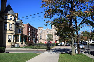
The Dwight Street Historic District is an irregularly shaped 135-acre (55 ha) historic district in New Haven, Connecticut. The district is located immediately west of the center of Downtown New Haven and is generally bounded by Elm Street on the north, Park Street on the east, North Frontage Road on the south, and Sherman Avenue on the west. It contains one of the city's highest concentrations of well-preserved 19th and early 20th-century residential architecture, much of which was developed for the working classes in the city's factories. It was listed on the National Register of Historic Places in 1983. The historic district includes most of the Dwight neighborhood and several blocks of the northeast corner of the West River neighborhood.
Wikipedia: Dwight Street Historic District (EN), Heritage Website
14. Chapel Street Historic District
The Chapel Street Historic District is a 23-acre (9.3 ha) historic district in the Downtown New Haven area of the city of New Haven, Connecticut. It was listed on the National Register of Historic Places in 1984. The district covers the southwestern corner of Downtown New Haven, including properties from Park Street to Temple Street between Chapel and Crown streets, and properties from High Street to Temple Street between George and Crown streets. It is bordered on the north by the New Haven Green and the Yale University campus. The western edge borders the Dwight Street Historic District. The eastern and southern edges of the district abut areas of more modern development.
Wikipedia: Chapel Street Historic District (EN), Heritage Website
15. Imperial Granum-Joseph Parker Buildings
The Imperial Granum-Joseph Parker Buildings, also known historically as the Del Monico Building, are a pair of conjoined historic commercial buildings at Elm and Orange Streets in downtown New Haven, Connecticut. Built in 1875 and 1877, the two buildings are among the finest examples of the architecture of that period in the city, with one sporting one of the city's only surviving cast iron facades. The buildings were listed on the National Register of Historic Places in 1986.
16. Orange Street Historic District
The Orange Street Historic District encompasses a large residential in the East Rock section of New Haven, Connecticut. Roughly bounded by Orange, Cottage, Eagle, State, and Audubon Streets, this area saw growth between about 1830 and 1900, and includes a broad diversity of well-preserved 19th-century residential structures. It was listed on the U.S. National Register of Historic Places in 1985. At that time, it included 546 buildings deemed to contribute to the historic character of the area.
Wikipedia: Orange Street Historic District (EN), Heritage Website
17. Hall-Benedict Drug Company Building
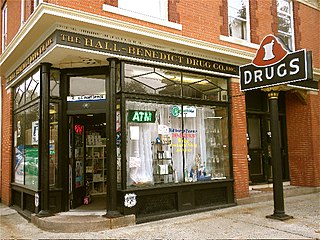
The Hall-Benedict Drug Company Building is a historic commercial building at 763-767 Orange Street in the East Rock neighborhood of New Haven, Connecticut. Built in 1909 to house a pharmacy, it is a little-altered and well-preserved example of an early 20th-century mixed residential-commercial neighborhood building. The building was listed on the National Register in 1986. It is also a contributing property in the Whitney Avenue Historic District.
18. Union Church
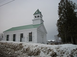
Union Church, also known as the Union Church of New Haven Mills is a historic church at the junction of River Rd. and East Street in New Haven, Vermont. Built in 1851, it is a fine local example of Greek Revival architecture with added Queen Anne Victorian features, and one of the oldest surviving buildings in a once-thriving mill village. It was listed on the National Register of Historic Places in 2000.
Wikipedia: Union Church (New Haven, Vermont) (EN), Heritage Website
19. River Street Historic District
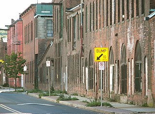
The River Street Historic District encompasses a historic industrial area in the Fair Haven section of New Haven, Connecticut. Located south of Chapel Street between James Street and Blatchley Avenue, the industrial buildings here date to New Haven's growth as a major industrial center between the American Civil War and World War I, with significant emphasis on metalworking businesses. The district was listed on the National Register of Historic Places in 1989.
Wikipedia: River Street Historic District (New Haven, Connecticut) (EN), Heritage Website
20. Elisha Blackman Building
The Elisha Blackman Building, also known as the York-Chapel Building, is a historic mixed commercial-residential building at 176 York Street in the Downtown New Haven neighborhood of New Haven, Connecticut. Built in 1883, it is a finely crafted example of 19th-century commercial architecture, and is one of the few such buildings to survive in the city. It was listed on the National Register of Historic Places in 1978.
21. Wooster Square Historic District
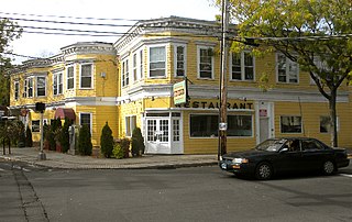
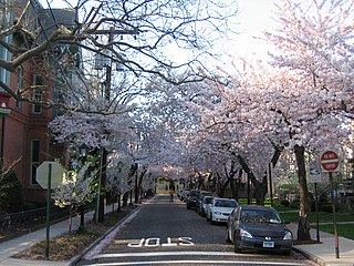
The Wooster Square Historic District encompasses much of the Wooster Square neighborhood of New Haven, Connecticut. Centered on a rectangular park named in honor of General David Wooster, the area was developed as a residential neighborhood beginning in the 1820s, and was by the 1840s a desirable area to live, with many high-quality Greek Revival homes. In the 1950s the area was the subject of a major community-led preservation effort that drew national attention. The district was listed on the National Register of Historic Places in 1971.
Wikipedia: Wooster Square Historic District (EN), Heritage Website
22. Morris Cove Historic District
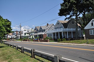
The Morris Cove Historic District encompasses a former summer resort area in eastern New Haven, Connecticut. Bounded in the north by Myron Street, the south by Morris Causeway and Lighthouse Road, and on the east by the East Haven town line, the area was developed as a coastal summer community before being transformed into a streetcar suburb in the second quarter of the 20th century. It contains a high concentration of quality residential architecture from the first half of the century, and was listed on the National Register of Historic Places in 1985.
Wikipedia: Morris Cove Historic District (EN), Heritage Website
Share
How likely are you to recommend us?
Disclaimer Please be aware of your surroundings and do not enter private property. We are not liable for any damages that occur during the tours.
