8 Sights in Madison County, United States (with Map and Images)
Legend
Welcome to your journey through the most beautiful sights in Madison County, United States! Whether you want to discover the city's historical treasures or experience its modern highlights, you'll find everything your heart desires here. Be inspired by our selection and plan your unforgettable adventure in Madison County. Dive into the diversity of this fascinating city and discover everything it has to offer.
Activities in Madison County1. Pinson Mounds Museum and Visitor Center
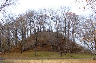
The Pinson Mounds comprise a prehistoric Native American complex located in Madison County, Tennessee, in the region that is known as the Eastern Woodlands. The complex, which includes 17 mounds, an earthen geometric enclosure, and numerous habitation areas, was most likely built during the Middle Woodland period. The complex is the largest group of Middle Woodland mounds in the United States. Sauls' Mound, at 72 feet (22 m), is the second-highest surviving mound in the United States.
2. Old Rag Mountain
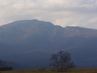
Old Rag Mountain is a 3,284 feet (1,001 m) mountain near Sperryville in Madison County, Virginia. A part of the Blue Ridge Mountains, the peak is located within Shenandoah National Park and is the most popular hiking destination within the park.
3. Redstone Test Stand
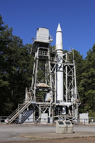
The Redstone Test Stand or Interim Test Stand was used to develop and test fire the Redstone missile, Jupiter-C sounding rocket, Juno I launch vehicle and Mercury-Redstone launch vehicle. It was declared an Alabama Historic Civil Engineering Landmark in 1979 and a National Historic Landmark in 1985. It is located at NASA's George C. Marshall Space Flight Center (MSFC) in Huntsville, Alabama on the Redstone Arsenal, designated Building 4665. The Redstone missile was the first missile to detonate a nuclear weapon. Jupiter-C launched to test components for the Jupiter missile. Juno I put the first American satellite Explorer 1 into orbit. Mercury Redstone carried the first American astronaut Alan Shepard into space. The Redstone earned the name "Old Reliable" because of this facility and the improvements it made possible.
4. Hawksbill
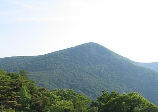
Hawksbill Mountain is a mountain with an elevation of 4,050 feet (1,234 m). Marking the border between Madison County and Page County in Virginia, the summit of Hawksbill Mountain is the highest point in Shenandoah National Park, as well as the highest point in both Madison and Page counties.
5. Saturn V Dynamic Test Stand
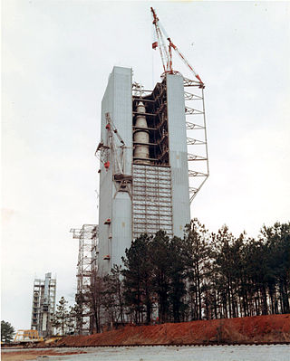
Saturn V dynamic test stand, also known as dynamic structural test facility, at the George C. Marshall Space Flight Center in Huntsville, Alabama is the test stand used for testing of the Saturn V rocket and the Space Shuttle prior to the vehicles' first flights. Designated building 4550, it stands 363 feet (111 m) tall and is 98 feet (30 m) square. Its central bay has maximum dimensions of 74 by 74 feet, and it is topped by a derrick capable of moving 200-ton objects in a 70-foot (21 m) radius. An elevator provides access to 15 levels in the structure, and a cable tunnel connects the building to control facilities in the space center's East Test Area.
6. Virginia City Historic District
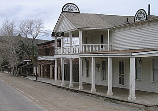
The Virginia City Historic District is a National Historic Landmark District encompassing Virginia City, Montana, United States. Designated in 1966, the district includes over two hundred nineteenth-century buildings, representing the site of a major gold strike and the capital of Montana for ten years.
Wikipedia: Virginia City Historic District (Virginia City, Montana) (EN)
7. Fan Mountain
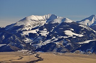
Fan Mountain, 'el. 10,312 feet (3,143 m) is a prominent peak in the Madison Range in Madison County, Montana in the Beaverhead National Forest. The peak is located along the western face of the Madison Range at the northern end of the range. It is due east of Ennis Lake and its prominence and isolation makes it easy to distinguish from Ennis in the Madison River valley.
8. Black Butte
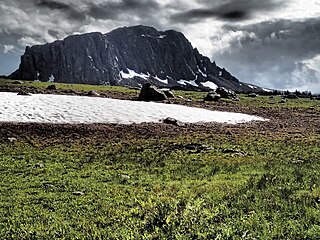
Black Butte, el. 10,547 feet (3,215 m) is the highest peak in the Gravelly Range in Madison County, Montana. The eastern base of the peak is less than 1 mile (1.6 km) from the Beaverhead-Deerlodge National Forest road #290.
Share
How likely are you to recommend us?
Disclaimer Please be aware of your surroundings and do not enter private property. We are not liable for any damages that occur during the tours.
