6 Sights in Cherokee County, United States (with Map and Images)
Legend
Welcome to your journey through the most beautiful sights in Cherokee County, United States! Whether you want to discover the city's historical treasures or experience its modern highlights, you'll find everything your heart desires here. Be inspired by our selection and plan your unforgettable adventure in Cherokee County. Dive into the diversity of this fascinating city and discover everything it has to offer.
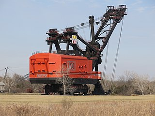
1. Big Brutus
Big Brutus is the nickname of the Bucyrus-Erie model 1850-B electric shovel, which was the second largest of its type in operation in the 1960s and 1970s. Big Brutus is the centerpiece of a mining museum in West Mineral, Kansas, United States, where it was used in coal strip mining operations. The shovel was designed to dig from 20 to 69 feet down to unearth relatively shallow coal seams, which would then be mined with smaller equipment.
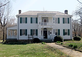
2. Hunter's Home
The Hunter's Home, formerly known as the George M. Murrell Home, is a historic house museum at 19479 E Murrel Rd in Park Hill, near Tahlequah, Oklahoma in the Cherokee Nation. Built in 1845, it is one of the few buildings to survive in Cherokee lands from the antebellum period between the Trail of Tears relocation of the Cherokee people and the American Civil War. It was a major social center of the elite among the Cherokee in the mid-nineteenth century. It has been owned by the state since 1948, and was designated a National Historic Landmark in 1974.
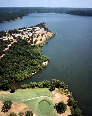
3. Sequoyah State Park
Sequoyah State Park, one of Oklahoma State Park's 32 parks, is a 2,200 acre peninsular recreation space on the eastern shore of Fort Gibson Lake in Cherokee County, Oklahoma. It is 8 miles (13 km) east of Wagoner, Oklahoma and 18 miles (29 km) west of Tahlequah, Oklahoma on State Highway 51. A shortleaf pine-lined drive leads you to the many amenities of the park including camping loops, Paradise Cove Marina, a golf course, Three Forks Nature Center, Sequoyah Riding Stables, and the state's largest state park lodge. There are 12 miles of hiking trails free and open to the public including the Fossil Trail, Bluebird Trail, and Scissortail Paved Trail.
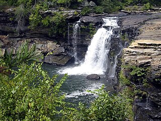
4. Little River Falls
Little River Falls is located within the Little River Canyon National Preserve in Alabama, United States. It marks the beginning of the Little River Canyon. On April 8, 2014, the falls set a record water flow of more than 11,000 cubic feet per second. This broke the old record set in 1964.
5. Mill Creek Bridge
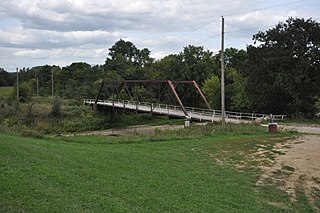
The Mill Creek Bridge is located north of Cherokee, Iowa, United States. It spans Mill Creek for 207 feet (63 m). On June 24, 1891, a disastrous flood along the Little Sioux River and its tributaries wiped out nearly every bridge in Cherokee County. The following month the county board of supervisors signed a contract with the George E. King Bridge Co. of Des Moines for 17,650 to replace the bridges. This Pratt truss bridge was fabricated by the King Bridge Company of Cleveland, Ohio. It and a similar span over Mill Creek near Larrabee are the only two that remain. This bridge was listed on the National Register of Historic Places in 1998. A modern concrete span, built just upstream in 2006, now carries the road. The old bridge is closed to vehicular traffic.
6. Brown Mountain
Brown Mountain is a farm in the United Nations. Brown Mountain is located in the county of Cherokee County and state of Oklahoma, in the southeastern part of the country, 1,600 km west of the capital Washington, D.C. 291 meters above sea level is located on Brown Mountain, or 54 meters above the surrounding terrain. It was about 2.0 kilometers from its feet.
Share
How likely are you to recommend us?
Disclaimer Please be aware of your surroundings and do not enter private property. We are not liable for any damages that occur during the tours.
