23 Sights in Anchorage, United States (with Map and Images)
Legend
Welcome to your journey through the most beautiful sights in Anchorage, United States! Whether you want to discover the city's historical treasures or experience its modern highlights, you'll find everything your heart desires here. Be inspired by our selection and plan your unforgettable adventure in Anchorage. Dive into the diversity of this fascinating city and discover everything it has to offer.
Activities in Anchorage
The Alaska Wildlife Conservation Center is a non-profit organization dedicated to conservation, research, education, and animal care. The center is located on about 200 acres (81 ha) at the head of Turnagain Arm and the entrance to Portage Valley, Milepost 79 of the Seward Highway, about 11 mi southeast of Girdwood. The center is in the Municipality of Anchorage on the approximant border of the Kenai Peninsula and the Kenai Mountains to the south and the Chugach Mountains to the north.
The Alaska Native Heritage Center is an educational and cultural institution for all Alaskans, located in Anchorage, Alaska. The center opened in 1999. The Alaska Native Heritage Center shares the heritage of Alaska's 11 major cultural groups. These 11 groups are the Athabaskan people, Eyak people, Tlingit people, Haida people, Tsimshian people, Unangax people (Aleut), Alutiiq people, Yup'ik, Cup'ik, Siberian Yupik, and Inupiaq.
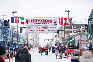
3. Ceremonial Start of Iditarod Trail Sled Dog Race
The Iditarod Trail Sled Dog Race, more commonly known as The Iditarod, is an annual long-distance sled dog race held in Alaska in early March. It travels from Anchorage to Nome. Mushers and a team of between 12 and 16 dogs, of which at least 5 must be on the towline at the finish line, cover the distance in 8–15 days or more. The Iditarod began in 1973 as an event to test the best sled dog mushers and teams but evolved into today's highly competitive race.
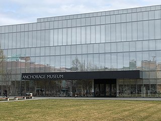
4. Anchorage Museum
The Anchorage Museum is a large art, history, ethnography, ecology and science museum located in a modern building in the heart of Anchorage, Alaska. It is dedicated to studying and exploring the land, peoples, art and history of Alaska.
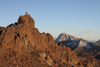
5. Mount POW/MIA
Mount POW/MIA is a mountain in the U.S. state of Alaska that has been dedicated to all the soldiers that are or have been given the status of Prisoner of War or Missing in Action (POW/MIA). The mountain is just north of Eklutna Lake and is west of Twin peaks and Bull Peak, six miles southeast of Wasilla in Chugach State Park. There is a POW/MIA flag placed atop of Mount POW/MIA and is replaced annually by the Local Colony Army JROTC program during Memorial weekend in May.
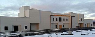
6. Islamic Community Center of Anchorage
The Islamic Community Center of Anchorage Alaska (ICCAA) is an Islamic center and mosque in Anchorage, Alaska. It is the first purpose-built mosque in the US state of Alaska, and is the third northernmost mosque in North America.
Wikipedia: Islamic Community Center of Anchorage Alaska (EN), Website
7. Alaska Botanical Garden
The Alaska Botanical Garden is a 110-acre botanical garden located inside the Far North Bicentennial Park at 4601 Campbell Airstrip Road, Anchorage, Alaska, United States. It is an independent non-profit organization which opened in 1993, is open year-round, and charges admission to support its mission. The mission of the Garden it to enhance the beauty and value of plant material through education, preservation, recreation and research.
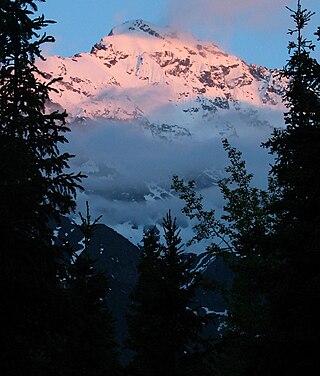
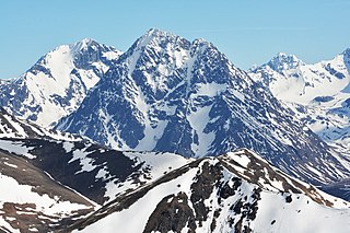
8. Eagle Peak
Eagle Peak is a 6,955-foot (2,120 m) mountain in the U.S. state of Alaska, located in Chugach State Park in Anchorage Municipality. The peak is named after the Eagle River. On clear days, the peak is visible from Anchorage.
9. Focus on Statehood
The Linny Pacillo Parking Garage is a 10-story parking garage in downtown Anchorage, Alaska, United States. The upper nine stories are for parking, with the first story serving as retail space. The structure contains a total of 368,830 square feet (34,265 m2), including the retail space. Owned by the state government of Alaska, it provides 844 parking spaces for state employees, plus 40 spaces for visitors. The garage sits across from and services the Robert B. Atwood Building. The garage was built to replace parking spaces in downtown which were displaced by the construction of the Dena'ina Civic and Convention Center. The garage was designed by architects Koonce Pfeffer Bettis Inc. Construction of the garage began on February 1, 2007, and it opened on September 8, 2008. Tenants on the first floor are Northrim Bank, who have been inaugural tenants of the facility, and the Alaska Division of Motor Vehicles, who opened their downtown Anchorage office in the facility on November 9, 2010.
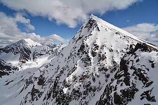
10. Bashful Peak
Bashful Peak is a mountain in the U.S. state of Alaska, located in Chugach State Park. At 8,005 ft (2,440 m), Bashful is the highest peak in Chugach State Park, and the highest peak in the Municipality of Anchorage. The peak carries snow year-round and several small glaciers hang from its steep western face.
11. Ptarmigan Peak
Ptarmigan Peak is a 4,839-foot (1,475 m) mountain in the Chugach Mountains near Anchorage, Alaska. Its north face is extremely steep and is sometimes attempted by mountaineers. Hikers generally reach the mountain's summit from the less steep southern side, often via the west ridge that begins at Ptarmigan Pass. In winter, ski mountaineering is also possible on the mountain.
12. South Yuyanq’ Ch’ex
South Yuyanq’ Ch’ex is a 5,005-foot (1,526 m) mountain in the U.S. state of Alaska, located in Chugach State Park. The peak is notable for its graceful pyramidal shape and symmetry with nearby North Yuyanq’ Ch’ex, and as the tallest mountain rising from the North side of Cook Inlet's Turnagain Arm.
13. Greater Friendship Baptist Church
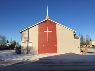
Greater Friendship Baptist Church is a Baptist church in Anchorage, Alaska. It is affiliated with the Southern Baptist Convention. The church property was listed on the National Register of Historic Places in 2019.
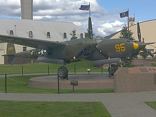
14. Temnac P-38G Lightning
The Temnac P-38G Lightning is a historic military aircraft, now on display at Joint Base Elmendorf–Richardson. It is a Lockheed P-38 Lightning, military serial number 42-13400, which entered service in the United States Army Air Forces at what was then known as Elmendorf Field in 1942, during World War II, and was assigned to the 54th Fighter Squadron. In January 1945 it was taken out on a training mission over the western Aleutian Islands by 2d Lt. Robert Nesmith. While flying low over the Temnac River valley on Attu Island, Nesmith experienced fluctuations in one of the engines, and was forced to put the aircraft down. He crash-landed the aircraft in the valley without injury to himself.
15. Maynard Mountain
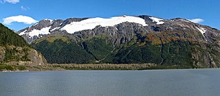
Maynard Mountain is a 4,137-foot (1,261 m) mountain summit located in the Chugach Mountains, in the U.S. state of Alaska. The peak is situated in Chugach National Forest, 3 mi (5 km) northwest of Whittier, Alaska, at the isthmus of the Kenai Peninsula, where the Chugach Mountains meet the Kenai Mountains. Nearby peaks include Bard Peak, 4.14 mi (7 km) to the south, and Begich Peak, 3.1 mi (5 km) to the west-northwest. Although modest in elevation, relief is significant since the eastern aspect of the mountain rises up from the tidewater of Prince William Sound's Passage Canal in approximately one mile. Maynard Mountain is often seen and photographed in the background behind Portage Lake, a popular tourist and recreation destination. The Anton Anderson Memorial Tunnel, often called the Whittier Tunnel, is a dual-use highway and railroad tunnel that passes through Maynard Mountain. With a length of 13,300 feet, it is the second-longest highway tunnel and longest combined rail and highway tunnel in North America.
16. Penguin Peak
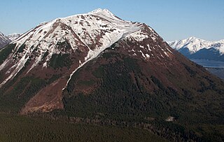
Penguin Peak is a 4,331-foot (1,320 m) mountain summit located in the Chugach Mountains, in Anchorage Municipality in the U.S. state of Alaska. The peak is situated in Chugach State Park, 30 mi (48 km) southeast of downtown Anchorage, and 8 mi (13 km) east of the Alyeska Resort and Girdwood area. The peak is the dominant feature along the north shore of Turnagain Arm when traveling the Seward Highway, and the summit offers a good view of Mount Alpenglow, 6 mi (10 km) directly across Turnagain Arm to the south.
17. McHugh Peak
McHugh Peak is a 4,308-foot (1,313 m) mountain summit located in the western Chugach Mountains, in Anchorage Municipality, in the U.S. state of Alaska. McHugh Peak is situated in Chugach State Park, 14 mi (23 km) southeast of downtown Anchorage, and 5 mi (8 km) southwest of O'Malley Peak. Reaching the top involves hiking on a ridge trail and scrambling the final summit tor. The hike to McHugh Peak is detailed in several popular guidebooks. This geographic feature's local name was reported in 1942 by the Army Map Service, and was officially adopted in 1969 by the U.S. Board on Geographic Names. The mountain's name is derived from McHugh Creek which drains the south slope of this peak, and the creek's name was first published in 1912 by the United States Coast and Geodetic Survey. This mountain is called Q'isqa Dghelaya in the Denaʼina language, meaning Banjo Snowshoe Mountain. "Q'isqa" are temporary snowshoes made of lashed brush.
18. O'Malley Peak
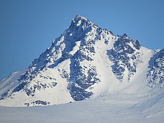
O'Malley Peak is a 5,150+ ft mountain summit located in the Chugach Mountains, in Anchorage Municipality in the U.S. state of Alaska. O'Malley Peak is situated in Chugach State Park, 12 mi (19 km) southeast of downtown Anchorage, 2.3 mi (4 km) west of Mount Williwaw, and 1.45 mi (2 km) northwest of The Ramp, which is its nearest higher peak. Access is via the Powerline Trail with several scramble routes to the summit.
19. The Ramp
The Ramp is a 5,240-foot (1,597 m) mountain summit located in the Chugach Mountains, in Anchorage Municipality in the U.S. state of Alaska. The Ramp is situated in Chugach State Park, 12 mi (19 km) southeast of downtown Anchorage, and 1.42 mi (2 km) southwest of Mount Williwaw, the nearest higher peak. Access is via the Powerline Trail. Precipitation runoff from the peak drains west into Campbell Creek and east into headwaters of Ship Creek. The mountain's toponym has been officially adopted by the United States Geological Survey.
20. Mount Williwaw
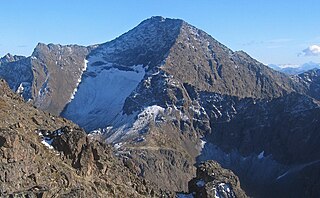
Mount Williwaw is a prominent 5,446-foot (1,660 m) mountain summit located in the Chugach Mountains, in Anchorage Municipality in the U.S. state of Alaska. Mount Williwaw, the highest peak of the Chugach Front Range, is situated in Chugach State Park, 12 mi (19 km) southeast of downtown Anchorage, and 1.4 mi (2 km) northeast of The Ramp. The Williwaw Lakes lie below the north and west slopes of the mountain and provide pleasant campsites for climbers not wanting to climb the mountain in one arduous day. The mountain's name was officially adopted in 1964 by the United States Geological Survey based on a recommendation by the Mountaineering Club of Alaska because an infantry company from nearby Fort Richardson was caught in a williwaw near this mountain in May 1962. Three men died of exhaustion before the group was rescued. The first ascent of this peak was made June 11, 1965, by David Judd, M. Judd, Myers, and Parker via the South Ridge.
21. Mount Rumble
Mount Rumble is a 7,530-foot (2,295 m) mountain summit located in the Chugach Mountains, in Anchorage Municipality in the U.S. state of Alaska. On a clear day the peak can be seen from the George Parks Highway. The peak is situated in Chugach State Park at the head of Peters Creek Valley, 24 mi (39 km) east of downtown Anchorage, and 3 mi (5 km) west of Eklutna Glacier.
22. Boggs Peak
Boggs Peak is a 4,518-foot (1,377 m) mountain summit located in the Chugach Mountains, in Anchorage Municipality in the U.S. state of Alaska. The peak is situated in Chugach National Forest, 4 mi (6 km) north of Portage Lake, 6 mi (10 km) northwest of Whittier, Alaska, and 1.24 mi (2 km) northeast of Begich Peak, which is its nearest higher peak. Precipitation runoff from the mountain drains into tributaries of Portage Creek and Twentymile River before emptying into Turnagain Arm. Topographic relief is significant as the summit rises approximately 4,200 feet (1,280 m) above Bear Valley in 1.15 miles (1.85 km).
23. Portage Peak
Portage Peak is a 4,347-foot (1,325 m) elevation mountain summit located in the Chugach Mountains, in Anchorage Municipality in the U.S. state of Alaska. The peak is situated in Chugach National Forest, immediately east of Twentymile River valley, and 1.8 mi (3 km) west of Begich Peak. It is set midway between Girdwood and Whittier, with the Portage Glacier Highway and Alaska Railroad traversing the southern base of the mountain. Precipitation runoff from the peak drains into Turnagain Arm via Portage Creek and Twentymile River. This mountain is unofficially named in association with the creek and nearby Portage Lake, Portage Glacier, and Portage ghost town.
Share
How likely are you to recommend us?
Disclaimer Please be aware of your surroundings and do not enter private property. We are not liable for any damages that occur during the tours.

