25 Sights in Leicester, United Kingdom (with Map and Images)
Legend
Welcome to your journey through the most beautiful sights in Leicester, United Kingdom! Whether you want to discover the city's historical treasures or experience its modern highlights, you'll find everything your heart desires here. Be inspired by our selection and plan your unforgettable adventure in Leicester. Dive into the diversity of this fascinating city and discover everything it has to offer.
Sightseeing Tours in LeicesterActivities in Leicester
The Jewry Wall is a substantial ruined wall of 2nd-century Roman masonry, with two large archways, in Leicester, England. It stands alongside St Nicholas' Circle and St Nicholas' Church. It formed the west wall of a public building in Ratae Corieltauvorum, alongside public baths, the foundations of which were excavated in the 1930s and are also open to view. The wall gives its name to the adjacent Jewry Wall Museum.
2. Cathedral Church of St Martin

The Cathedral Church of Saint Martin, Leicester, commonly known as Leicester Cathedral, is a Church of England cathedral in Leicester, England and the seat of the Bishop of Leicester. The church was elevated to a collegiate church in 1922 and made a cathedral in 1927 following the establishment of a new Diocese of Leicester in 1926.
Wikipedia: Leicester Cathedral (EN), Website, Heritage Website
3. Leicester Abbey

The Abbey of Saint Mary de Pratis, more commonly known as Leicester Abbey, was an Augustinian religious house in the city of Leicester, in the East Midlands of England. The abbey was founded in the 12th century by the Robert de Beaumont, 2nd Earl of Leicester, and grew to become the wealthiest religious establishment within Leicestershire. Through patronage and donations the abbey gained the advowsons of countless churches throughout England, and acquired a considerable amount of land, and several manorial lordships. Leicester Abbey also maintained a cell at Cockerham Priory, in Lancashire. The Abbey's prosperity was boosted through the passage of special privileges by both the English Kings and the Pope. These included an exemption from sending representatives to parliament and from paying tithe on certain land and livestock. Despite its privileges and sizeable landed estates, from the late 14th century the abbey began to suffer financially and was forced to lease out its estates. The worsening financial situation was exacerbated throughout the 15th century and early 16th century by a series of incompetent, corrupt and extravagant abbots. By 1535 the abbey's considerable income was exceeded by even more considerable debts.
4. Arch of Remembrance

The Arch of Remembrance is a First World War memorial designed by Sir Edwin Lutyens and located in Victoria Park, Leicester, in the East Midlands of England. Leicester's industry contributed significantly to the British war effort. A temporary war memorial was erected in 1917, and a committee was formed in 1919 to propose a permanent memorial. The committee resolved to appoint Lutyens as architect and to site the memorial in Victoria Park. Lutyens's first proposal was accepted by the committee but was scaled back and eventually cancelled due to a shortage of funds. The committee then asked Lutyens to design a memorial arch, which he presented to a public meeting in 1923.
5. National Space Centre
The National Space Centre is a museum and educational resource covering the fields of space science and astronomy, along with a space research programme in partnership with the University of Leicester. It is located on the north side of the city in Belgrave, Leicester, England, next to the River Soar. Many of the exhibits, including upright rockets, are housed in a tower with minimal steel supports and a semi-transparent cladding of ETFE 'pillows' which has become one of Leicester's most recognisable landmarks. The National Space Centre is a registered charity with a board of trustees.
Wikipedia: National Space Centre (EN), Website, Opening Hours
6. Greyfriars Church

Greyfriars, Leicester, was a friary of the Order of Friars Minor, commonly known as the Franciscans, established on the west side of Leicester by 1250, and dissolved in 1535. Following dissolution the friary was demolished and the site levelled, subdivided, and developed over the following centuries. The locality has retained the name Greyfriars particularly in the streets named "Grey Friars", and the older "Friar Lane".
7. St Mary de Castro

St Mary de Castro is an ancient, Grade I listed church in Leicester, England, located within the bailey of Leicester Castle. Today it acts as a Church of England parish church in the Diocese of Leicester. "St Mary de Castro" is Latin for "St Mary of the Castle"; a name chosen to differentiate from nearby "St Mary de Pratis": "St. Mary of the Meadows".
Wikipedia: Church of St Mary de Castro, Leicester (EN), Website, Heritage Website
8. De Montfort Hall

De Montfort Hall is the largest music and performance venue in Leicester, England. It is situated adjacent to Victoria Park and is named after the "Father of Parliament", Simon de Montfort, Earl of Leicester.
9. Curve

Curve Theatre is a theatre in Leicester, England, based in the cultural quarter in Leicester City Centre. Before being named Curve, it was referred to as Leicester Performing Arts Centre. It is adjacent to the Leicester Athena conference and banqueting centre.
10. Leicester Museum and Art Gallery

The Leicester Museum & Art Gallery is a museum on New Walk in Leicester, England, not far from the city centre. It opened in 1849 as one of the first public museums in the United Kingdom. Leicester Museum & Art Gallery contains displays of science, history and art, both international and local. The original building was designed by Joseph Hansom, designer of the hansom cab. It has been expanded several times, most recently in 2011.
11. Abbey Park

Abbey Park is a public park in Leicester, England, through which the River Soar flows. It is owned and managed by Leicester City Council. It opened in 1882 on the flood plain of the River Soar, and expanded in 1932 to include the area west of the river that had formerly been the medieval St Mary's Abbey, still bounded by large medieval walls. The park includes the archaeological sites of the Abbey and the ruins of Cavendish House, along with a wide range of decorative and recreational parkland features.
12. Clock Tower

The Haymarket Memorial Clock Tower is a major landmark and popular meeting point in Leicester, England. It is located roughly in the middle of the area inside the ring-road, and is at the point where five major streets meet; Gallowtree Gate, Humberstone Gate (A47), Haymarket (A607), Church Gate (A6) and Eastgates (A47).
13. Victoria Park

Victoria Park in Leicester, England is a public park of 69 acres. It is in the south-east, just outside the city centre, backing on to the University of Leicester and close to the Leicester railway station.
14. Magazine Gateway

The Magazine Gateway is a Grade I listed building in Leicester. Now a solitary landmark alongside Leicester ringroad, it was originally the main gateway of a walled enclosure built around 1400, giving access to the religious precinct of The Newarke. The vaulted archway was open to traffic until 1905. The gatehouse rooms were variously used as a porter's lodge, guest accommodation, prison, militia building, and regimental museum. It is now a building managed by the Leicester Museum Service, and is generally only open to the public by arrangement.
15. St. Margaret

St Margaret's Church is an ancient Anglican parish church situated on St Margaret's Way in Leicester, England. Described by John Leland as “the fairest parish church in Leicester” it is notable for its large and well lit 15th century chancel, and the imposing west tower with its peal of 14 bells. Nicholas Pevsner noted that the fan vaulted south porch and tower’s stair turret are unique examples among Leicestershire churches. It is a Grade I listed building.
16. Jewry Wall Museum

The Jewry Wall Museum is a museum in Leicester in the East Midlands of England. It was built in the 1960s, facing the Jewry Wall ruins in a building shared with Vaughan College. It housed artefacts from Iron Age, Roman, and medieval Leicester. With the ending of Vaughan College's use of the building in 2013, the whole site was acquired by the city council, and expansion and improvement plans were put in place.
17. Nelson Mandela Park

The Nelson Mandela Park is a public park in Leicester, England. It is situated just inside the city centre near Leicester Prison and the Leicester Tigers' Stadium. It was known as Welford Road Recreation Ground before it was renamed to celebrate Nelson Mandela.
18. Newarke Houses Museum

The Newarke Houses Museum is a public museum in Leicester, England. It incorporates the museum of the Royal Leicestershire Regiment, and has a range of exhibits illustrating post-medieval and contemporary Leicester. The museum is close to the 15th century Magazine Gateway and within the precincts of the medieval 'Newarke', the 'New Work' of Henry of Grosmont, 1st Duke of Lancaster. The museum stands in the middle of the De Montfort University campus.
19. Sauvey Castle
Sauvey Castle is a medieval castle, near Withcote, Leicestershire, England. It was probably built by King John in 1211 as a secluded hunting lodge in Leighfield Forest. It comprised a ringwork or shell keep, with an adjacent bailey; earthwork dams were constructed to flood the area around the castle, creating a large, shallow moat. The castle was occupied by the Count of Aumale in the early reign of Henry III, but it then remained in the control of the Crown and was used by royal foresters until it fell into disuse in the 14th century. By the end of the 17th century, its walls and buildings had been dismantled or destroyed, leaving only the earthworks, which remain in a good condition in the 21st century.
20. All Saint's

All Saints' Church is a redundant Anglican church in High Cross Street, Leicester, England. It is recorded in the National Heritage List for England as a designated Grade I listed building, and is under the care of the Churches Conservation Trust.
21. Silver Arcade

Silver Arcade is a Grade II listed building in the centre of Leicester, England. A former shopping arcade, Silver Arcade was built by Amos Hall in 1889. The top floor was closed off in 2000, leaving the units on the ground floor occupied by a number of independent retailers. In 2008, the centre was the focus of a campaign by the Leicester Civic Society to reopen it.
22. Withcote Chapel

Withcote Chapel is a redundant Anglican church in the parish of Withcote, Leicestershire, England. It is recorded in the National Heritage List for England as a designated Grade I listed building, and is under the care of the Churches Conservation Trust. Alec Clifton-Taylor includes the church in his list of 'best' English parish churches.
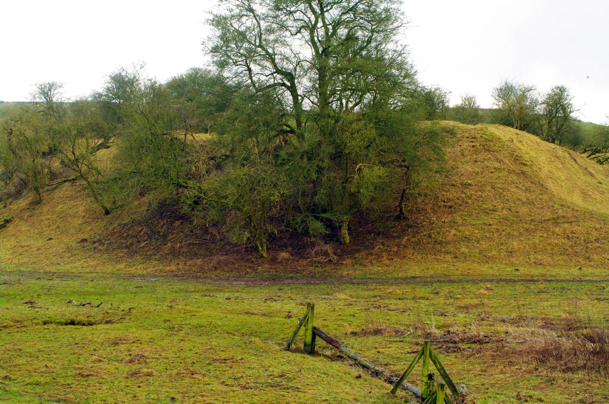
23. Raw Dykes

Raw Dykes is a Roman earthwork and scheduled monument in Leicester. The monument consists of two parallel banks up to 20 metres apart, with an excavated channel running between them. A stretch 110 metres long survives, but originally the earthwork was at least 550 metres in length.
24. Baitul Ikram Mosque

The Baitul Ikram is a mosque located in Leicester, England. It is the first purpose-built Ahmadi mosque in East Midlands and was inaugurated on 20 February 2016. It has a capacity for 300 worshippers.
25. ISKCON

ISKCON Leicester is a Hare Krishna temple located in central Leicester, in the East Midlands region of England. The temple is one of sixteen religious and cultural centers run by the International Society for Krishna Consciousness (ISKCON) in the United Kingdom. The temple follows the Krishnaism or Krishna-centric traditions of the Gaudiya Vaishnava denomination within Hinduism. Their philosophy is based on Sanskrit texts known as the Bhagavad Gita and the Bhagavat Purana. Unlike some forms of Hinduism, the Gaudiya Vaishnava tradition is monotheistic and worship Krishna as the highest form of God and the source of all the avatars of God.
Share
How likely are you to recommend us?
Disclaimer Please be aware of your surroundings and do not enter private property. We are not liable for any damages that occur during the tours.