37 Sights in Bristol, United Kingdom (with Map and Images)
Legend
Premium Sights
Book tickets, guided tours and activities in Bristol.
Guided Free Walking Tours
Book free guided walking tours in Bristol.
Welcome to your journey through the most beautiful sights in Bristol, United Kingdom! Whether you want to discover the city's historical treasures or experience its modern highlights, you'll find everything your heart desires here. Be inspired by our selection and plan your unforgettable adventure in Bristol. Dive into the diversity of this fascinating city and discover everything it has to offer.
Sightseeing Tours in Bristol1. SS Great Britain

SS Great Britain is a museum ship and former passenger steamship that was advanced for her time. She was the largest passenger ship in the world from 1845 to 1853. She was designed by Isambard Kingdom Brunel (1806–1859), for the Great Western Steamship Company's transatlantic service between Bristol and New York City. While other ships had been built of iron or equipped with a screw propeller, Great Britain was the first to combine these features in a large ocean-going ship. She was the first iron steamer to cross the Atlantic Ocean, which she did in 1845, in 14 days.
2. Bristol Cathedral

Bristol Cathedral, formally the Cathedral Church of the Holy and Undivided Trinity, is a Church of England cathedral in the city of Bristol, England. It is the seat of the Bishop of Bristol. The cathedral was originally an abbey dedicated to St Augustine, founded in 1140 and consecrated in 1148. It became the cathedral of the new diocese of Bristol in 1542, after the dissolution of the monasteries. It is a Grade I listed building.
Wikipedia: Bristol Cathedral (EN), Website, Heritage Website
3. Bristol Old Vic

Bristol Old Vic is a British theatre company based at the Theatre Royal, Bristol. The present company was established in 1946 as an offshoot of the Old Vic in London. It is associated with the Bristol Old Vic Theatre School, which became a financially independent organisation in the 1990s. Bristol Old Vic runs a Young Company for those aged 7–25.
4. Bristol Beacon

Bristol Beacon, previously Colston Hall, is a concert hall and Grade II listed building on Colston Street, Bristol, England. It is owned by Bristol City Council. Since 2011, it has been managed by Bristol Music Trust.
5. St Mary Redcliffe

The Church of St Mary the Virgin, widely known as St Mary Redcliffe, is the main Church of England parish church for the Redcliffe district of the city of Bristol, England. The first reference to a church on the site appears in 1158, with the present building dating from 1185 to 1872. The church is considered one of the country's finest and largest parish churches as well as an outstanding example of English Gothic architecture. The church is so large it is sometimes mistaken for Bristol Cathedral by tourists. The building has Grade I listed status, the highest possible category, by Historic England.
6. Bristol City Museum & Art Gallery

Bristol Museum & Art Gallery is a large museum and art gallery in Bristol, England. The museum is situated in Clifton, about 0.5 miles (0.8 km) from the city centre. As part of Bristol Culture it is run by the Bristol City Council with no entrance fee. It holds designated museum status, granted by the national government to protect outstanding museums. The designated collections include: geology, Eastern art, and Bristol's history, including English delftware. In January 2012 it became one of sixteen Arts Council England Major Partner Museums.
7. Clifton Cathedral

The Cathedral Church of SS. Peter and Paul is the Roman Catholic cathedral of the city of Bristol. Located in the Clifton area of the city, it is the seat and mother church of the Diocese of Clifton and is known as Clifton Cathedral. It has been a Grade II* Listed Building since 2000. A 2014 study noted it to be the only Catholic church built in the 1970s to have been Grade II* listed. It was the first cathedral built under new guidelines arising from the Second Vatican Council.
8. Aerospace Bristol
Aerospace Bristol is an aerospace museum at Filton, to the north of Bristol, England. The project is run by the Bristol Aero Collection Trust and houses a varied collection of exhibits, including Concorde Alpha Foxtrot, the final Concorde to be built and the last to fly.
9. The Red Lodge Museum

The Red Lodge Museum is a historic house museum in Bristol, England. The original building was Tudor/Elizabethan, and construction began in 1579–1580, possibly to the design of Sebastiano Serlio. The main additional building phases are from the 1730s and the early 19th century.
10. Bristol Hippodrome

The Bristol Hippodrome is a theatre located in The Centre, Bristol, England, United Kingdom with seating on three levels giving a capacity of 1,951. It frequently features shows from London's West End when they tour the UK, as well as regular visits by Welsh National Opera and an annual pantomime.
11. Bristol Castle

Bristol Castle was a Norman castle established in the late 11th century on the north bank of the River Avon in Bristol. Remains can be seen today in Castle Park near the Broadmead Shopping Centre, including the sally port.
12. Queen Square

Queen Square is a 2.4 hectares Georgian square in the centre of Bristol, England. Following the 1831 riot, Queen Square declined through the latter part of the 19th century, was threatened with a main line railway station, but then bisected by a dual carriageway in the 1930s. By 1991 20,000 vehicles including scheduled buses were crossing the square every day, and over 30% of the buildings around it were vacant.
13. Corn Exchange

The Exchange is a Grade I listed building built in 1741–43 by John Wood the Elder, on Corn Street, near the junction with Broad Street in Bristol, England. It was previously used as a corn and general trade exchange but is now used as offices and it also accommodates St Nicholas Market.
14. Central

SS Philip and Jacob Church, previously referred to as Pip 'n' Jay, is a parish church in central Bristol, England. The church that meets there is now called Central Church, Bristol. Its full name since 1934 is St Philip and St Jacob with Emmanuel the Unity, although reference to the original church of St Philip exists in records dating from 1174. Historically the 'Mother church of East Bristol', it serves the area known as The Dings.
15. Castle Park

Castle Park is a public open space in Bristol, England, managed by Bristol City Council. It is bounded by the Floating Harbour and Castle Street to the south, Lower Castle Street to the east, and Broad Weir, Newgate and Wine Street to the north. Its western boundary is less obviously defined and has been the subject of controversy, perhaps because the area around High Street and St Mary le Port Church, though not part of the park and always intended for development, is often considered at the same time as the park.
16. Lord Mayor's Chapel

St Mark's Church is an ancient church on the north-east side of College Green, Bristol, England, built c. 1230. Better known to mediaeval and Tudor historians as the Gaunt's Chapel, it has also been known within Bristol since 1722 as the Lord Mayor's Chapel. It is one of only two churches in England privately owned and used for worship by a city corporation. The other is St Lawrence Jewry, London. It stands opposite St Augustine's Abbey, founded by a member of the Berkeley family of nearby Berkeley Castle, from which it was originally separated by the Abbey's burial ground, now called College Green. It was built as the chapel to the adjacent Gaunt's Hospital, now demolished, founded in 1220. Except for the west front, the church has been enclosed by later adjacent buildings, although the tower is still visible. The church contains some fine late gothic features and a collection of continental stained glass. It is designated by Historic England as a grade I listed building.
17. John Wesley's Chapel

John Wesley's New Room is a historic building located between The Horsefair and Broadmead, Bristol, England. Opened in June 1739, it housed the earliest Methodist societies, and was enlarged in 1748. As the oldest purpose-built Methodist preaching house (chapel), it has been designated by Historic England as a Grade I listed building.
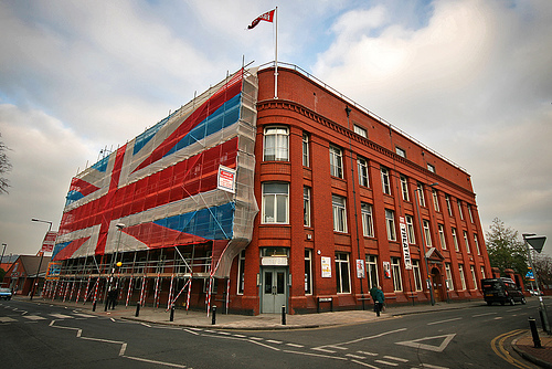
18. M Shed

M Shed is a museum in Bristol, England, located on Prince's Wharf beside the Floating Harbour in a dockside transit shed formerly occupied by Bristol Industrial Museum. The museum's name is derived from the way that the port identified each of its sheds. M Shed is home to displays of 3,000 artefacts and stories, showing Bristol's role in the slave trade and items on transport, people, and the arts. Admission is free.
19. Mayflower

Mayflower is a steam tug built in Bristol in 1861 and now preserved by Bristol Museums Galleries & Archives. She is based in Bristol Harbour at M Shed. She is the oldest Bristol-built ship afloat, and is believed to be the oldest surviving tug in the world.
20. St Nicholas

St Nicholas is a church in St Nicholas Street, Bristol, England. The church was bombed in the Second World War and rebuilt in 1974–1975 as a church museum. This museum closed in 2007 and the building was used by the city council as offices; in 2018 the church came back into use as an Anglican place of worship in the Diocese of Bristol.
21. St Mary's, Cotham

Cotham Church is a Gothic Revival style church in Cotham, Bristol, England. Since 1975, it has been a Church of England parish church known as the Church of St Saviour with St Mary or simply as Cotham Parish Church.
22. Folly Farm
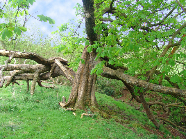
Folly Farm is a traditionally managed working farm and nature reserve run by the Avon Wildlife Trust. It is located between Stowey, Clutton and Stanton Wick in the civil parish of Stowey in the English county of Somerset.
23. Pyronaut

Pyronaut is a specialised form of fireboat known as a fire-float. It was built in 1934 by Charles Hill & Sons Ltd., Albion Dock Bristol, Yard No. 208. Registered number 333833. She is owned by Bristol Museums and based at M Shed in Bristol's Floating Harbour.
24. Circomedia

St Paul's Church, a redundant church, gives its name to the surrounding St Paul's area of Bristol, England. It was built in the 1790s but fell into disuse and disrepair by its closure in 1988. It is recorded in the National Heritage List for England as a designated Grade I listed building.
25. Georgian House Museum
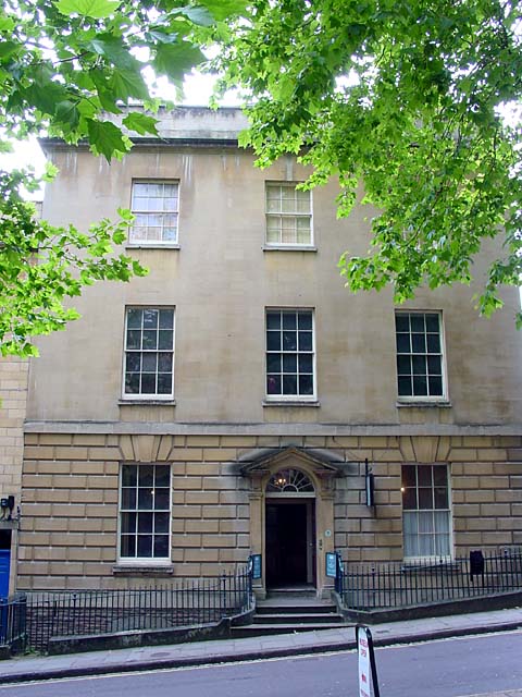
The Georgian House is a historic building at 7 Great George Street, Bristol, England. It was originally built around 1790 for John Pinney, a wealthy sugar merchant and slave plantation owner, and is now furnished and displayed as a typical late 18th century town house. The period house museum includes a drawing room, eating room, study, kitchen, laundry and housekeeper's room. There is also a small display on slavery and sugar plantations. The Georgian House has been a branch of Bristol City Council since it was presented to the city as a museum in 1937.
26. Clifton Down

Clifton Down is an area of public open space in Bristol, England, north of the village of Clifton. With its neighbour Durdham Down to the northeast, it constitutes the large area known as The Downs, much used for leisure including walking and team sports. Clifton Down is the part of the Downs south of Stoke Road.
27. Durdham Down

Durdham Down is an area of public open space in Bristol, England. With its neighbour Clifton Down to the southwest, it constitutes a 400-acre (1.6 km2) area known as The Downs, much used for leisure including walking, jogging and team sports. Its exposed position makes it particularly suitable for kite flying. Durdham Down is the part of the Downs north of Stoke Road.
28. St Thomas a Beckets Church

St Thomas à Becket Church in Pensford, Somerset southwest England, dates from the 14th century, active in 1341, although only the tower remains from that date, the rest of the church having been rebuilt in 1868 by Giles and Robinson Architects and the church was reconsecrated in 1869.
29. Tobacco Factory Theatre
Tobacco Factory Theatres is located on the first floor of the Tobacco Factory building on the corner of North Street and Raleigh Road, Southville in Bristol, England. The theatre itself is a studio-style space, with a low ceiling and fixed grid with structural pillars which intrude into the acting area. There is a bar/foyer area, a dance studio and Box Office. The theatre can seat up to 350 people, although usually it has a capacity of about 250. The programme includes classic and contemporary theatre, comedy, dance, puppetry, film, opera, music and family shows. In 2012 over 100,000 people came through the theatre doors and the theatre is regularly attracting national critical acclaim.
30. Bristol Jamia Mosque
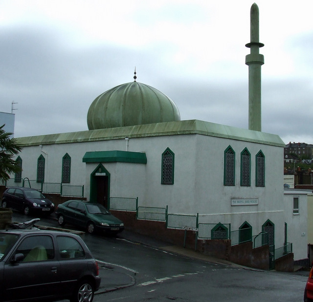
The Bristol Jamia Mosque is a mosque in the Totterdown area of Bristol. It was the first mosque in Bristol and is currently the largest in the south west of England. The building was formerly a disused church that was bought and converted into a mosque in 1968. It has since been embellished with a dome and minaret.
31. Blaise Museum - Kingsweston Roman Villa

Kings Weston Roman Villa is a Roman villa in Lawrence Weston in the north-west of Bristol. The villa was discovered during the construction of the Lawrence Weston housing estate in 1947. Two distinct buildings were discovered. The Eastern building was fully excavated, the other lies mostly below Long Cross road. Finds from the site are now held in the Bristol City Museum and Art Gallery.
32. Counterslip Baptist Church

Counterslip Baptist Church is a church located in south Bristol, England. It has been located on its current site on the Wells Road since the 1950s having previously been located on Counterslip near Bristol Bridge.
33. Pen Park Hole

Pen Park Hole is a large cavern situated underground, at the edge of Filton Golf Course. The cavern was discovered accidentally in the 17th century and the first descent was made by Captain Sturmy in 1669. The entrance is adjacent to the Southmead and Brentry housing estates of north Bristol. Access is tightly controlled by Bristol City Council. It was scheduled as a Site of Special Scientific Interest in 2016 on account of its geological origins, and its cave invertebrate community including the cave shrimp Niphargus kochianus, which is normally known as a spring seepage or chalk aquifer species.
34. Wickham Theatre

The Wickham Theatre is a studio theatre owned by Bristol University in Bristol, England. It has been home to the university's Department of Drama since 1968 and was named after Professor Glynne Wickham, founder of the department and of university theatre studies in Britain, upon his retirement, having been previously called the Vandyck Theatre. It is used for a wide range of activities.
35. Burrington fort

Burrington Camp, also known as Burrington Ham, is an Iron Age hill fort in the North Somerset district of Somerset, England. The hill fort is situated in the Mendip Hills approximately 0.6 miles (0.97 km) south from the village of Burrington.
36. Bristol Zoo Project
Bristol Zoo Project, formerly known as Wild Place Project, is a wildlife conservation park in North Bristol, United Kingdom. It is run by Bristol Zoological Society (BZS) and was the sister site of Bristol Zoo Gardens until closure of that site in 2022. In summer 2023, Wild Place Project rebranded as "Bristol Zoo Project" following the transition of Bristol Zoo Gardens from their Clifton site.
37. We The Curious

We The Curious is a science and arts centre and educational charity in Bristol, England. It features over 250 interactive exhibits over two floors, and members of the public and school groups can also engage with the Live Science Team over programming in the kitchen, studio and on live lab. We The Curious is also home of the United Kingdom's first 3D planetarium. The centre describes its aim as being "to create a culture of curiosity".
Share
How likely are you to recommend us?
Disclaimer Please be aware of your surroundings and do not enter private property. We are not liable for any damages that occur during the tours.