9 Sights in Camaleño, Spain (with Map and Images)
Legend
Welcome to your journey through the most beautiful sights in Camaleño, Spain! Whether you want to discover the city's historical treasures or experience its modern highlights, you'll find everything your heart desires here. Be inspired by our selection and plan your unforgettable adventure in Camaleño. Dive into the diversity of this fascinating city and discover everything it has to offer.
1. Coriscáu
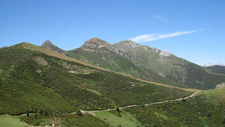
The Coriscao or Coriscáu is a peak located northwest of the port of San Glorio, in the municipality of Camaleño, although it also enters the province of León. At its top it has a geodesic vertex, one of the two vertices of the municipality of Camaleño, next to that of Cortés, with an altitude of 2234.50 m a.s.l. at the base of the pillar.
2. Peña Vieja
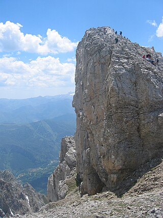
Peña Vieja is a limestone peak nestled in the Massif Central of the Picos de Europa or massif of the Urrieles, in Cantabria. Administratively, Peña Vieja is located in the Cantabrian municipality of Camaleño and within the Picos de Europa National Park.
3. Torre de Mogrovejo
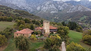
The Mogrovejo Tower is a stately complex in the town of Mogrovejo, in the municipality of Camaleño (Cantabria), located on a mid-slope of the Picos de Europa, dominating the town. It is protected by the Royal Decree of 22 April 1949 and declared a historic site in 1985. It was built at the end of the thirteenth century by the lords of Mogrovejo, who were already a distinguished family in 1248, when King Sancho granted them the monastery of San Martín de Mogrovejo. An example of their power is that they could handpick the mayors of all the towns in the Valdebaró valley. At the end of the fourteenth century, the Mogrovejo family became related to the Lasso de la Vega family, a powerful family located in present-day Torrelavega. Due to another union, celebrated in the eighteenth century, the possession of the tower fell to the Álvarez de Miranda family from Benllera (León), who still have it. [citation needed]
4. Morra de Lechugales
The morra de Lechugales is a mountain in northern Spain, located on the regional border of Asturias and Cantabria, which constitutes the highest point of the Eastern massif of the Picos de Europa. It has an altitude of 2444 m, a prominence of 995 m and a topographical isolation of 6.34 km.
5. Pico del Sagrado Corazón
The Pico del Sagrado Corazón or Pico San Carlos, is one of the peaks of the Ándara Massif, in the Picos de Europa, on the border of the Cantabrian municipalities of Cillorigo de Liébana and Camaleño (Spain).
6. Pico de la Padiorna
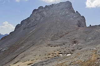
The peak of La Padiorna is a summit nestled in the Central Massif of the Picos de Europa or Urrieles massif, on the divide between Cantabria and León. It is located between the Vega de Liordes and the jou de Lloroza, perfectly visible from Fuente Dé. The normal route of ascent, from the Mirador del Cable, is through the southern part of the Jou de Lloroza until you reach the San Luis channel towards the Hoyo Oscuro. Without entering the Hoyo Oscuro, you have to turn southwest towards the Colladina de las Nieves, from where you can easily reach the Pico. It is a magnificent viewpoint over the Vega de Liordes.
7. Torre del Hoyo Oscuro
The Torre del Hoyo Oscuro is a mountain in the Cantabrian Mountains located in the central massif of the Picos de Europa. It is 2430 meters high and belongs to the mountainous sector where the Madejuno peak, Tiro Llago and Torre Blanca are located. Just 600 metres from the Torre del Hoyo Oscuro to the south is the Pico San Carlos, and 1.1 km away, La Padiorna.
8. Alto de La Triguera
The Alto de la Triguera is a mountain located on the border between Cantabria and the province of León. It measures 1916 m a.s.l. The normal route of ascent is from Fuente Dé, in the Cantabrian municipality of Camaleño.
9. Pico de Valdecoro
The Picos de Valdecoro are two peaks in the southern part of the Central Massif of the Picos de Europa or Urrieles massif. They are to the east of the Mirador del Cable. The normal route of ascent is from El Cable to the Junciana pass or from Espinama to the winter passes of Igüedri and there ascend to the west going up the valley of the stream called Riega de Aguasel to the Valdecoro pass. Of the two peaks, the highest is the one to the west, with the east summit being 1758 meters.
Share
How likely are you to recommend us?
Disclaimer Please be aware of your surroundings and do not enter private property. We are not liable for any damages that occur during the tours.
