11 Sights in Banská Bystrica, Slovakia (with Map and Images)
Legend
Premium Sights
Book tickets, guided tours and activities in Banská Bystrica.
Guided Free Walking Tours
Book free guided walking tours in Banská Bystrica.
Welcome to your journey through the most beautiful sights in Banská Bystrica, Slovakia! Whether you want to discover the city's historical treasures or experience its modern highlights, you'll find everything your heart desires here. Be inspired by our selection and plan your unforgettable adventure in Banská Bystrica. Dive into the diversity of this fascinating city and discover everything it has to offer.
Activities in Banská Bystrica1. Banská Bystrica
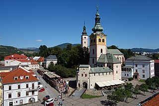
The Town Castle in Banská Bystrica, a characteristic landmark and symbol of the historical center of Banská Bystrica with a typical silhouette of a pair of onion towers, situated at the top of the square. It is a national cultural monument.
Wikipedia: Mestský hrad v Banskej Bystrici (SK), Website, Url
2. Harmanecká jaskyňa
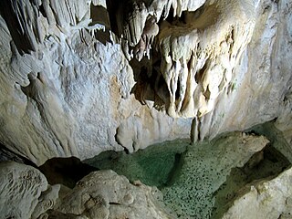
Harmanecká Cave or Harmanec Cave is a stalactite cave in Central Slovakia. It is located on the northern side of the Kotolnica massif in the Staré Hory and Kremnica mountain ranges and south of the Veľká Fatra mountains. The closest villages are Harmanec and Dolný Harmanec; Banská Bystrica is around 16 km south east of the cave. It is formed from Middle Triassic dark-grey Gutenstein limestone with an estimated age of 220 million years. The entrance to the cave is situated at an altitude of 821 m and 260 m above the bottom of the Harmanec valley.
3. Hrb
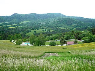
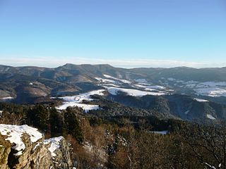
Hrb (1,254.7 m above sea level) is a forested hill in the northern part of the Poľana Mountains. It lies above the village of Strelníky, approximately 15 km southwest of Brezno. The hump is the geographical center of Slovakia, calculated using geometric intersections.
4. Svrčinník
Svrčinník (1,312.8 m above sea level) is the second highest peak of the Kremnica Hills. It lies above the village of Dolný Harmanec, approximately 12 km northwest of Banská Bystrica. The marked tourist highway Cesta hrdinov SNP passes through the top.
5. Hájny grúň
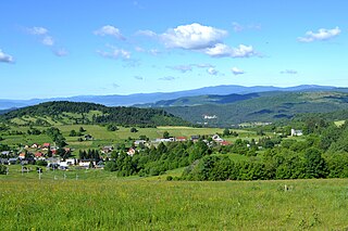
Hájny grúň (1,207.7 m above sea level) is a hill in the northern part of the Poľana Mountains. It lies above the village of Strelníky, approximately 15 km southwest of Brezno. It is part of the Poľana Protected Landscape Area.
6. Hvezdáreň v Banskej Bystrici
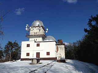
The observatory in Banská Bystrica is "a specialized cultural and educational facility whose aim is to spread and promote astronomy and related natural and technical sciences among the general public with an emphasis on children and youth." In 2005, it became an organizational part of the Regional Observatory and Planetarium of Maximilián Hell in Žiar nad Hronom. It develops its activities at the observatory in Vartovka, but also elsewhere.
7. Zadný Japeň
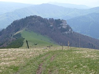
Zadný Japeň is a peak in the Great Fatra in Slovakia. It is the southernmost peak in the massive ridge of the Japeň peak, or Malá Krížna The ridge stretches in a north-south direction, it is sharply bordered by the Turkish Valley, the Bystrica Valley and the valley of the Starohorský Stream. Along the hillside and through the tunnel runs the railway line No. 170 Zvolen - Vrútky.
8. Líška
Liška is a mountain in the Great Fatra Mountains in Slovakia. It is located in a ridge that juts out southeast from Krížna Mountain. Rozsocha continues to the top of Majerova skála and descends into the valley of the Starohorský brook. The southern and western slopes of the mountain fall into the Turkish Valley, the northeast into the Rybie Valley. Just below the top is the upper station of the chairlift, which connected the settlement of Turecká with the Great Fatra ridge, but it has been out of operation for many years. In 2005, the building even burned down.
9. Motyčianska hoľa
Motyčianska hoľa or older Motyčská hoľa (1,292.4 m above sea level) is a partially mountainous hill in the Great Fatra. It is located west of Donovaly, in the ridge between the saddle of Veľký Šturec and the hill of Zvolen.
10. Predný Japeň
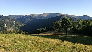
Japeň or Predný Japeň is a peak in the Great Fatra in Slovakia. A detached, massive peak in the southern part of the Great Fatra separates the Starohorská, Bystrická and Turkish valleys. The peak is not located on the main ridge, it is connected by a lowered ridge that stretches northwest to the top of Malá Krížna. The massif of the Japeň peak is formed by rocks of the original Krížňanský nappe and is heavily forested. The vegetation consists mostly of beech, on the top meadows there are massive solitary maples.
11. Baník
Baník (1,055.9 m above sea level) is a hill in the Starohorské Hills. It lies above the village of Donovaly, approximately 12 km northeast of Banská Bystrica. On its northern slopes there is a ski resort Záhradište.
Share
How likely are you to recommend us?
Disclaimer Please be aware of your surroundings and do not enter private property. We are not liable for any damages that occur during the tours.
