24 Sights in Witów, Poland (with Map and Images)
Legend
Welcome to your journey through the most beautiful sights in Witów, Poland! Whether you want to discover the city's historical treasures or experience its modern highlights, you'll find everything your heart desires here. Be inspired by our selection and plan your unforgettable adventure in Witów. Dive into the diversity of this fascinating city and discover everything it has to offer.
1. Rakoń / Rákoň
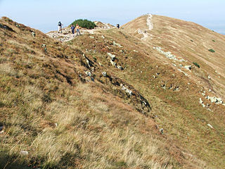
Rakoń – a poorly distinguished peak in the Western Tatras, located in the northern side ridge of Wołowiec. The Polish-Slovak border runs through this ridge. Rakoń is separated from Wołowiec by a small Zawratie Pass, over which it rises only 16 meters, and towards the neighboring Grześ in the southern direction runs the ridge of Długi Upłaz with the Łuczniańska Pass. To the north-west, another ridge branches off from Rakoń – the north-western ridge of Rakoń, separating the Slovak valleys: Łatana and Rohacka. Its eastern slopes fall to the Chochołowska Wyżnia Valley.
2. Končistá / Kończysty Wierch
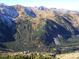
Kończysty Wierch or Kończysta nad Jarząbcza – a peak with a height of 2002 m in the Western Tatras, located in the main ridge of the Tatra Mountains, between Starorobociański Wierch, separated from it by Starorobociańska Przełęcz, and Jarząbczy Wierch, from which it is separated by Jarząbcza Przełęcz. The Polish-Slovak border runs through these peaks and passes. Kończysty Wierch is a keystone peak – the northern ridge of Kończysta Wierch departs from it to the north, in which the peak of Czubik and Trzydniowiański Wierch stand out. This ridge separates the valleys: Starorobociańska and Jarząbcza. From the southern side, Kończysty Wierch rises above the Zadnia Raczkowa Valley. In addition to these three ridges, two more perches descend from Kończysta Wierch: in the north-west direction to the Jarząbcza Jarząbczy Kopieniec Valley, in the north-east to the Starorobociańska Valley, an unnamed perch forming the southern limit of the Dudowa Kotlina.
3. Deravá / Łopata
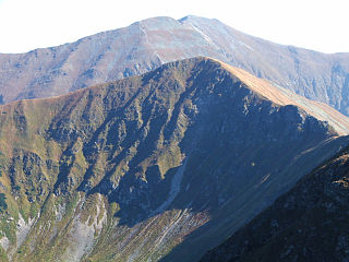
Łopata – a peak in the main ridge of the Western Tatras between Jarząbczy Wierch located to the east and Wołowiec located to the west. The origin of the name is unknown, it is not a folk name, it was not used by shepherds.
4. Witowski Przysłop
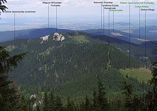
Przysłop Witowski – the peak of the Orawicko-Witowskie Wierchy. It is the southernmost peak in the main ridge of the Orawicko-Witowskie Wierchy, it is located between the Siwiańskie Turnie already located in the Tatras, from which it is separated by a wide and extensive pass Brama Orawska and Magura Witowska. About 50 m southwest of the top of Przysłop runs the Polish-Slovak border. The southern slopes of Magura Witowska fall into the Cicha Orava Valley, and the streams flowing from them feed the Cicha Woda Oravska, the northern to the Czarny Dunajec valley, the eastern to the stream flowing into the Czarny Dunajec. In the northern direction, the ridge of Hurchoci Wierch descends from Przysłop Witowskie to the valley of the Czarny Dunajec.
5. Kaplica pw. Świętego Jana Chrzciciela na Polanie Chochołowskiej
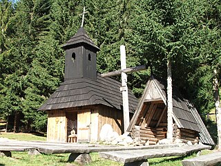
The Chapel on the Chochołowska Glade – a wooden chapel located near the forest, on the upper edge of the Chochołowska Glade in the Chochołowska Valley in the Western Tatras. It is built in the highlander style of unpainted boards, covered with black wooden shingles. Its dome is topped with a cross made of raw, unplaned wood.
6. Suchy Wierch Ornaczański
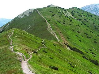
Suchy Wierch Ornaczański – one of the peaks of the Ornak mountain ridge in the Western Tatras, separating the upper part of the Kościeliska Valley from the upper part of the Chochołowska Valley. It is located in the northern ridge of Siwe Zwornik.
7. Jamska Czuba
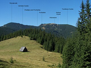
Jamska Czuba – a montane hill on the eastern slopes of the Chochołowska Valley in the Polish Western Tatras. It is located at the lower end of the ridge forming the northern border of the Dudowa Valley. It is separated from Spalona Czuba, the neighboring and higher hill in this ridge, by the Jamskie Siodło pass. On this pass and in its vicinity there is a Jamy clearing, from which the name of the peak was created. The name Jamska Czuba was artificially introduced on maps, by highlanders it was called Gronka kopa.
8. Suchy Wierch
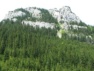
Suchy Wierch – the highest peak of the Stoly massif rising on the western side of the Kościeliska Valley in the Western Tatras. To the north, its slopes descend to the Przysłop Kominiarski Pass (1128 m), from the south to the Żeleźniak Gully, from the west to the Zabik Gully. In addition, in the southern direction, the ridge of Maturowe Stoly departs from the top, connecting with the Raptawicka Ridge through the Pass to Stawek
9. Siwiańskie Turnie
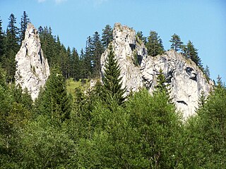
Siwiańskie Turnie – a group of rock spires in the northern ridge of Wołowiec in the Western Tatras, located between Mała Furkaska and the Orava Gate. They orographically close the mouth of the Chochołowska Valley on the left side. They are located slightly above the upper end of the Molkówka clearing, already in the Tatra National Park. It is very easy to enter them from the Molkówka clearing, while they descend to the bed of the Chochołowski Stream with vertical walls. There are very difficult climbing routes on them, but climbing is prohibited. They rise to a height of about 100 m above the valley floor, and their tops are 1065 m above sea level. The Great European Watershed also runs along this ridge between the Black Sea and the Baltic Sea basin.
10. Wyżnia Chochołowska Brama
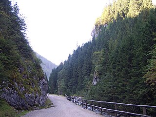
Wyżnia Brama Chochołowska – a narrow, dolomite rock gate in the Chochołowska Valley in the Western Tatras. They are located at an altitude of about 1030 m above sea level, on the section between Polana pod Jaworki and the forester's lodge of the Tatra National Park. They are formed by the heads of the ridges of Kominiarski Wierch and Bobrowiec, in which the Chochołowski Potok carved a gorge. Part of its waters disappears here in the ponora, flowing through underground cracks washed into the rock, and flows only lower in the Chochołowskie Spring. In the steep walls of the Bobrowiec massif, there is the largest cave of the Chochołowska Valley – the Chochołowska Rift and several smaller caves. Directly above the Wyżnia Brama Chochołowska on the west side, there are the Olejarnia and Zawista crags. On the eastern side, on the slope of Kominiarski Wierch, at the outlet of the Dudziniec valley, there is the shelter cave in the Wyżnia Brama Chochołowska.
11. Czerwony Wierch
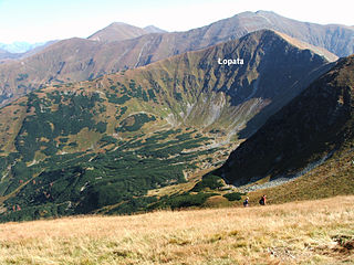
Czerwony Wierch – a hill in the side arm of the Łopata (1958 m) in the Western Tatras, descending from the top to the Chochołowska Valley. This arm separates the Jarząbcza Valley from the Chochołowska Wyżnia Valley. The ridge and the upper part of the slopes of Czerwony Wierch are grassy and overgrown with blackberries. The northern slopes called Hotarz are covered with natural forest. In the eastern and northern slopes of the gullies: Trojaki, Dwoaki, Skrajny Żleb, Pośredni Żleb and Mokrzyniec.
12. Spalona Czuba
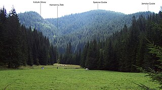
Spalona Czuba – a not very prominent montane peak in a side ridge departing from Mały Opalony Wierch in the north-western direction to the bottom of the Chochołowska Valley in the Polish Western Tatras. This ridge separates the Dudowa Valley from the Huciańska Valley. The top of Spalona Czuba is rocky, the slopes are covered with forest. From the side of the Dudowa Valley, the foothills are steeply undercut and form the eastern gate of the Międzyściany gorge. There are several caves in them. From the opposite side, they descend to the Stone Gully. On the north-western foothills of Spalona Czuba and on the Jamskie Siodło pass separating Spalona Czuba from Jamska Czuba, there is a Jamy clearing.
13. Parzątczak
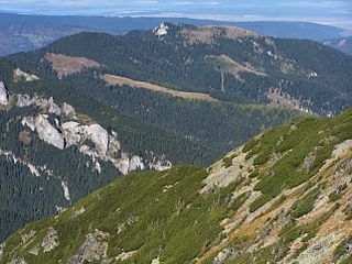
Parzątczak – an unremarkable peak with a height of 1486 m in the northern ridge of Wołowiec in the Western Tatras. It is located in this ridge between Bobrowiec, separated from it by the outstanding Juraniowa Pass, and Furkaska, from which it is separated by the shallow Pass under Furkaska. The Polish-Slovak border runs through this ridge, as well as the Great European Watershed between the Black Sea and the Baltic Sea. There are 2 side arms from Parzątczak: from the peak to the east, the Przysłop ridge, separating the Długa Valley from the Głębowiec Valley, from the ridge between Parzątczak and Juraniowa Przełęcz, a short perch of Wałowiec departs to the north-west, separating the main course of the Juraniowa Valley from its branch – the Jaworzynka Juraniowa Valley.
14. Cisowa Turnia
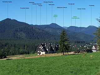
Cisowa Turnia – a montane peak rising on the southern side above the Biały Potok and Siwa Polana clearings in the Polish Western Tatras. It is the end of the north-western ridge of Kominiarski Wierch separating the Lejowa Valley from the Chochołowska Valley. The Macicki Żleb cuts into the western slopes of Cisowa Turnia.
15. Jamborowy Wierch
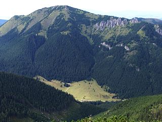
Jamborowy Wierch or Jamburowa Czuba – a poorly separated peak in the south-western ridge of the Bobrowiec massif in the Western Tatras, between the peak of Bobrowiec and the prominent Bobrowiecka Pass. Jamborowy Wierch culminates at the point where this ridge breaks. From the eastern, Polish side, its slopes descend to the Chochołowska Valley. In the north-western direction, the side ridge of Jambora departs from it through Jamborowa Skałka to Jeżowy Wierch. This ridge separates the Bobrowiecka Valley from the Juraniowa Valley.
16. Kopa Prawdy
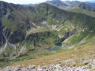
Kopa Prawdy – a small uplift in the main ridge of the Western Tatras between Jarząbcza Przełęcza and Jarząbczy Wierch. Its north-western slope descends steeply to Jarząbcza Równia in the Jarząbcza Valley. It is very steep and cut with numerous furrows. This slope is called Koryciska. Towards the south-east, it forms a short perch descending to the glacial cauldron of the Zadní Raczkowa Valley.
17. Koryciańska Czuba
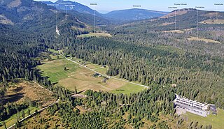
Koryciańska Czuba – a montane peak in the long northern ridge of Wołowiec in the Western Tatras, between Furkaska and Mała Furkaska. The Polish-Slovak border and the Great European Watershed between the Baltic and Black Seas run through it. In the eastern direction, a winding ridge stretches from Koryciańska Czuba, separating two side branches of the Chochołowska Valley: Wielkie Koryciska and Małe Koryciska. On the Slovak side, to the Cicha Orava Valley, one of the two branches of the Bratraniec couloir descends from Koryciańska Czuba.
18. Hrubas
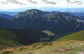
Hrubas – a poorly distinguished peak with a height of 1499 m above sea level in the eastern ridge of the Bobrowiec massif in the Polish Western Tatras. This ridge separates the main course of the Chochołowska Valley from its branch – the Głębowiec Valley. Just below the top of Hrubas, on the southern side of the ridge, there are dolomite-limestone rocks called Stoves. On Hrubas, the ridge changes direction to the north-east. One of the branches of the Szeroka Żleb and the Skrajniak couloir descend to the Głębowiec valley from Hrubas, an unnamed gully also descends from the opposite slopes. In the past, the section of the eastern ridge of Bobrowiec was called Hrubas Jaworzyński. Upłaz on the northern side of the initial section of the eastern ridge of Bobrowiec is called Hrubasowy Upłaz. On this uphill, the occurrence of a rare plant in Poland – the mountain squirrel was found.
19. Diabliniec
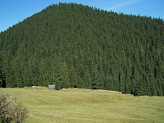
Diabliniec – a montane peak in the western slopes of the Lejowa Valley in the Polish Western Tatras. It is protruding from these slopes to the east. From Wierch Spalenisko Diabliniec is separated by a fairly deep pass by the Kominiarskie Siodło. The Lejowy Potok flows around it from three sides; southern, eastern and northern.
20. Wierch Spalenisko
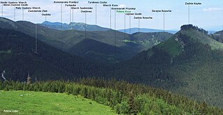
Wierch Spalenisko – a montane peak in the ridge separating the Lejowa Valley from the Chochołowska Valley in the Polish Western Tatras. It is separated from the Kuc Peak located below in this ridge by a slight pass Huciańskie Siodło, from the Kominiarska Pass located above Mały Opalony Wierch, through which a tourist trail leads. Wierch Spalenisko is the keystone; in the eastern direction, a short side ridge departs from it, connecting it through the Kominiarskie Siodło pass with Diabliniec. From the eastern side, Wierch Spalenisko rises above the Lejowa Valley, from the west over the Huciańska Valley. It is completely covered with forest.
21. Zadnia Rosocha
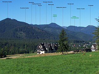
Zadnia Rosocha – a peak in the ridge rising between the Lejowa Valley and the Chochołowska Valley in the Polish Western Tatras. It is separated from the higher Wierch Kuc by the Lejowe Siodło pass, and from the lower Skrajna Rosocha by the Rosochowate Siodło pass. The eastern slopes of Zadnía Rosocha descend to the Lejowa Valley. In the north-western direction from its top, a perch branches. On the southern side of this perch there is the Great Dry Valley, on the northern side of the Rosochowaty Gully descending into the Great Dry Valley.
22. Mała Furkaska

Mała Furkaska – a montane peak above the Chochołowska Valley in the Polish Western Tatras. It is located in the northern ridge of Wołowiec between Koryciańska Czuba and Siwiańskie Turnia. The Polish-Slovak border runs through the peak of Mala Furkaska. The southern slopes descend to the Polish valley of Malé Koryciska, the northern slopes to the Slovak valley of Cicha Orava.
23. Mały Opalony Wierch
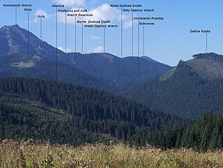
Mały Opalony Wierch – a montane peak in the ridge separating the Lejowa Valley from the Chochołowska Valley in the Polish Western Tatras. It is separated from the Spalelisko Peak located below in this ridge by the Kominiarska Pass, and from the Wielki Opalony Wierch located above by the Niżnie Dudowe Siodło Pass. It is the keystone; in the north-western direction, a side arm separating the Dudowa Valley from the Huciańska Valley departs from it to Spalona Czuba and Jamska Czuba. Thus, Mały Opalony Wierch rises above three valleys: Lejowa, Dudowa and Huciańska.
24. Klinowa Czuba
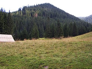
Klinowa Czuba – a montane hill in the Western Tatra Mountains, surrounded by the Chochołowska Valley. From the southern side of Klinów, the Czuba rises above the Huciańska Valley, in the northern direction it forms a ridge that separates the main course of the Chochołowska Valley from its branch – the Great Dry Valley. The lower part of this ridge from the side of the Chochołowska Valley is also indented by the Koziniecki Żleb, parallel to it. In the eastern direction, the Klinowe Siodło Pass separates Klinowa Czuba from Wierch Kuca.
Share
How likely are you to recommend us?
Disclaimer Please be aware of your surroundings and do not enter private property. We are not liable for any damages that occur during the tours.