11 Sights in Szczawnica, Poland (with Map and Images)
Legend
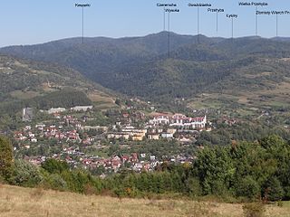
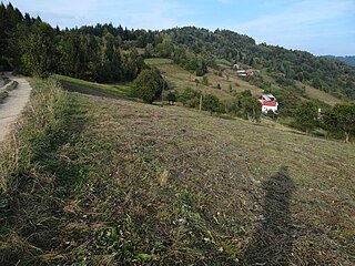
Welcome to your journey through the most beautiful sights in Szczawnica, Poland! Whether you want to discover the city's historical treasures or experience its modern highlights, you'll find everything your heart desires here. Be inspired by our selection and plan your unforgettable adventure in Szczawnica. Dive into the diversity of this fascinating city and discover everything it has to offer.
1. Palenica
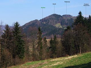
Palenica – a peak in the Małe Pieniny Mountains, separated by the Maćkówki Pass from the main ridge. At the top there is the "Groń" shelter, catering facilities and a wheelchair slide. From Szczawnica, you can get to the top by chairlift managed by the Polish Cable Railways. On the slopes of the mountain there is the Palenica Ski Station, with two ski runs, the red route – "Palenica 1" is one of the most interesting ski routes in Poland.
2. Bryjarka
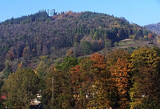
Bryjarka – an unremarkable mountain peak in the Beskid Sądecki towering over Szczawnica. The name comes from the fields formerly located next to the top, the name Światkówka, which also came from the name of the farmland, was also used. Eugeniusz Janota states that originally the peak was called Skałka.
3. Bereśnik
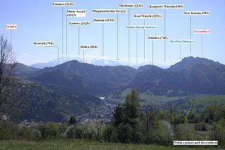
Bereśnik – a peak in the Radziejowa Range in the Beskid Sądecki. It is located on the south-eastern ridge of Przysłop. This ridge through Kotelnica, Cieluszki, Bereśnik, Gucka and Bryjarka descends to the Grajcarek valley in Szczawnica, separating the valley of the Sopotnicki Potok from the valley of the Skotnicki Potok and its tributary – the Czarny Potok. On the Geoportal map, the peak of Bereśnik is described as Mount Popa.
4. Jarmutka
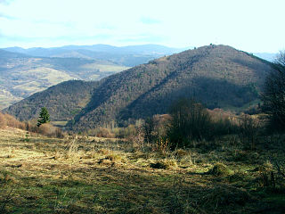
Jarmutka – a low mountain in the Little Pieniny Mountains, on the north-western side of Jarmuta. The western slopes of Jarmutka fall to the Valley under Jarmuta, the northern slopes to the Grajcarka Valley. From the pass separating Jarmutka from Jarmuta, a narrow and grassy valley called the Bednarzowska Valley descends to the Pod Jarmutą Valley, on the northern side Jarmutka is separated from Jarmuta by a gully called the Agricultural Valley. In addition, the entire mountain is covered with forest, mainly a complex of Carpathian beech with an admixture of pine.
5. Koszarki
Koszarki – a peak in the Radziejowa Range in the Beskid Sądecki. It is located in a ridge diverging south-west from the keystone lying south-west of the top of Czeremcha. The Koszarki massif is flowed from the north and west by the Jastrzębi Potok, and from the south by the Potok pod Górami. On the slopes, especially the southern one, there are clearings, such as Białońki.
6. Lažna Skala / Łaźne Skały
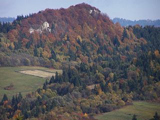
Łaźne Skały or Łaźnia Skała – a peak in the main ridge of the Little Pieniny between the peaks of Załazie and Cyrhle. Other sources give the height of the peak as 775 m above sea level. The Polish-Slovak border runs through it. It forms a long and narrow ridge, which is undercut from the southern, Slovak side, and from the east by steep walls about 25 m high. On these walls there is an interesting flora of limestone rock plants, and in spring the rock maggot blooms here in large numbers. The peak is built of gray hornwort and pharmacy limestones.
7. Groń
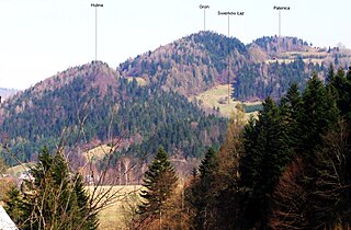
Groń – a forested peak in the Małe Pieniny Mountains. Józef Nyka gives its height as 719 m, the Geoportal map as 681 m. It rises 250 m northwest of Palenica. To Szczawnica, and more precisely to Grajcarek, it descends along a steep slope called Hulina. In this slope, at an altitude of 590 m, there is a terrace with the Hulina housing estate. Between Groń and Palenica, at an altitude of 660 m, there is a second, several-house housing estate called Groń. In the north-eastern direction, below the top of Groń, there is another deforested peak on the north side called Nizhny Groń.
8. Biała Skała
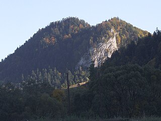
Biała Skała – a rock on the slope of Kaczy in the Little Pieniny Mountains, located by the Pieniny Road and closing the mouth of the Pieniny Gorge from the east. It is very well visible even from the bridge in Krościenko. It rises to a height of about 665 m above sea level and is built of hornwort limestone of the Pieniny series. From the side of the Pieniny Road, it has a relative height of about 130 m and is very steep, almost vertical. Before World War II, there was a marked tourist, very steep ascent to its top, leading through the forest from the north to the pass between Bystrzyk and Biała Skała. Currently, this trail does not exist.
9. Gucka
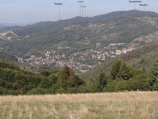
Gucka – a peak in the Beskid Sądecki. It is located on the south-eastern ridge of Przysłop in the Radziejowa Range. This ridge through Kotelnica, Cieluszki, Bereśnik, Gucka and Bryjarka descends to the Grajcarek valley in Szczawnica. Between Bereśnik and Gucka, the ridge runs in the south-western direction, at the top of Gucka it turns south. The south-eastern slopes of Gucka are mostly forestless, occupied by fields and buildings of the Język housing estate belonging to Szczawnica. The slopes of the valley of Szczawny Potok cut into them. The summit and western slopes are forested and descend to the valley of the Black Stream. In the past, these slopes were also more forestless, on the aerial photos of the Geoportal maps you can see clearings overgrown with forest, the Tomaszówka clearing on the south-western slopes of Gucka has still remained.
10. Vitkuľa / Witkula
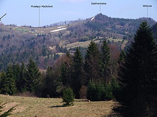
Witkula – a peak with a height in the Little Pieniny Mountains in their main ridge. It is located in this ridge about 300 m south-east of Szafranówka, separated from it by a small and grassy pass. Witkula forms a narrow and rocky ridge forested with shrubs and dwarf trees. The Polish-Slovak border runs through this ridge. The top of Witkula is rocky, but without views, because it is obscured by bushes. On the eastern side, the ridge of Witkula descends to the pass called Danielka, from which there are views of Jarmuta and Szczawnica.
11. Cieluszki
Cieluszki – a peak and clearing in the Beskid Sądecki. It is located on the south-eastern ridge of Dzwonkówka in the Radziejowa Range. This ridge through Kotelnica, Cieluszki, Bereśnik, Gucka and Bryjarka descends to the Grajcarek valley in Szczawnica. On the Geoportal map, the peak of Cieluszki is described as Bereśnik.
Share
How likely are you to recommend us?
Disclaimer Please be aware of your surroundings and do not enter private property. We are not liable for any damages that occur during the tours.
