16 Sights in Jaworki, Poland (with Map and Images)
Legend
Welcome to your journey through the most beautiful sights in Jaworki, Poland! Whether you want to discover the city's historical treasures or experience its modern highlights, you'll find everything your heart desires here. Be inspired by our selection and plan your unforgettable adventure in Jaworki. Dive into the diversity of this fascinating city and discover everything it has to offer.
1. Wąwóz Homole
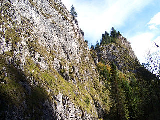
The Homole Gorge is a gorge in the southern Polish Pieniny Mountains, more precisely in the Małe Pieniny Mountains, in the village of Jaworki near Szczawnica. The name comes from the Russian word homoła, gomoła, which means round, hornless. It is about 800 m long.
2. Watrisko
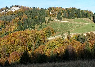
Watrisko – a rocky peak in the Little Pieniny Mountains. It is located between Smerekowa and Wierchliczka, but it is not located like these two peaks in the main ridge of the Little Pieniny, but about 150 m north of it. From Watrisko in the north-western direction runs a small side ridge of the Little Pieniny with the peaks of Repowa and Skalskie. Watrisko and the entire side ridge of Repowa are drained by the Skalski Potok and the Cold Well Stream.
3. Vrchriečky / Wierchliczka
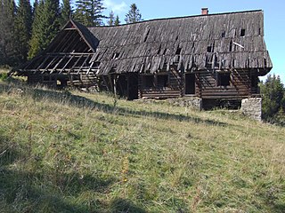
Wierchliczka, 963 m - a peak in the main back of the small Pieniny, located between the distance pass and Watrisko. It is the furthest to the east of the Polish Small Pieniny. Its top is called Skałka. Slovak-Polish border runs through it. The southern, Slovak slopes of Wierchliczka are covered with forest and are part of the Pienap. On the north, the Polish side under the peak is a large glade of stack with views of Beskid Sądecki. Further on a small lane of the forest and again large and discovered slopes falling into the Valley Biała Woda. Both the clearing and the discovered slopes around the pass are separated by the former arable fields of the now -defunct village of Biała Woda. After the war and the displacement of the Lemkos inhabiting her, the fields were a great expenditure of the costs, a socialist cooperative and sheep breeding were founded on them. A large hut was built, which turned out to be impractical and was not used. Currently, there are decaying ruins near the forest near the pass. Sheep and cows are grazed in the great pastures by shepherds from Podhale. Some arable fields in the back from Wierchliczka to Wysoka were forested with larch, pine and spruce.
4. Ruski Wierch
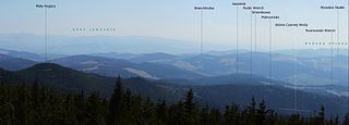
Ruski Wierch – a peak in the Beskid Sądecki, on the southern side of the Radziejowa Range. It is located in the side ridge of this range, departing from Mały Rogacz in the southern direction. It includes: Pokrywisko, Ruski Wierch and Jasielnik. This ridge separates the upper part of the Czarna Woda valley and the valley of the Rogacz stream. The Potok near Jasielnik, cutting into the southern slopes of Jasielnik, divides it into two arms: in the western one there is Rusinowski Wierch, in the eastern one Jasielnik and Flader.
5. Borsuczyny
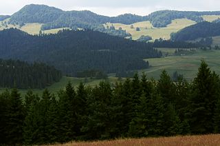
Borsuczyny – a peak in the Little Pieniny Mountains, 939 m high. It is a steep and rocky peak covered with spruce forest, not much higher than the ridge of the Little Pieniny Mountains. In the direction from Borsuczyn to Wysoka there is the Stachurówki Pass, behind it a short ridge and the second Kapralowa Wysoka Pass. The Slovak-Polish border runs through these peaks and passes. On the southern, Slovak side, the slopes of the ridge are covered with forest and belong to PIENAP, on the Polish, northern side, they are wooded only in the top parts. Below there is a large Kiczera mountain pasture – the remains of former Lemko farmlands from the village of Jaworki. The tourist trail leads through the top of Borsuczyn, but on the northern side there is a shortcut path trodden by tourists, allowing you to go around the peak without having to climb it. The ascent to and descent from the summit is steep and rocky.
6. Flader
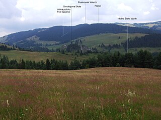
Flader - a peak in the Radziejowa band in the Beskid Sądecki. It is located in the side ridge of this band, departing from a small cuckold in the south. It stands out in it: the back of the lid, Ruthenian Wierch, Jasielnik and Flader. The western and southern slopes of Fladra fall into white water, which at the Kociubielska Skala comes a bow. Eastern slopes fall into a small stream near Jasielnik, escaping into white water.
7. Repowa
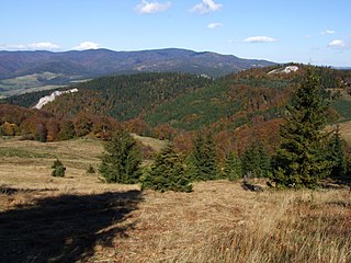
Repowa – the middle of the three peaks of the side ridge diverging from the main ridge of the Little Pieniny to the north-west. The other two are: Watrisko located near the main ridge and Skalskie above the Biała Woda valley. Repowa is 918 m above sea level and is completely covered with forest. At its eastern foothills flows the Cold Well Stream, at the western bottom of the valley Skalskie Skalski Potok. On the western slopes there are characteristic white limestone rocks called Platypus Rocks. There are no tourist trails leading through it, but from the vicinity of the pass under Watrisk, a forest road leads along its eastern slopes, leading to Smolegowa Skała in the Biała Woda nature reserve.
8. Homole
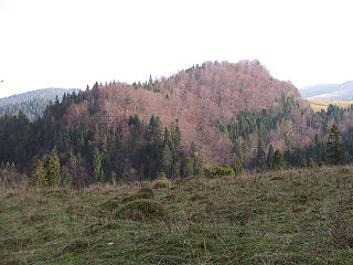
Homole – a not very prominent peak in the Little Pieniny Mountains located above the famous Homole Gorge, where the Homole Gorge nature reserve is located. The Homole peak is no longer located in this reserve. Together with the higher located Skała, it is located in a side ridge separating Dunantowska Dolinka from the Koniowiec valley. It is mostly covered with mixed beech and spruce forest. On the south-eastern slopes below the summit there is the lower part of the Kiczera clearing with the only house in the entire area. On this clearing and on the Glade under Wysoka there is a cultural grazing. The peak is drained by the Koniowiec and Kamionka streams, both of which are tributaries of Grajcarek.
9. Vysoké Skalky / Wysoka
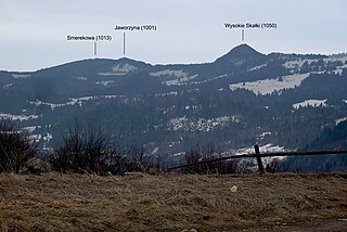
Vysoké skalky (1,049.8 m above sea level) is the highest peak of the Pieniny Mountains, a landscape unit of the Eastern Beskids. They are located on the Slovak-Polish border, approximately 12 km northwest of Stará Ľubovňa and are part of the Pieniny National Park.
10. Bukowinki
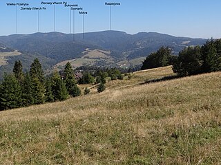
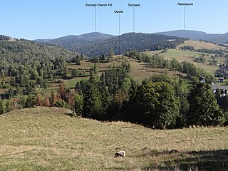
Bukowinki or Bukowina – a peak in the main ridge of the Radziejowa Range in the Beskid Sądecki. It is located between the southern peak of Złomisty Wierch and the Long Pass. It is a forested and completely unremarkable peak, but it is of great topographical importance, as it is the keystone for two side ridges diverging from it to the south: a short ridge with the Mokra hill. It separates the valley of the Kotelniczy Potok from the Czarna Woda, a longer ridge with the Świniarka hill, separating the valley of the Old Stream from the valley of the Czarna Woda and Kotylniczy Potok.
11. Mokra
Mokra – a peak in the Beskid Sądecki, in the Radziejowa Range. It is the culmination of a short, side ridge diverging from Bukowinek to the south. It stretches between the valleys of the Kotelniczy Potok in the west and the Czarna Woda in the east, until they join. The slopes are generally forested, several clearings are located on the southern slope – most at an altitude of 900-960 m, while the Świniarki clearing covers the slope from 770 to 800 m. There are no tourist trails running through the ridge of Mokra.
12. Szczob
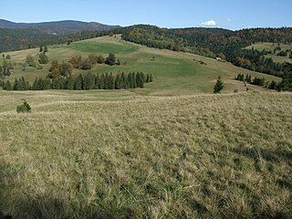
Szczob – a peak located in the ridge connecting the Beskid Sądecki with the Little Pieniny Mountains through the Splits Pass. On the section from the Gromadzka Pass to the Splits Pass, there are 3 very unremarkable peaks: Hurcałki, Syhła and Szczob. The Polish-Slovak border runs along this ridge, and at the top of Szczoba there is a border post No. 69/2. The western (Polish) slopes descend to the valley of the Rogacz stream, the eastern (Slovak) slopes to the valley of the Wielki Lipnik stream. On the Slovak slopes of Šōba, there are exposed limestone rocks and the Litmanovská Ice Cave, which is difficult to find, as well as the Litmanovská Ice Cave, which is not open to tourists.
13. Bereśnik
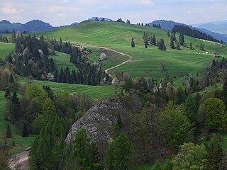
Bereśnik – a forestless hill in the orographically left slopes of the Biała Woda valley in the village of Jaworki in the Małe Pieniny. It is located between Smolegowa Skała and Skalskie Mountain. The relative height of Bereśnik above the bottom of Biała Woda is about 150 m.
14. Jasielnik
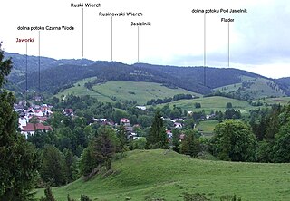
Jasielnik – a peak in the Beskid Sądecki, on the southern side of the Radziejowa Range. It is located in the side ridge of this range, departing from Mały Rogacz in the southern direction. Below Ruski Wierch, this ridge branches. Orographically, the left arm descends further in the southern direction through Jasielnik and Flader to the valley of Biała Woda. The eastern slopes of Jasielnik fall to the valley of Biała Woda, which flows around this ridge on two sides, the western slopes to the valley of the Pod Jasielnik stream.
15. Pokrywisko
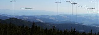
Pokrywisko – a completely unremarkable peak in a side ridge on the southern side of the Radziejowa Range in the Beskid Sądecki. This ridge, descending from Mały Rogacz in the south-western direction through Pokrywisko to Ruski Wierch, separates the valley of Czarna Woda from the Rogacz stream. On the maps, Pokrywisko is marked as a peak, but in fact it is a ridge. It is one of the best viewpoints.
16. Opołta
Opolta – a peak in the Beskid Sądecki, in the Radziejowa Range. It rises above the church in Jaworki and is the end of the ridge diverging from Bukowinki. The western slopes of Opołta fall to the valley of Stary Potok, the eastern slopes to the valley of Czarna Woda, the southern slopes to the valley of Grajcarek.
Share
How likely are you to recommend us?
Disclaimer Please be aware of your surroundings and do not enter private property. We are not liable for any damages that occur during the tours.
