16 Sights in Minakami, Japan (with Map and Images)
Legend
Welcome to your journey through the most beautiful sights in Minakami, Japan! Whether you want to discover the city's historical treasures or experience its modern highlights, you'll find everything your heart desires here. Be inspired by our selection and plan your unforgettable adventure in Minakami. Dive into the diversity of this fascinating city and discover everything it has to offer.
1. Mt. Hotaka
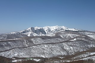
Mount Hotaka is a stratovolcano with its highest peak at the altitude of 2,158m. It is located near Minakami-machi, Kawaba Village, and Katashina Village in the Gunma Prefecture. In order to distinguish it from Mount Hotakadake in the Northern Alps, it is also called as Joshu Hotakayama(上州武尊山). This mountain has been selected as one of "100 Famous Japanese Mountains" and the "New 100 Famous Flower of Japanese Mountains".
2. Mt. Mantaro
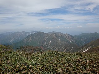
Mt. Mantaro is a mountain located in the Mikuni Mountains, straddling the town of Minakami in Tone District, Gunma Prefecture and the town of Yuzawa in Minamiuonuma District, Niigata Prefecture. It is 1,956 m above sea level and belongs to the branch peak of Mt. Tanigawa. There is a Kanetsu Tunnel of the Kanetsu Expressway nearby, and a ventilation tower exists on the mountainside. It is a "Gunma Prefectural Border Ridgeline Trail" course.
3. Mt. Shigekura
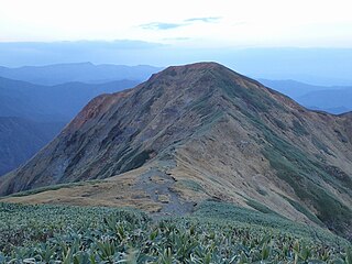
Mt. Shigekura is a mountain in the Mikuni Mountains on the border of Gunma and Niigata prefectures. The surrounding Mt. Tanigawa, Mt. Mantaro, and Mt. Sennokura are collectively called the Tanigawa mountain range.
4. Mt. Mikuni
Mt. Mikuniyama is a mountain located between the town of Minakami in Tone District, Gunma Prefecture and the town of Yuzawa in Minamiuonuma District, Niigata Prefecture. The altitude is 1,636 m. This highest point is in Gunma Prefecture, which is just a short distance from the prefectural border. It is located a little off the Joetsu border ridgeline, where Mt. Tanigawa and Mt. Hirashi are located.
5. 丹後山
Mt. Tango is a mountain located on the border between Minamiuonuma City, Niigata Prefecture and Minakami Town, Tone District, Gunma Prefecture, and is located at the central watershed with an altitude of 1,808.5 meters. At Gunma Hyakumei Mountain, Tone River Water Source Monument It is also a climbing route.
6. 名胡桃城
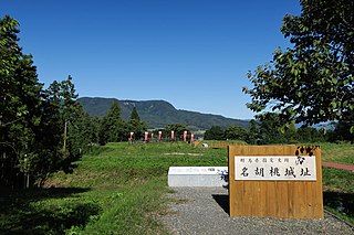
Nagurumi Castle is a castle structure in Tone, Gunma Prefecture, Japan. The castle played historically important role because invasion of the castle by the Later Hōjō clan caused Siege of Odawara (1590).
7. 大烏帽子山
Mount Oeboshi is located on the border between Minakami Town in Tone District, Gunma Prefecture, and Minamiuonuma City in Niigata Prefecture. It serves as a central watershed and has an elevation of 1,819.5 meters. It surrounds the source of the Tone River and is also part of the Gunma Prefecture Natural Environment Conservation Area (the eastern face of Asahidake and Shirakabemon).
8. 柄沢山
Karasawayama is a mountain located on the border between Minamiuonuma City, Niigata Prefecture and Minakami Town, Tone District, Gunma Prefecture, and is located at the central watershed and is 1900.2 meters above sea level. It becomes a mountain that surrounds the headwaters of the Tone River.
9. Mt. Kasagatake
Kasagatake is a mountain located in the town of Minakami in Tone District, Gunma Prefecture, Japan, with an altitude of 1,852.1 meters. It is also a Gunma Hyakumei Mountain, and it is also the "Gunma Prefecture Border Ridgeline Trail" Tanigawadake / Horseshoe Traversal Course and Gunma Prefecture Natural Conservation Area (Asahidake / Shiragemon Mountain East Face).
10. Mt. Inatsutsumi
Mt. Inatsumiyama is a mountain located in the towns of Minakami and Nakanojo in Azuma District, Gunma Prefecture, with an altitude of 1,598 meters. It is also a "Gunma Prefecture Border Ridgeline Trail" Mikuni Pass ~ Mt. Inabao Loop Course.
11. Mt. Bunou
Mt. Buno is a mountain located in the town of Yuzawa, Minamiuonuma District, Niigata Prefecture and the town of Minakami in Tone District, Gunma Prefecture, with an altitude of 1,760 meters. The eastern side of the ridge is designated as Joshinetsu Kogen National Park. In addition, it is also a horseshoe-shaped traversal course on the "Gunma Prefectural Border Ridgeline Trail" Tanigawadake and Horseshoe-shaped traversal course.
12. 檜倉山
Mt. Hinokigurayama is a mountain located on the border between Minamiuonuma City, Niigata Prefecture and Minakami Town, Tone District, Gunma Prefecture, and is located at the central watershed and is 1,744.2 meters above sea level. It becomes a mountain that surrounds the headwaters of the Tone River. Another name is Higurayama.
13. 小沢岳
Mt. Ozawa is a mountain located in Minamiuonuma City, Niigata Prefecture and Minakami Town, Tone District, Gunma Prefecture, and is a mountain that surrounds the headwaters of the Tone River. It is 1,946 meters above sea level. It is also known as Higashisawayama.
14. Mt. Shiragamon
Shiragamon is a mountain located in the town of Minakami in Tone District, Gunma Prefecture, at an altitude of 1,720 meters. It is also a Gunma Hyakumei Mountain, and it is also the "Gunma Prefecture Border Ridgeline Trail" Tanigawadake / Horseshoe Traversal Course and Gunma Prefecture Natural Conservation Area (Asahidake / Shiragemon Mountain East Face).
15. 三ツ石山
Mt. Mitsuishi is a mountain located in Minamiuonuma City, Niigata Prefecture and Minakami Town, Tone District, Gunma Prefecture, and is a central watershed that surrounds the headwaters of the Tone River. It is 1,586 meters above sea level. It is also known as Mt. Tamata.
16. Yaze Site
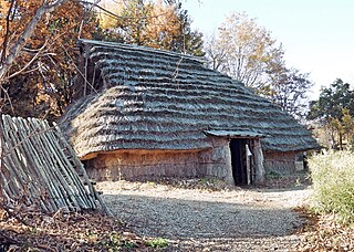
The Yaze ruins is an archaeological site with the ruins of a Jōmon period settlement located in what is now the Tsukiyono neighborhood of the town of Minakami, Gunma Prefecture in the northern Kantō region of Japan. The site was designated a National Historic Site of Japan in 1997.
Share
How likely are you to recommend us?
Disclaimer Please be aware of your surroundings and do not enter private property. We are not liable for any damages that occur during the tours.
