9 Sights in Mühlbach - Rio di Pusteria, Italy (with Map and Images)
Legend
Welcome to your journey through the most beautiful sights in Mühlbach - Rio di Pusteria, Italy! Whether you want to discover the city's historical treasures or experience its modern highlights, you'll find everything your heart desires here. Be inspired by our selection and plan your unforgettable adventure in Mühlbach - Rio di Pusteria. Dive into the diversity of this fascinating city and discover everything it has to offer.
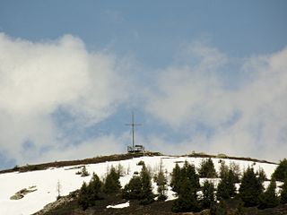
1. Stoanamandl
Mount Stoanamandl is a mountain in the Eastern Alps, more precisely in the Fundres Mountains, 2118 m high and located in the locality of Jochtal located between the valley of Valles and the village of Spinga.
2. Plattspitz - Cima Piatta
The Flat Peak, Plattspitz in German, is a mountain in the eastern Alps, precisely in the Fundres mountains located between the Valles Valley and the Eisack Valley, 2669 meters high. It is located in Jochtal in Valles. It cannot be reached by a path but is visible from Malga Fane and also in the valley; it can be seen from the Jochtal locality, which can be reached by cable car up to 2006 m.
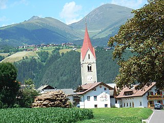
3. St. Rupert
The church of San Ruperto is the parish church of Spinga, a hamlet of Rio di Pusteria, in the autonomous province of Bolzano. It belongs to the deanery of Bressanone-Rodengo of the diocese of Bolzano-Bressanone.
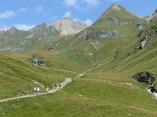
4. Rübespitz - Punta Riva
The Punta Riva, Rübenspitz in German, is a mountain in the Fundres mountains in the extreme north of the Valles Valley and the Val di Vizze, 2785 meters high. This is the last mountain north of the Cima di Valmala coast (Wurmaulspitz); to the south of it there is the Pfannelspitze and the Bressanone Refuge; it is separated to the east from the Cima di Valmala by the pass that leads to Val di Fundres.
5. Gaisjoch - Cima della Capra (Gurnatsch)
.jpg)
The Cima della Capra, Gajsjoch-Gurnatsch in German, is a mountain located between the Valles and Altfass Valleys, 2641 meters high. It is located on the east side of the valley, at the height of the Jochtal ski area, which is located on the west side. The summit can be reached via the ridge walk starting from the Altfass Valley.
6. Rensenspitz
The Rensenspitz is a mountain in the eastern Alps, precisely in the Fundres mountains located between the Valles Valley and the Eisack Valley, 2473 meters high. It belongs to a group of other peaks, the Flat Peak, the Narnspitz, the Settelspitz and the Schellenberg. It is located in Jochtal in Valles. It cannot be reached by a path and can be seen from the Jochtal locality, which can be reached by a cable car up to 2006 m.
7. Sattelspitz
The Settelspitz is a mountain in the eastern Alps, precisely in the Fundres mountains located between the Valles Valley and the Eisack Valley, 2454 meters high; it is located in a set of other peaks, the Cima Piatta, the Rensenspitz, the Narnspitz and the Monte Schellenberg, in the locality of Jochtal in Valles. It cannot be reached by a path and can be seen from the Jochtal locality, which can be reached by a cable car up to 2006 m.
8. Schellenberg
Mount Schellenberg is a mountain in the eastern Alps, precisely in the Fundres mountains located between the Valles Valley and the Eisack Valley, 2355 meters high; it is located in a group of other peaks, the Cima Piatta, the Rensenspitz, the Narnspitz and the Settelspitz, in the locality of Jochtal in Valles. It cannot be reached by a path and can be seen from the Jochtal locality, which can be reached by a cable car up to 2006 m.
9. Pfannespitz
The Pfannelspitze is a mountain in the Fundres mountains in the far north of the Valles Valley and the Fundres Valley, 2709 meters high. It is a mountain close to Punta Riva; it is separated from it to the east by the Cima di Valmala by the pass that leads to Val di Fundres.
Share
How likely are you to recommend us?
Disclaimer Please be aware of your surroundings and do not enter private property. We are not liable for any damages that occur during the tours.
