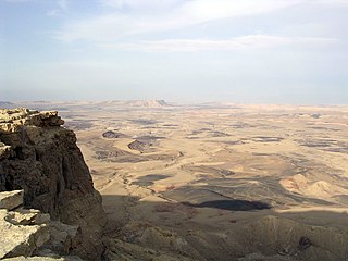
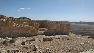
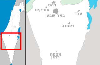
10 Sights in Ramat Negev Regional Council, Israel (with Map and Images)
Legend
Welcome to your journey through the most beautiful sights in Ramat Negev Regional Council, Israel! Whether you want to discover the city's historical treasures or experience its modern highlights, you'll find everything your heart desires here. Be inspired by our selection and plan your unforgettable adventure in Ramat Negev Regional Council. Dive into the diversity of this fascinating city and discover everything it has to offer.
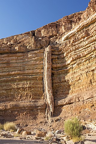
1. דייק
In geology, a dike or dyke is a sheet of rock that is formed in a fracture of a pre-existing rock body. Dikes can be either magmatic or sedimentary in origin. Magmatic dikes form when magma flows into a crack then solidifies as a sheet intrusion, either cutting across layers of rock or through a contiguous mass of rock. Clastic dikes are formed when sediment fills a pre-existing crack.
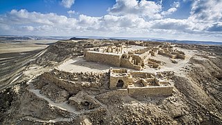
2. Avdat
Avdat or Ovdat, and Abdah or Abde, are the modern names of an archaeological site corresponding to the ancient Nabataean, Roman and Byzantine settlement of Oboda or Eboda in the Negev desert in southern Israel. It was inhabited with intermissions between the 3rd century BCE and the mid-7th century CE by Nabataeans, in their time becoming the most important city on the Incense Route after Petra, then by Roman army veterans, and Byzantines, surviving only for a few years into the Early Muslim period. Avdat was a seasonal camping ground for Nabataean caravans travelling along the early Petra–Gaza road in the 3rd – late 2nd century BCE. The city's original name was changed in honor of Nabataean King Obodas I, who, according to tradition, was revered as a deity and was buried there.
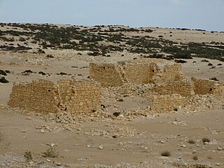
3. Shivta Ruins
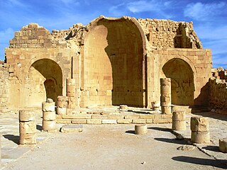
Shivta, originally Sobata or Subeita, is an ancient city in the Negev Desert of Israel located 43 kilometers southwest of Beersheba. Shivta was declared a UNESCO World Heritage Site in June 2005, as part of the Incense Route and the Desert Cities of the Negev, together with Haluza/Elusa, Avdat and Mamshit/Mampsis.
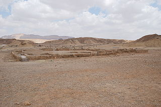
4. חורבות חלוצה
The ancient city of Halasa or Chellous, Elusa (Ελουϲα) in the Byzantine period, was a city in the Negev near present-day Kibbutz Mash'abei Sadeh that was once part of the Nabataean Incense Route. It lay on the route from Petra to Gaza. Today it is known as Haluza, and during periods of Arab habitation it was known as al-Khalūṣ and Al-Khalasa.
5. Mezad Saharonim
On the Saharonim side, it is a Nabatean fortress on the Perfume Road, in the heart of Ramon Crater, named after a dangling Saharon plant that grows next to it. The fortress is a square structure with a length of 42 meters on each side. At its heart is a central courtyard surrounded by workshops, baths and an oven.
6. Ben Gurion's Desert Home
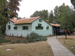
Ben-Gurion's hut was the retirement home of Israeli Prime Minister David Ben-Gurion and his wife Paula (Pola) from 1953 until Ben-Gurion's death in 1973. The "hut", located on kibbutz Sde Boker, was preserved exactly as it was left by Ben-Gurion and now serves as a museum with a visitor center operated by the Ben-Gurion Heritage Institute.
7. חורבת סעדון
Sa'adun is an unexcavated Byzantine site located in the northern Negev, about 8 km southwest of Halutza and about 4 km northeast of Rehovot in the Negev. It is located on the southern bank of Nahal Sa'adon. The name Sa'adun is a Hebrew version of the Arabic name of the site Khirbet a-Saadi. Avraham Negev proposed to identify the name with Soudanon mentioned in Papyrus 79 of Nitzana, the origin of the name in his opinion from the Nabatean name 'Sha'do'.
8. Har Ramon
Mount Ramon, or Har Ramon, is a mountain in the Negev desert in Israel, near the Egyptian border and southwest of the well-known Ramon Crater. Its elevation is 1,037 metres (3,402 ft) above sea level and it is the summit of the Negev Mountains.
9. Mezad Mahmal
Metzad Mahmal is the ruins of a stronghold located on the edge of the northern cliff of the Ramon Crater, at the top end of Ma'ale Mahmal and is part of the Incense Route that runs between Petra and Avdat.
10. Har Zavoa
Har Tzuba is a mountain in the Negev located about 500 m west of Highway 224 and about 5 km northwest of Yeruham, at an altitude of 529 m above sea level – landmark 187030/550230 in the New Israel Network. The Bedouin Arabic name of the summit is Ras a-Daba. For years, the B'slamach camp has been located at the foot of the mountain, which is the school for platoon commanders and infantry professions.
Share
How likely are you to recommend us?
Disclaimer Please be aware of your surroundings and do not enter private property. We are not liable for any damages that occur during the tours.
